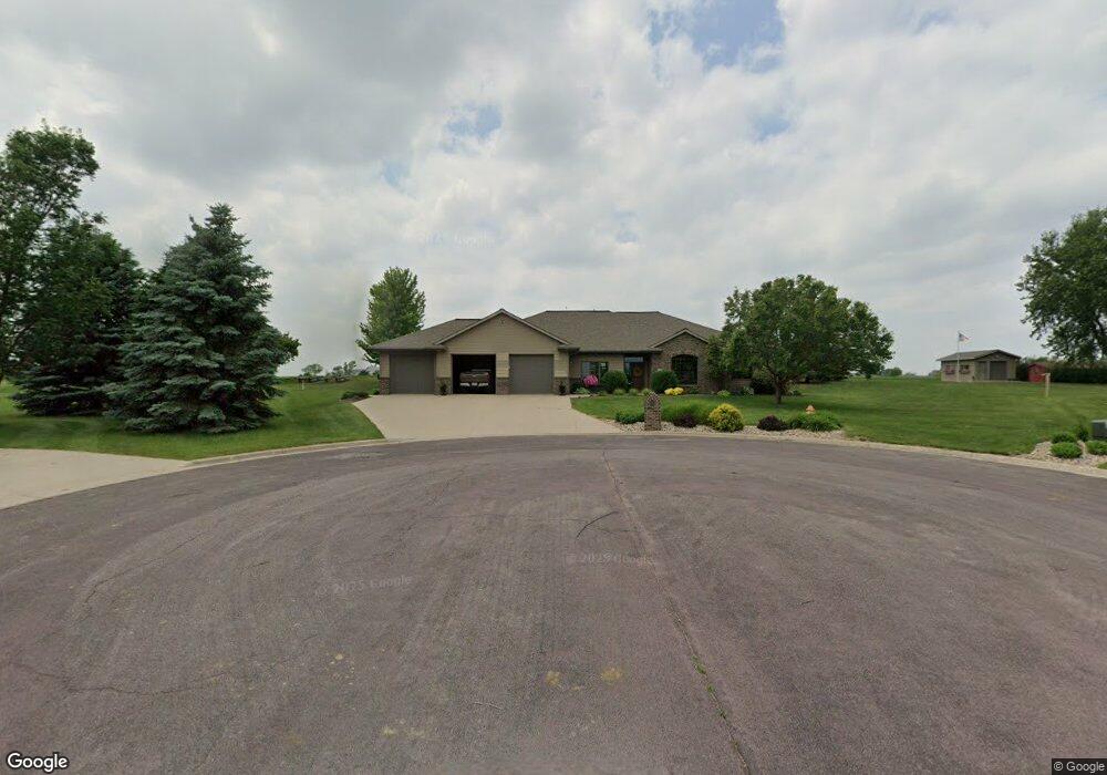
205 Cedar Ln Rock Rapids, IA 51246
Estimated Value: $600,000 - $684,000
4
Beds
4
Baths
2,578
Sq Ft
$246/Sq Ft
Est. Value
About This Home
This home is located at 205 Cedar Ln, Rock Rapids, IA 51246 and is currently estimated at $635,193, approximately $246 per square foot. 205 Cedar Ln is a home located in Lyon County with nearby schools including Central Lyon Elementary School, Central Lyon Senior High School, and Ignite Christian Academy.
Ownership History
Date
Name
Owned For
Owner Type
Purchase Details
Closed on
Jun 5, 2012
Sold by
Mill Pond Development L L C
Bought by
Metzger William A and Metzger Charlotte K
Current Estimated Value
Purchase Details
Closed on
Jun 4, 2012
Sold by
Metzger Willam A and Mertzger Charlotte
Bought by
William A Mertzger Ret
Purchase Details
Closed on
May 1, 2009
Sold by
Mill Pond Development L L C
Bought by
Iowa Limited Liability Co
Create a Home Valuation Report for This Property
The Home Valuation Report is an in-depth analysis detailing your home's value as well as a comparison with similar homes in the area
Home Values in the Area
Average Home Value in this Area
Purchase History
| Date | Buyer | Sale Price | Title Company |
|---|---|---|---|
| Metzger William A | $10,500 | None Available | |
| William A Mertzger Ret | -- | -- | |
| Metzger Charlotte | -- | None Available | |
| Metzger William A | -- | None Available | |
| Metzger William A | -- | None Available | |
| Iowa Limited Liability Co | $25,000 | None Available |
Source: Public Records
Tax History
| Year | Tax Paid | Tax Assessment Tax Assessment Total Assessment is a certain percentage of the fair market value that is determined by local assessors to be the total taxable value of land and additions on the property. | Land | Improvement |
|---|---|---|---|---|
| 2025 | $8,174 | $624,760 | $66,960 | $557,800 |
| 2024 | $8,174 | $554,390 | $66,960 | $487,430 |
| 2023 | $7,750 | $555,910 | $66,960 | $488,950 |
| 2022 | $7,048 | $428,450 | $66,960 | $361,490 |
| 2021 | $7,048 | $428,450 | $66,960 | $361,490 |
| 2020 | $6,692 | $350,610 | $0 | $0 |
| 2019 | $7,054 | $350,610 | $0 | $0 |
| 2018 | $7,054 | $350,610 | $0 | $0 |
| 2017 | $6,924 | $330,610 | $0 | $0 |
| 2016 | $6,626 | $330,610 | $0 | $0 |
| 2015 | $6,626 | $247,329 | $0 | $0 |
| 2014 | $4,812 | $243,065 | $0 | $0 |
Source: Public Records
Map
Nearby Homes
- 204 S 15th Ave
- 104 Cedar Ln
- 1009 S Tama St
- 707 Mill Pond Rd
- 505 Mill Pond Rd Unit 2
- 603 Mill Pond Rd
- 505 Mill Pond Rd Unit 1
- 507 Mill Pond Rd
- 903 S Jansen St
- 1400 S Greene St
- 708 S Story St
- 709 S Carroll St
- 601 Mill Pond Rd Unit 2
- 601 Mill Pond Rd Unit 1
- 507 S Greene St
- 1100 S 6th Ave
- 904 Davis St
- 1104 S 6th Ave
- 1102 S 6th Ave
- 1002 S 6th Ave
Your Personal Tour Guide
Ask me questions while you tour the home.