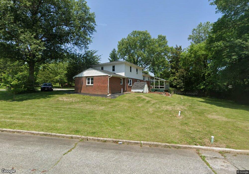
205 Cedar St Chestertown, MD 21620
Estimated Value: $413,000 - $455,000
Studio
3
Baths
2,111
Sq Ft
$206/Sq Ft
Est. Value
About This Home
This home is located at 205 Cedar St, Chestertown, MD 21620 and is currently estimated at $433,960, approximately $205 per square foot. 205 Cedar St is a home located in Kent County with nearby schools including Kent County Middle School, Kent County High School, and Chestertown Christian Academy.
Ownership History
Date
Name
Owned For
Owner Type
Purchase Details
Closed on
Oct 2, 2009
Sold by
Ramsey Shaun D and Ramsey Kimberly S
Bought by
Ramsey Shaun D
Current Estimated Value
Purchase Details
Closed on
Dec 7, 2004
Sold by
Sorrentino Angelo M and Jr
Bought by
Ramsey Shaun D
Purchase Details
Closed on
Jul 24, 2000
Sold by
Styers Louron J and Styers Brenda R
Bought by
Sorrentino Angelo M and Sorrentino Janet M
Purchase Details
Closed on
Jun 28, 1996
Sold by
Duell Joseph E
Bought by
Styers Louron J and Styers Brenda R
Create a Home Valuation Report for This Property
The Home Valuation Report is an in-depth analysis detailing your home's value as well as a comparison with similar homes in the area
Home Values in the Area
Average Home Value in this Area
Purchase History
| Date | Buyer | Sale Price | Title Company |
|---|---|---|---|
| Ramsey Shaun D | -- | -- | |
| Ramsey Shaun D | $250,000 | -- | |
| Sorrentino Angelo M | $142,655 | -- | |
| Styers Louron J | $130,000 | -- |
Source: Public Records
Tax History
| Year | Tax Paid | Tax Assessment Tax Assessment Total Assessment is a certain percentage of the fair market value that is determined by local assessors to be the total taxable value of land and additions on the property. | Land | Improvement |
|---|---|---|---|---|
| 2025 | $4,167 | $265,900 | $93,200 | $172,700 |
| 2024 | $3,989 | $254,500 | $0 | $0 |
| 2023 | $3,810 | $243,100 | $0 | $0 |
| 2022 | $3,608 | $231,700 | $93,200 | $138,500 |
| 2021 | $3,621 | $231,367 | $0 | $0 |
| 2020 | $3,621 | $231,033 | $0 | $0 |
| 2019 | $3,608 | $230,700 | $103,200 | $127,500 |
| 2018 | $3,580 | $230,367 | $0 | $0 |
| 2017 | $3,460 | $230,033 | $0 | $0 |
| 2016 | -- | $229,700 | $0 | $0 |
| 2015 | $3,199 | $224,033 | $0 | $0 |
| 2014 | $3,199 | $218,367 | $0 | $0 |
Source: Public Records
Map
Nearby Homes
- 0 Elm St Unit MDKE2003590
- 201 Greenwood Ave
- 112 Elm St
- 515 N Kent St
- 107 Metcalfe Rd
- 109 Metcalfe Rd
- 222 Mount Vernon Ave
- 112 Metcalf Rd
- 107 Conley Dr
- 231 Richard Dr
- 104 Flying Cloud Dr
- 132 Prospect St
- 107 Oak Leaf Dr
- 234 N College Ave
- 201 N Lynchburg St
- 109 S College Ave
- 611 Cannon St
- 349 & 351 High St
- 349 High St
- 117 N Water St Unit 1A, 1B, 2A, & 2B
Your Personal Tour Guide
Ask me questions while you tour the home.