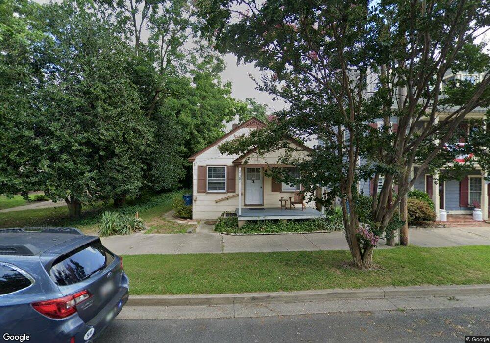
205 E Chestnut St Saint Michaels, MD 21663
Estimated Value: $399,574 - $1,018,000
Studio
--
Bath
640
Sq Ft
$1,033/Sq Ft
Est. Value
About This Home
This home is located at 205 E Chestnut St, Saint Michaels, MD 21663 and is currently estimated at $661,394, approximately $1,033 per square foot. 205 E Chestnut St is a home located in Talbot County with nearby schools including St. Michaels Elementary School, St. Michaels Middle/High School, and Easton High School.
Ownership History
Date
Name
Owned For
Owner Type
Purchase Details
Closed on
Feb 22, 1994
Sold by
Groft Lelah C
Bought by
O'Shell Christin Lee and O'Shell C
Current Estimated Value
Home Financials for this Owner
Home Financials are based on the most recent Mortgage that was taken out on this home.
Original Mortgage
$83,125
Interest Rate
7.11%
Purchase Details
Closed on
May 1, 1987
Sold by
Kastel Frederick and Kastel Daisylea C
Bought by
Groft Lelah C
Purchase Details
Closed on
Aug 15, 1983
Sold by
Duncan Sheila T
Bought by
Kastel Frederick and Kastel Daisylea C
Create a Home Valuation Report for This Property
The Home Valuation Report is an in-depth analysis detailing your home's value as well as a comparison with similar homes in the area
Home Values in the Area
Average Home Value in this Area
Purchase History
| Date | Buyer | Sale Price | Title Company |
|---|---|---|---|
| O'Shell Christin Lee | $87,500 | -- | |
| Groft Lelah C | $69,500 | -- | |
| Kastel Frederick | $41,000 | -- |
Source: Public Records
Mortgage History
| Date | Status | Borrower | Loan Amount |
|---|---|---|---|
| Closed | O'Shell Christin Lee | $83,125 |
Source: Public Records
Tax History
| Year | Tax Paid | Tax Assessment Tax Assessment Total Assessment is a certain percentage of the fair market value that is determined by local assessors to be the total taxable value of land and additions on the property. | Land | Improvement |
|---|---|---|---|---|
| 2025 | $4,134 | $331,600 | $275,000 | $56,600 |
| 2024 | $4,049 | $327,967 | $0 | $0 |
| 2023 | $3,852 | $324,333 | $0 | $0 |
| 2022 | $3,677 | $320,700 | $275,000 | $45,700 |
| 2021 | $3,596 | $320,700 | $275,000 | $45,700 |
| 2020 | $3,643 | $320,700 | $275,000 | $45,700 |
| 2019 | $3,680 | $324,000 | $275,000 | $49,000 |
| 2018 | $3,511 | $314,833 | $0 | $0 |
| 2017 | $3,301 | $305,667 | $0 | $0 |
| 2016 | $2,854 | $296,500 | $0 | $0 |
| 2015 | $3,796 | $296,500 | $0 | $0 |
| 2014 | $3,796 | $296,500 | $0 | $0 |
Source: Public Records
Map
Nearby Homes
- 106 E Chestnut St
- 114 E Chew Ave
- 107 W Chestnut St
- 101 Mulberry St
- 216 E Chew Ave
- Lot 16A Meadow St
- 111 Gloria Ave
- 205 Cherry St
- 117 Chesapeake Ave
- 938 Marea Terrace
- 408 Spinnaker Ln
- 101 Brooks Ln
- 209 Webb Ln
- 912 Calvert Ave
- 926 Calvert Ave
- 216 Brooks Ln
- 320 Perry Cabin Dr
- 228 Perry Cabin Dr Unit 228 / 226
- 228 Tyler Ave
- 24390 Oakwood Park Rd
- 201 E Chestnut St
- 410 Water St
- 207 E Chestnut St
- 209 E Chestnut St
- 412 Water St
- 410 Saint Marys Square
- 116 E Chestnut St
- 410 St Marys Square
- 112 E Chestnut St
- 410 St Mary's Square
- 111 E Chestnut St
- 111 Chestnut St E
- 406 Water St
- 204 E Chestnut St
- 200 E Chestnut St
- 109 Chestnut St E
- 109 E Chestnut St
- 108 W Chestnut St
- 108 E Chestnut St
- 110 E Chestnut St
Your Personal Tour Guide
Ask me questions while you tour the home.