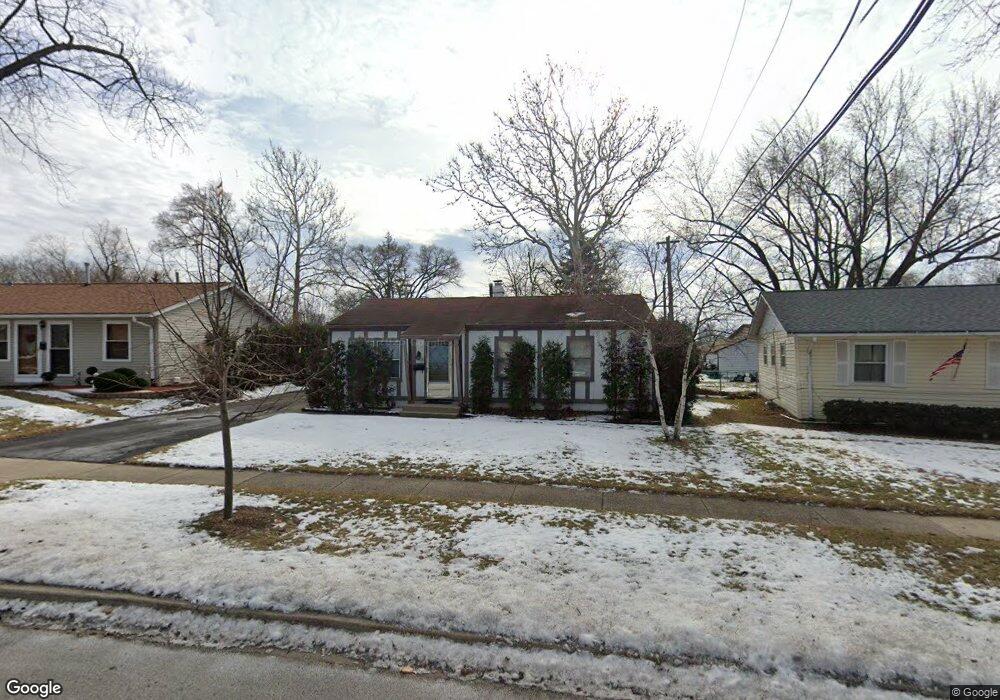
205 E Maxon Ln Streamwood, IL 60107
Estimated Value: $284,914 - $308,000
3
Beds
1
Bath
1,233
Sq Ft
$242/Sq Ft
Est. Value
About This Home
This home is located at 205 E Maxon Ln, Streamwood, IL 60107 and is currently estimated at $298,229, approximately $241 per square foot. 205 E Maxon Ln is a home located in Cook County with nearby schools including Oakhill Elementary School, Canton Middle School, and Streamwood High School.
Ownership History
Date
Name
Owned For
Owner Type
Purchase Details
Closed on
Feb 2, 1996
Sold by
Levin David G and Levin Diane L
Bought by
Olsowski Gerald F
Current Estimated Value
Home Financials for this Owner
Home Financials are based on the most recent Mortgage that was taken out on this home.
Original Mortgage
$98,950
Interest Rate
7.05%
Purchase Details
Closed on
Sep 21, 1993
Sold by
Tunzi Vincent N and Selva Michele K
Bought by
Levin David G and Levin Diane S
Home Financials for this Owner
Home Financials are based on the most recent Mortgage that was taken out on this home.
Original Mortgage
$81,600
Interest Rate
7.05%
Create a Home Valuation Report for This Property
The Home Valuation Report is an in-depth analysis detailing your home's value as well as a comparison with similar homes in the area
Home Values in the Area
Average Home Value in this Area
Purchase History
| Date | Buyer | Sale Price | Title Company |
|---|---|---|---|
| Olsowski Gerald F | $124,000 | Attorneys Natl Title Network | |
| Levin David G | $68,000 | -- |
Source: Public Records
Mortgage History
| Date | Status | Borrower | Loan Amount |
|---|---|---|---|
| Closed | Olsowski Gerald F | $98,950 | |
| Previous Owner | Levin David G | $81,600 |
Source: Public Records
Tax History
| Year | Tax Paid | Tax Assessment Tax Assessment Total Assessment is a certain percentage of the fair market value that is determined by local assessors to be the total taxable value of land and additions on the property. | Land | Improvement |
|---|---|---|---|---|
| 2025 | $2,278 | $26,000 | $4,657 | $21,343 |
| 2024 | $2,278 | $20,001 | $3,327 | $16,674 |
| 2023 | $2,289 | $20,001 | $3,327 | $16,674 |
| 2022 | $2,289 | $20,001 | $3,327 | $16,674 |
| 2021 | $2,716 | $16,099 | $2,328 | $13,771 |
| 2020 | $2,487 | $16,099 | $2,328 | $13,771 |
| 2019 | $2,664 | $18,089 | $2,328 | $15,761 |
| 2018 | $2,941 | $14,535 | $1,995 | $12,540 |
| 2017 | $3,876 | $14,535 | $1,995 | $12,540 |
| 2016 | $3,899 | $14,535 | $1,995 | $12,540 |
| 2015 | $3,318 | $11,977 | $1,829 | $10,148 |
| 2014 | $3,730 | $13,247 | $1,829 | $11,418 |
| 2013 | $3,594 | $13,247 | $1,829 | $11,418 |
Source: Public Records
Map
Nearby Homes
- 120 S Chestnut Dr
- 305 S Bartlett Rd
- 110 Elm Ln
- 120 Grow Ln
- 17 S Bartlett Rd
- 110 Cedar Cir
- 128 Mccabe Dr
- 27 Hawthorne Ln
- 11 E Streamwood Blvd
- 8 Timber Trail
- 4 Haverton Ct Unit 2003
- 317 E Schaumburg Rd
- 416 Concord Dr
- 407 Concord Dr
- 40 Jackson Ln
- 62 Washington Ave
- 28 Chaucer Ln
- 301 Villa Rd
- 211 N Oltendorf Rd
- 215 Mayfield Dr
- 207 E Maxon Ln
- 212 Cypress Dr
- 210 Cypress Dr
- 209 E Maxon Ln
- 214 Cypress Dr
- 201 E Maxon Ln
- 208 Cypress Dr
- 145 E Streamwood Blvd
- 216 Cypress Dr
- 204 E Maxon Ln
- 202 E Maxon Ln
- 211 E Maxon Ln
- 143 E Streamwood Blvd
- 218 Cypress Dr
- 208 E Maxon Ln
- 204 Cypress Dr
- 213 E Maxon Ln
- 210 E Maxon Ln
- 200 Cypress Dr
- 220 Cypress Dr
Your Personal Tour Guide
Ask me questions while you tour the home.