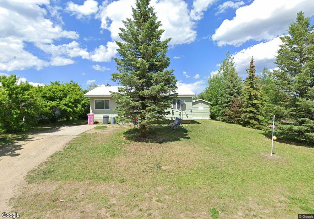
205 Edgerton St Boulder, MT 59632
Estimated Value: $281,000 - $356,000
2
Beds
2
Baths
2,018
Sq Ft
$153/Sq Ft
Est. Value
About This Home
This home is located at 205 Edgerton St, Boulder, MT 59632 and is currently estimated at $308,973, approximately $153 per square foot. 205 Edgerton St is a home located in Jefferson County with nearby schools including Jefferson High School.
Ownership History
Date
Name
Owned For
Owner Type
Purchase Details
Closed on
Dec 1, 2011
Sold by
Huff Linda
Bought by
Ellsworth Nina
Current Estimated Value
Home Financials for this Owner
Home Financials are based on the most recent Mortgage that was taken out on this home.
Original Mortgage
$96,938
Outstanding Balance
$66,471
Interest Rate
4.06%
Mortgage Type
New Conventional
Estimated Equity
$242,502
Purchase Details
Closed on
Sep 2, 2010
Sold by
Odell Jonathan C
Bought by
Huff Clinton and Huff Linda
Home Financials for this Owner
Home Financials are based on the most recent Mortgage that was taken out on this home.
Original Mortgage
$104,591
Interest Rate
4.87%
Mortgage Type
FHA
Purchase Details
Closed on
Nov 27, 2009
Sold by
Odell Johnathan C and Estate Of Douglas Lee Odell
Bought by
Odell Johnathan C
Create a Home Valuation Report for This Property
The Home Valuation Report is an in-depth analysis detailing your home's value as well as a comparison with similar homes in the area
Home Values in the Area
Average Home Value in this Area
Purchase History
| Date | Buyer | Sale Price | Title Company |
|---|---|---|---|
| Ellsworth Nina | -- | Rocky Mountain Title & Insur | |
| Huff Clinton | -- | Surety Title Llc | |
| Odell Johnathan C | -- | None Available |
Source: Public Records
Mortgage History
| Date | Status | Borrower | Loan Amount |
|---|---|---|---|
| Open | Ellsworth Nina | $96,938 | |
| Previous Owner | Huff Clinton | $104,591 |
Source: Public Records
Tax History Compared to Growth
Tax History
| Year | Tax Paid | Tax Assessment Tax Assessment Total Assessment is a certain percentage of the fair market value that is determined by local assessors to be the total taxable value of land and additions on the property. | Land | Improvement |
|---|---|---|---|---|
| 2025 | $1,755 | $288,600 | $0 | $0 |
| 2024 | $2,163 | $228,400 | $0 | $0 |
| 2023 | $1,949 | $237,800 | $0 | $0 |
| 2022 | $1,651 | $148,500 | $0 | $0 |
| 2021 | $1,457 | $148,500 | $0 | $0 |
| 2020 | $1,524 | $136,900 | $0 | $0 |
| 2019 | $1,504 | $136,900 | $0 | $0 |
| 2018 | $1,356 | $120,200 | $0 | $0 |
| 2017 | $1,321 | $120,200 | $0 | $0 |
| 2016 | $1,207 | $112,900 | $0 | $0 |
| 2015 | $1,093 | $105,100 | $0 | $0 |
| 2014 | $914 | $51,039 | $0 | $0 |
Source: Public Records
Map
Nearby Homes
- 510 Garden Dr
- 303 N Adams St
- 508 & 510 W 1st Ave
- 114 N Washington St
- 218 S Madison St
- 306 S Adams St Unit 13
- 301 S Elder St
- 125 S Cleveland St
- 400 S Adams St Unit 12
- 3 Hanging Wall Rd
- TBD Lot16a -Idaho Lode
- 75 Foothill Rd
- 31 Rogers Ln
- TBD (12.7+/- acres) High Ore Rd
- TBD (12.7 +/- Acres High Ore Rd
- TBD (28.6 +/- Acres) High Ore Rd
- TBD (28.6+/- acres) High Ore Rd
- 0 Tbd High Ore Rd Unit 23845743
- 0 Tbd High Ore Rd Unit LotWP003
- 0 Tbd High Ore Rd Unit 23863048