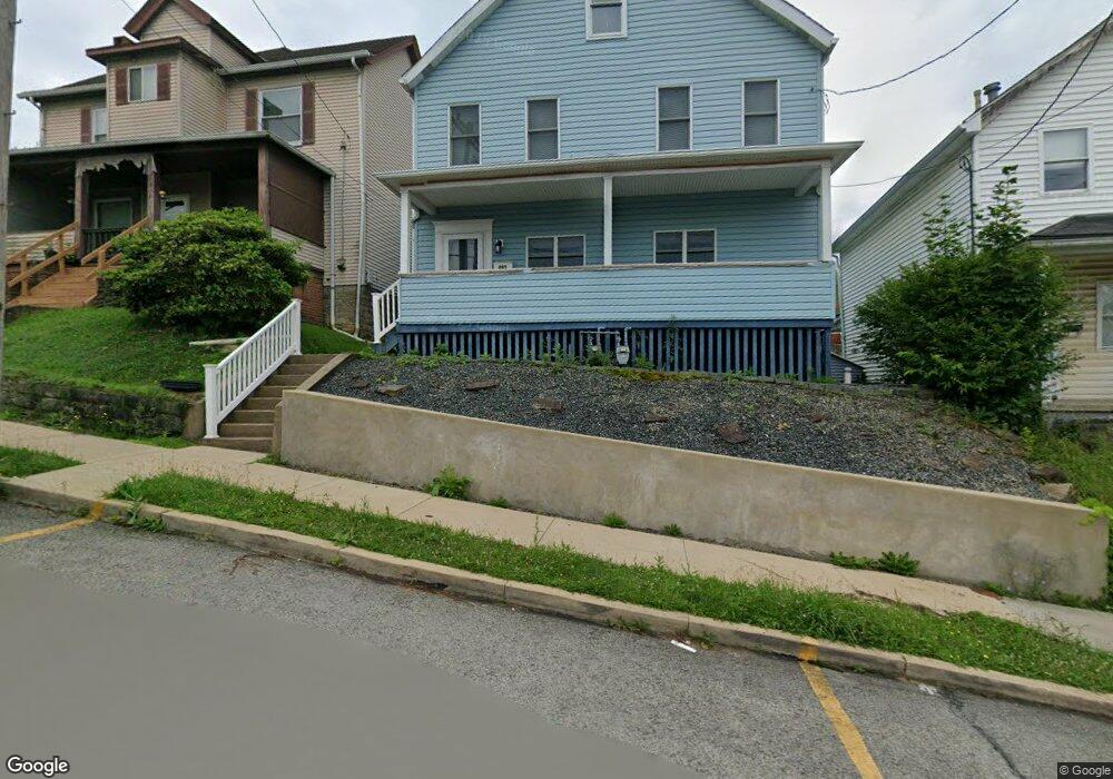
205 Emerson St Vandergrift, PA 15690
Estimated Value: $79,102 - $127,000
3
Beds
1
Bath
--
Sq Ft
6,011
Sq Ft Lot
About This Home
This home is located at 205 Emerson St, Vandergrift, PA 15690 and is currently estimated at $99,526. 205 Emerson St is a home located in Westmoreland County with nearby schools including Kiski Area High School.
Ownership History
Date
Name
Owned For
Owner Type
Purchase Details
Closed on
Aug 1, 2019
Sold by
Antenucci Ralph A and Antenucci Nancy
Bought by
Beck Brittany M
Current Estimated Value
Home Financials for this Owner
Home Financials are based on the most recent Mortgage that was taken out on this home.
Original Mortgage
$70,100
Outstanding Balance
$61,520
Interest Rate
3.8%
Mortgage Type
Unknown
Estimated Equity
$38,006
Create a Home Valuation Report for This Property
The Home Valuation Report is an in-depth analysis detailing your home's value as well as a comparison with similar homes in the area
Home Values in the Area
Average Home Value in this Area
Purchase History
| Date | Buyer | Sale Price | Title Company |
|---|---|---|---|
| Beck Brittany M | $80,000 | None Available |
Source: Public Records
Mortgage History
| Date | Status | Borrower | Loan Amount |
|---|---|---|---|
| Open | Beck Brittany M | $70,100 |
Source: Public Records
Tax History Compared to Growth
Tax History
| Year | Tax Paid | Tax Assessment Tax Assessment Total Assessment is a certain percentage of the fair market value that is determined by local assessors to be the total taxable value of land and additions on the property. | Land | Improvement |
|---|---|---|---|---|
| 2025 | $1,829 | $11,210 | $1,780 | $9,430 |
| 2024 | $1,742 | $11,210 | $1,780 | $9,430 |
| 2023 | $1,604 | $11,210 | $1,780 | $9,430 |
| 2022 | $1,570 | $11,210 | $1,780 | $9,430 |
| 2021 | $1,571 | $11,210 | $1,780 | $9,430 |
| 2020 | $1,567 | $11,210 | $1,780 | $9,430 |
| 2019 | $1,561 | $11,210 | $1,780 | $9,430 |
| 2018 | $1,539 | $11,210 | $1,780 | $9,430 |
| 2017 | $1,505 | $11,210 | $1,780 | $9,430 |
| 2016 | $1,485 | $11,210 | $1,780 | $9,430 |
| 2015 | $1,485 | $11,210 | $1,780 | $9,430 |
| 2014 | $1,478 | $11,210 | $1,780 | $9,430 |
Source: Public Records
Map
Nearby Homes
- 800 Wallace St
- 105 Longfellow St
- 311 Lowell St
- 314 1/2 Lowell St
- 213 Whittier St
- 231 Whittier St
- 403 Lowell St
- 410 Longfellow St
- 431 Longfellow St
- 716 Kennedy Ave
- 323 Sycamore St
- 439 Longfellow St
- 314 Linden St
- 512 Watson St
- 608 Kennedy Ave
- 315 Spruce St
- 525 Burns St
- 517 Sycamore St
- 704-706 Holland St
- 528 Longfellow St
- 207 Emerson St Unit K
- 207 Emerson St
- 207 Emerson St
- 203 Emerson St
- 209 Emerson St
- 804 Hancock Ave
- 802 Hancock Ave
- 808 Hancock Ave
- 211 Emerson St
- 206 1/2 Lowell St
- 202 1/2 Emerson St
- 213 Emerson St
- 204 Lowell St
- 801 Hancock Ave
- 805 Hancock Ave
- 208 Lowell St
- 204 Emerson St
- 206 Emerson St
- 202 Emerson St
- 215 Emerson St