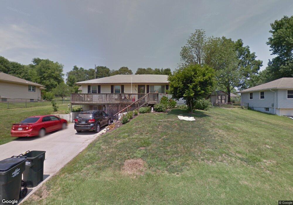
205 Emile St Lansing, KS 66043
Estimated Value: $207,000 - $233,000
3
Beds
1
Bath
1,430
Sq Ft
$153/Sq Ft
Est. Value
About This Home
This home is located at 205 Emile St, Lansing, KS 66043 and is currently estimated at $219,038, approximately $153 per square foot. 205 Emile St is a home located in Leavenworth County with nearby schools including Lansing Elementary School, Lansing Middle 6-8, and Lansing High 9-12.
Ownership History
Date
Name
Owned For
Owner Type
Purchase Details
Closed on
Jul 30, 2019
Sold by
Blendall and Mouhlas Rosemary H
Bought by
Brooks Johnston
Current Estimated Value
Home Financials for this Owner
Home Financials are based on the most recent Mortgage that was taken out on this home.
Original Mortgage
$65,000
Outstanding Balance
$42,912
Interest Rate
3.73%
Mortgage Type
New Conventional
Estimated Equity
$176,126
Create a Home Valuation Report for This Property
The Home Valuation Report is an in-depth analysis detailing your home's value as well as a comparison with similar homes in the area
Home Values in the Area
Average Home Value in this Area
Purchase History
| Date | Buyer | Sale Price | Title Company |
|---|---|---|---|
| Brooks Johnston | $81,250 | Lawyers Title Kansas Inc |
Source: Public Records
Mortgage History
| Date | Status | Borrower | Loan Amount |
|---|---|---|---|
| Open | Brooks Johnston | $65,000 |
Source: Public Records
Tax History Compared to Growth
Tax History
| Year | Tax Paid | Tax Assessment Tax Assessment Total Assessment is a certain percentage of the fair market value that is determined by local assessors to be the total taxable value of land and additions on the property. | Land | Improvement |
|---|---|---|---|---|
| 2025 | $2,313 | $20,228 | $1,972 | $18,256 |
| 2024 | $2,313 | $18,905 | $1,972 | $16,933 |
| 2023 | $2,313 | $18,178 | $1,871 | $16,307 |
| 2022 | $2,161 | $16,526 | $1,662 | $14,864 |
| 2021 | $2,161 | $15,164 | $1,662 | $13,502 |
| 2020 | $1,961 | $13,568 | $1,662 | $11,906 |
| 2019 | $1,907 | $13,186 | $1,662 | $11,524 |
| 2018 | $1,711 | $11,871 | $1,662 | $10,209 |
| 2017 | $1,601 | $11,100 | $1,662 | $9,438 |
| 2016 | $1,585 | $10,990 | $1,662 | $9,328 |
| 2015 | -- | $10,990 | $1,662 | $9,328 |
| 2014 | $3,994 | $11,298 | $1,662 | $9,636 |
Source: Public Records
Map
Nearby Homes
- 1100 N 4th St
- 1102 N 4th St
- 603 E Beth St
- 601 E Eisenhower Rd
- 1102 N Main St
- 129 Brookwood St
- 268 Holiday Dr
- 4 Eisenhower Rd
- 129 Crestview Ct
- 310 E Kansas Ave
- 415 Fairlane St
- 218 Oak Hill St
- 218 E Kay St
- 306 E Kay St
- 124 S Main St
- 202 S Main St
- 20958 Ida St
- 610 Meadowlark Rd
- 546 Hithergreen Dr
- 521 Hillbrook Dr
- 207 Emile St
- 203 Emile St
- 209 Emile St
- 108 Timber Creek Cir
- 700 N 2nd St
- 106 Timber Creek Cir
- 210 Emile St
- 104 Timber Creek Cir
- 110 Timber Creek Cir
- 102 Timber Creek Cir
- 211 Emile St
- 100 Timber Creek Cir
- 0 N 2nd St Unit 1521642
- 704 N 2nd St
- 135 Emile St
- 112 Timber Creek Cir
- 136 Emile St
- 705 N 2nd St
- 608 N 2nd St
- 133 Emile St