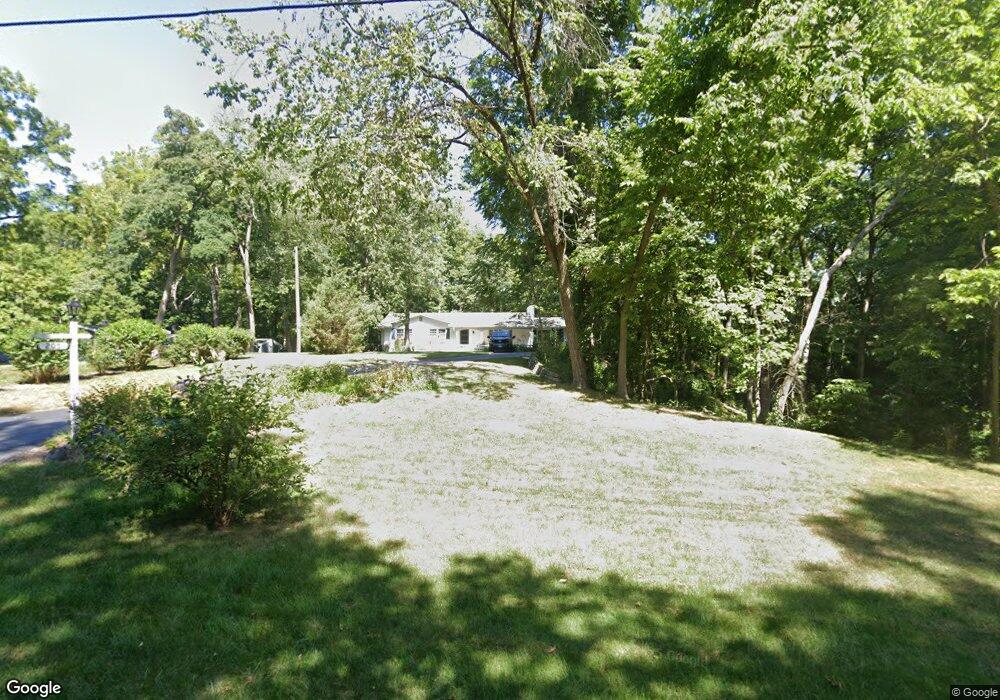
205 Foxridge Dr Dayton, OH 45429
Estimated Value: $360,000 - $574,000
3
Beds
3
Baths
1,828
Sq Ft
$243/Sq Ft
Est. Value
About This Home
This home is located at 205 Foxridge Dr, Dayton, OH 45429 and is currently estimated at $443,490, approximately $242 per square foot. 205 Foxridge Dr is a home located in Montgomery County with nearby schools including Southdale Elementary School, Van Buren Middle School, and Kettering Fairmont High School.
Ownership History
Date
Name
Owned For
Owner Type
Purchase Details
Closed on
May 2, 2019
Sold by
Ramga Victoria S
Bought by
Roll Gregory J and Roll Molly C
Current Estimated Value
Home Financials for this Owner
Home Financials are based on the most recent Mortgage that was taken out on this home.
Original Mortgage
$292,000
Outstanding Balance
$254,048
Interest Rate
4%
Mortgage Type
New Conventional
Estimated Equity
$189,442
Purchase Details
Closed on
Jan 9, 2015
Sold by
Woolum Mary Sue
Bought by
Ramga Victoria S
Home Financials for this Owner
Home Financials are based on the most recent Mortgage that was taken out on this home.
Original Mortgage
$160,000
Interest Rate
3.37%
Mortgage Type
Adjustable Rate Mortgage/ARM
Purchase Details
Closed on
Aug 26, 1998
Sold by
Black Harry R and Black Virginia L
Bought by
Black Harry R and Black Virginia L
Create a Home Valuation Report for This Property
The Home Valuation Report is an in-depth analysis detailing your home's value as well as a comparison with similar homes in the area
Home Values in the Area
Average Home Value in this Area
Purchase History
| Date | Buyer | Sale Price | Title Company |
|---|---|---|---|
| Roll Gregory J | $365,000 | Agility Closing & Ttl Svcs I | |
| Ramga Victoria S | $200,000 | Fidelity Lawyers Title Agenc | |
| Black Harry R | -- | -- | |
| Black Harry R | -- | -- |
Source: Public Records
Mortgage History
| Date | Status | Borrower | Loan Amount |
|---|---|---|---|
| Open | Roll Gregory J | $292,000 | |
| Previous Owner | Ramga Victoria S | $160,000 |
Source: Public Records
Tax History
| Year | Tax Paid | Tax Assessment Tax Assessment Total Assessment is a certain percentage of the fair market value that is determined by local assessors to be the total taxable value of land and additions on the property. | Land | Improvement |
|---|---|---|---|---|
| 2025 | $8,318 | $130,460 | $43,400 | $87,060 |
| 2024 | $8,081 | $130,460 | $43,400 | $87,060 |
| 2023 | $8,081 | $130,460 | $43,400 | $87,060 |
| 2022 | $7,981 | $101,920 | $33,900 | $68,020 |
| 2021 | $7,380 | $101,920 | $33,900 | $68,020 |
| 2020 | $7,402 | $101,920 | $33,900 | $68,020 |
| 2019 | $6,661 | $81,050 | $32,290 | $48,760 |
| 2018 | $6,697 | $81,050 | $32,290 | $48,760 |
| 2017 | $6,168 | $81,050 | $32,290 | $48,760 |
| 2016 | $5,683 | $70,130 | $32,290 | $37,840 |
| 2015 | $4,756 | $70,130 | $32,290 | $37,840 |
| 2014 | $4,756 | $70,130 | $32,290 | $37,840 |
| 2012 | -- | $79,790 | $32,290 | $47,500 |
Source: Public Records
Map
Nearby Homes
- 305 Glenridge Rd
- 3448 Indian Hill Dr
- 110 Lincoln Park Blvd Unit 110
- 3487 Far Hills Ave
- 3510 Ridgeway Rd
- 4024 Overland Trail
- 117 Balmoral Dr
- 326 N Bromfield Rd
- 500 Schuyler Dr
- 3993 Applewood Ln
- 3854 Shroyer Rd
- 3102 Lenox Dr
- 1905 Tait Rd
- 309 Rockhill Ave
- 3025 Big Hill Rd
- 4440 Lotz Rd
- 4422 Toulouse Cir
- 4390 Overland Trail
- 835 Big Hill Rd
- 639 Storms Rd
- 3707 Lenox Dr
- 213 Foxridge Dr
- 3700 Lenox Dr
- 3620 Lenox Dr
- 221 Foxridge Dr
- 3820 Stoneyridge Dr
- 146 Wyngate Dr
- 3625 Lenox Dr
- 3810 Stoneyridge Dr
- 155 Foxridge Dr
- 147 Wyngate Dr
- 324 Tamarac Trail
- 138 Wyngate Dr
- 139 Wyngate Dr
- 145 Foxridge Dr
- 274 Tamarac Ln Unit 14
- 266 Tamarac Ln Unit 13
- 348 Tamarac Trail
- 3801 Lenox Dr
- 130 Wyngate Dr
Your Personal Tour Guide
Ask me questions while you tour the home.