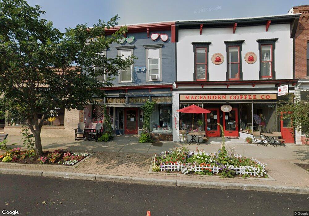
205 Main St Dansville, NY 14437
Estimated Value: $115,266
--
Bed
--
Bath
3,312
Sq Ft
$35/Sq Ft
Est. Value
About This Home
This home is located at 205 Main St, Dansville, NY 14437 and is currently estimated at $115,266, approximately $34 per square foot. 205 Main St is a home located in Livingston County with nearby schools including Dansville Primary School, Ellis B Hyde Elementary School, and Dansville Junior Senior High School.
Ownership History
Date
Name
Owned For
Owner Type
Purchase Details
Closed on
Nov 8, 2016
Sold by
Leuzzi John T
Bought by
Thaddeus Enterprises Llc
Current Estimated Value
Purchase Details
Closed on
Oct 30, 2009
Sold by
Cliff Michelle L
Bought by
Backus
Purchase Details
Closed on
Oct 25, 2006
Sold by
Fallon Mary Lee
Bought by
Cliff Michelle
Purchase Details
Closed on
Jan 6, 2006
Sold by
Knapp Kathleen P
Bought by
Fallon Mary Lee
Purchase Details
Closed on
Sep 21, 1994
Sold by
Hartman Dennis W
Bought by
Poole Kathleen P
Create a Home Valuation Report for This Property
The Home Valuation Report is an in-depth analysis detailing your home's value as well as a comparison with similar homes in the area
Home Values in the Area
Average Home Value in this Area
Purchase History
| Date | Buyer | Sale Price | Title Company |
|---|---|---|---|
| Thaddeus Enterprises Llc | -- | -- | |
| Backus | $59,000 | John Scura | |
| Cliff Michelle | -- | John Putney | |
| Fallon Mary Lee | $39,000 | John C Putney | |
| Poole Kathleen P | $34,000 | -- |
Source: Public Records
Tax History Compared to Growth
Tax History
| Year | Tax Paid | Tax Assessment Tax Assessment Total Assessment is a certain percentage of the fair market value that is determined by local assessors to be the total taxable value of land and additions on the property. | Land | Improvement |
|---|---|---|---|---|
| 2024 | $2,813 | $85,200 | $12,700 | $72,500 |
| 2023 | $2,384 | $85,200 | $12,700 | $72,500 |
| 2022 | $3,143 | $85,200 | $12,700 | $72,500 |
| 2021 | $3,369 | $85,200 | $12,700 | $72,500 |
| 2020 | $2,773 | $85,200 | $12,700 | $72,500 |
| 2019 | $2,661 | $85,200 | $12,700 | $72,500 |
| 2018 | $2,661 | $85,200 | $12,700 | $72,500 |
| 2017 | $2,642 | $80,900 | $11,800 | $69,100 |
| 2016 | $2,627 | $64,900 | $11,800 | $53,100 |
| 2015 | -- | $64,900 | $11,800 | $53,100 |
| 2014 | -- | $64,900 | $11,800 | $53,100 |
Source: Public Records
Map
Nearby Homes
- 237 Main St
- 10 Clinton St
- 30 Clara Barton St
- 21 Pine St
- 7 Clay St
- 40 Clara Barton St
- 30 Clay St
- 16 Elizabeth St
- 3 Jefferson St
- 74 Franklin St
- 3 Wilmot St
- 32 Jefferson St
- 75 Main St
- 12 Sunnyside Dr
- 70 Leonard St
- 9692 Highland Ave
- 9648 Mcwhorter Rd
- 0 Gibson St Unit R1517418
- 20 Depot Rd
- 0 Poags Hole Rd
- 205 Main St
- 211 Main St
- 201 Main St
- 195 Main St
- 4 Ossian St
- 193 Main St
- 178 Main St Unit 202
- 178 Main St Unit 302
- 176 Main St Unit 201
- 176 Main St Unit 301
- 170 Main St
- 0 Sthwy 256 Unit R1127210
- 0 Sthwy 256 Unit R1073623
- 0 State Route 256 Unit R130500
- 1 Sthwy 256
- 0 Sthwy 256 Unit R1014859
- 227 Main St
- 175 Main St
- 154 Main St
- 1 Franklin St
