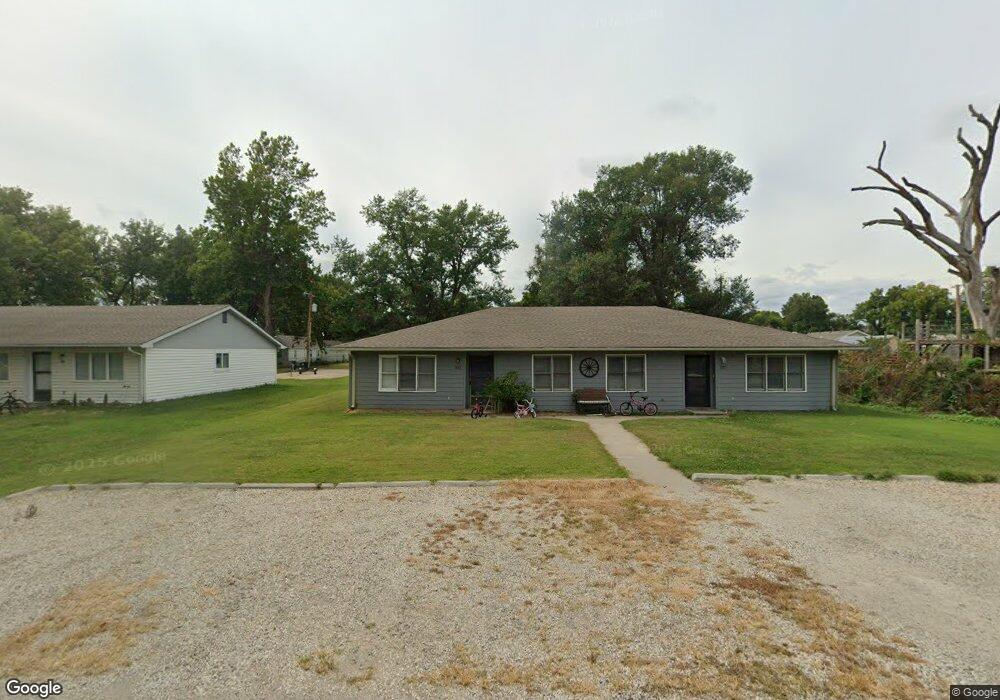
205 Maple St Wamego, KS 66547
Estimated Value: $205,000 - $293,000
6
Beds
2
Baths
2,224
Sq Ft
$108/Sq Ft
Est. Value
About This Home
This home is located at 205 Maple St, Wamego, KS 66547 and is currently estimated at $239,227, approximately $107 per square foot. 205 Maple St is a home located in Pottawatomie County with nearby schools including Central Elementary School, West Elementary School, and Wamego Middle School.
Ownership History
Date
Name
Owned For
Owner Type
Purchase Details
Closed on
Apr 15, 2022
Sold by
K3 & T Llc
Bought by
N & W Llc
Current Estimated Value
Home Financials for this Owner
Home Financials are based on the most recent Mortgage that was taken out on this home.
Original Mortgage
$141,000
Outstanding Balance
$131,873
Interest Rate
3.85%
Mortgage Type
Credit Line Revolving
Estimated Equity
$107,354
Purchase Details
Closed on
Nov 27, 2007
Sold by
Siebert Walter Anthony and Siebert Mary Catherine
Bought by
Kern William E and Kern Elizabeth L
Home Financials for this Owner
Home Financials are based on the most recent Mortgage that was taken out on this home.
Original Mortgage
$100,000
Interest Rate
6.3%
Create a Home Valuation Report for This Property
The Home Valuation Report is an in-depth analysis detailing your home's value as well as a comparison with similar homes in the area
Home Values in the Area
Average Home Value in this Area
Purchase History
| Date | Buyer | Sale Price | Title Company |
|---|---|---|---|
| N & W Llc | $187,530 | None Listed On Document | |
| Kern William E | -- | None Available |
Source: Public Records
Mortgage History
| Date | Status | Borrower | Loan Amount |
|---|---|---|---|
| Open | N & W Llc | $141,000 | |
| Previous Owner | Kern William E | $100,000 |
Source: Public Records
Tax History
| Year | Tax Paid | Tax Assessment Tax Assessment Total Assessment is a certain percentage of the fair market value that is determined by local assessors to be the total taxable value of land and additions on the property. | Land | Improvement |
|---|---|---|---|---|
| 2025 | $2,255 | $19,895 | $2,438 | $17,457 |
| 2024 | $23 | $18,997 | $2,167 | $16,830 |
| 2023 | $2,285 | $18,377 | $2,161 | $16,216 |
| 2022 | $2,062 | $18,370 | $2,122 | $16,248 |
| 2021 | $2,062 | $16,809 | $2,048 | $14,761 |
| 2020 | $2,062 | $16,709 | $2,354 | $14,355 |
| 2019 | $2,016 | $16,284 | $2,389 | $13,895 |
| 2018 | $2,060 | $16,684 | $2,389 | $14,295 |
| 2017 | $1,993 | $16,135 | $1,929 | $14,206 |
| 2016 | $1,953 | $16,019 | $1,337 | $14,682 |
| 2015 | -- | $14,985 | $1,415 | $13,570 |
| 2014 | -- | $14,363 | $1,358 | $13,005 |
Source: Public Records
Map
Nearby Homes
- 00000 Kansas 99 Unit North 25 acre lot
- 00000 Kansas 99 Unit South 25 acre lot
- 606 Oak St
- 613 Ash St
- 615 Ash St
- 700 Oak St
- 511 Poplar St
- 601 Poplar St
- 905 Vine St
- 0000 Highway 24
- 1507 Grandview Dr
- 503 Parkview Dr
- 809 14th St
- 815 14th St
- 208 Sandbar Dr
- 701 Parkview Dr
- 814 14th St
- 322 Simmer Dr
- 207 Sandbar Dr
- 205 Pebblebrook Cir
Your Personal Tour Guide
Ask me questions while you tour the home.