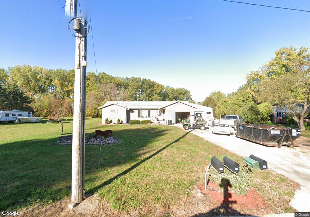
205 N Adams St Elkton, MN 55933
Estimated Value: $154,000 - $165,354
2
Beds
1
Bath
944
Sq Ft
$170/Sq Ft
Est. Value
About This Home
This home is located at 205 N Adams St, Elkton, MN 55933 and is currently estimated at $160,839, approximately $170 per square foot. 205 N Adams St is a home with nearby schools including Southland Elementary School, Southland Middle School, and Southland Senior High School.
Ownership History
Date
Name
Owned For
Owner Type
Purchase Details
Closed on
May 14, 2025
Sold by
Carol M Hamilton Revocable Living Trust
Bought by
Nelsen Gavin
Current Estimated Value
Home Financials for this Owner
Home Financials are based on the most recent Mortgage that was taken out on this home.
Original Mortgage
$154,500
Outstanding Balance
$153,952
Interest Rate
6.64%
Mortgage Type
New Conventional
Estimated Equity
$6,887
Create a Home Valuation Report for This Property
The Home Valuation Report is an in-depth analysis detailing your home's value as well as a comparison with similar homes in the area
Home Values in the Area
Average Home Value in this Area
Purchase History
| Date | Buyer | Sale Price | Title Company |
|---|---|---|---|
| Nelsen Gavin | $155,000 | -- |
Source: Public Records
Mortgage History
| Date | Status | Borrower | Loan Amount |
|---|---|---|---|
| Open | Nelsen Gavin | $154,500 |
Source: Public Records
Tax History Compared to Growth
Tax History
| Year | Tax Paid | Tax Assessment Tax Assessment Total Assessment is a certain percentage of the fair market value that is determined by local assessors to be the total taxable value of land and additions on the property. | Land | Improvement |
|---|---|---|---|---|
| 2025 | $2,018 | $159,400 | $30,000 | $129,400 |
| 2024 | $1,876 | $153,200 | $30,000 | $123,200 |
| 2023 | $1,866 | $149,200 | $30,000 | $119,200 |
| 2022 | $1,880 | $140,800 | $30,000 | $110,800 |
| 2021 | $1,398 | $99,900 | $19,400 | $80,500 |
| 2020 | $1,408 | $98,900 | $19,400 | $79,500 |
| 2018 | $0 | $94,800 | $19,400 | $75,400 |
| 2017 | $1,148 | $0 | $0 | $0 |
| 2016 | $868 | $0 | $0 | $0 |
| 2015 | $712 | $0 | $0 | $0 |
| 2012 | $712 | $0 | $0 | $0 |
Source: Public Records
Map
Nearby Homes