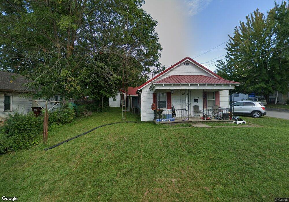
205 N Depot St Brownstown, IN 47220
Estimated Value: $108,228 - $147,000
2
Beds
1
Bath
816
Sq Ft
$157/Sq Ft
Est. Value
About This Home
This home is located at 205 N Depot St, Brownstown, IN 47220 and is currently estimated at $128,307, approximately $157 per square foot. 205 N Depot St is a home located in Jackson County with nearby schools including Brownstown Elementary School, Brownstown Central Middle School, and Brownstown Central High School.
Ownership History
Date
Name
Owned For
Owner Type
Purchase Details
Closed on
Dec 4, 2020
Sold by
Holloway Kenneth Ray and Holloway Lori J
Bought by
Holloway Patrick
Current Estimated Value
Purchase Details
Closed on
Jan 9, 2009
Sold by
Holloway Marian G
Bought by
Holloway Kenneth Ralph
Purchase Details
Closed on
Sep 8, 2008
Sold by
Holloway Kenneth Ralph and Holloway Marian G
Bought by
Holloway Kenneth Ralph and Holloway Marian G
Create a Home Valuation Report for This Property
The Home Valuation Report is an in-depth analysis detailing your home's value as well as a comparison with similar homes in the area
Home Values in the Area
Average Home Value in this Area
Purchase History
| Date | Buyer | Sale Price | Title Company |
|---|---|---|---|
| Holloway Patrick | -- | None Available | |
| Holloway Kenneth Ralph | -- | -- | |
| Holloway Kenneth Ralph | -- | None Available |
Source: Public Records
Tax History Compared to Growth
Tax History
| Year | Tax Paid | Tax Assessment Tax Assessment Total Assessment is a certain percentage of the fair market value that is determined by local assessors to be the total taxable value of land and additions on the property. | Land | Improvement |
|---|---|---|---|---|
| 2024 | $1,230 | $61,500 | $5,300 | $56,200 |
| 2023 | $1,377 | $68,300 | $5,300 | $63,000 |
| 2022 | $1,366 | $67,700 | $5,300 | $62,400 |
| 2021 | $1,253 | $62,100 | $5,300 | $56,800 |
| 2020 | $1,249 | $62,000 | $5,300 | $56,700 |
| 2019 | $1,229 | $61,100 | $5,300 | $55,800 |
| 2018 | $1,228 | $61,100 | $5,300 | $55,800 |
| 2017 | $1,215 | $60,500 | $5,300 | $55,200 |
| 2016 | $1,017 | $50,800 | $5,300 | $45,500 |
| 2014 | $1,009 | $50,400 | $6,300 | $44,100 |
| 2013 | $1,009 | $47,400 | $6,400 | $41,000 |
Source: Public Records
Map
Nearby Homes
- 1109 W Vine St
- 1321 Lakeview Dr
- 808 W Bridge St
- 702 W Cross St
- 521 Ashland St
- 4000 State Road 135
- 900 W Block Co Rd 50 S
- 209 S Block Clark St
- 220 W Spring St
- 453 S Scotty Dr
- 201 S Water St
- 908 S Main St
- 960 Buena Vista Dr
- 889 E North Shore Dr
- 1085 E North Shore Dr
- 995 E Skyline Dr
- 573 N County Road 250 E
- 2000 Block 275 S
- 3780 W County Road 300 N
- 5619 W County Road 200 N
- 1219 W Branch St
- 305 N Depot St
- 116 N Depot St
- 115 N Front St
- 109 N Depot St
- 1207 W Branch St
- 1215 W Branch St
- 105 N Depot St
- 1203 W Branch St
- 114 N Stillwell St
- 102 N Stillwell St
- 102 S Stillwell St
- 1063 W Walnut St
- 115 S Depot St
- 114 N Ewing St
- 1061 W Walnut St
- 1115 W Spring St
- 120 S Stillwell St
- 102 S Ewing St