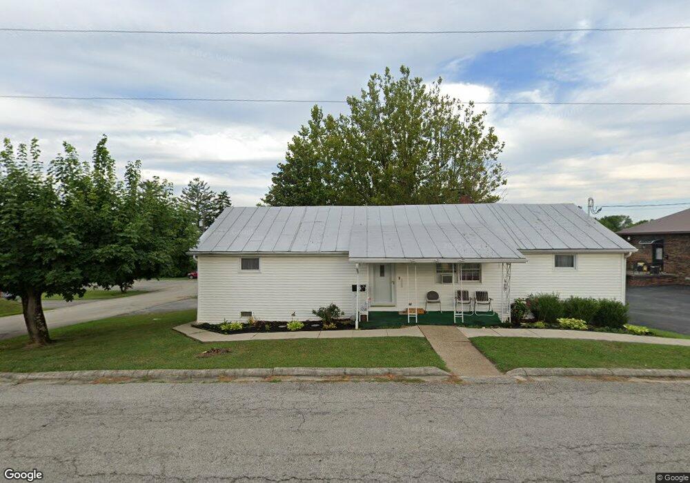
205 N Wilson Dr West Union, OH 45693
Estimated Value: $99,999 - $134,000
2
Beds
2
Baths
1,251
Sq Ft
$93/Sq Ft
Est. Value
About This Home
This home is located at 205 N Wilson Dr, West Union, OH 45693 and is currently estimated at $116,750, approximately $93 per square foot. 205 N Wilson Dr is a home located in Adams County with nearby schools including West Union Elementary School, West Union High School, and Adams County Christian School.
Ownership History
Date
Name
Owned For
Owner Type
Purchase Details
Closed on
Aug 28, 2003
Sold by
Dunkin Margaret
Bought by
Dunkin Margaret
Current Estimated Value
Purchase Details
Closed on
Nov 20, 1998
Sold by
Dunkin Robert T
Bought by
Dunkin Margaret
Purchase Details
Closed on
Jan 1, 1990
Bought by
Dunkin Robert T
Create a Home Valuation Report for This Property
The Home Valuation Report is an in-depth analysis detailing your home's value as well as a comparison with similar homes in the area
Home Values in the Area
Average Home Value in this Area
Purchase History
| Date | Buyer | Sale Price | Title Company |
|---|---|---|---|
| Dunkin Margaret | -- | -- | |
| Dunkin Margaret | -- | -- | |
| Dunkin Robert T | -- | -- |
Source: Public Records
Tax History Compared to Growth
Tax History
| Year | Tax Paid | Tax Assessment Tax Assessment Total Assessment is a certain percentage of the fair market value that is determined by local assessors to be the total taxable value of land and additions on the property. | Land | Improvement |
|---|---|---|---|---|
| 2024 | $508 | $23,670 | $1,720 | $21,950 |
| 2023 | $535 | $23,670 | $1,720 | $21,950 |
| 2022 | $501 | $19,640 | $1,300 | $18,340 |
| 2021 | $396 | $19,640 | $1,300 | $18,340 |
| 2020 | $404 | $19,640 | $1,300 | $18,340 |
| 2019 | $404 | $19,640 | $1,300 | $18,340 |
| 2018 | $329 | $17,260 | $1,300 | $15,960 |
| 2017 | $324 | $17,260 | $1,300 | $15,960 |
| 2016 | $323 | $17,260 | $1,300 | $15,960 |
| 2015 | $304 | $17,010 | $1,050 | $15,960 |
| 2014 | $304 | $17,010 | $1,050 | $15,960 |
Source: Public Records
Map
Nearby Homes
- 725 E Walnut St
- 3188 Ohio 125
- 601 E Main St
- 526 E Walnut St
- 501 E Mulberry St
- 104 N Washington St
- 618 Maple St
- 537 1st St
- 1082 E Walnut St
- 585 High St
- 175 Hidden Acres Dr
- 70 Logans Ln
- 204 E North St
- 12196 State Route 41
- 4700 Ohio 247
- 216 S Market St
- 286 & 290 S Market St
- 302 W Main St
- 305 W Walnut St
- 101 S Mound St
- 217 N Wilson Dr
- 119 N Wilson Dr
- 730 Elm St
- 729 Elm St
- 733 Elm St
- 727 Elm St
- 113 N Wilson Dr
- 17 Chestnut Ridge Rd
- 29 Chestnut Ridge Rd
- 727 E Mulberry St
- 43 Chestnut Ridge Rd
- 723 E Mulberry St
- 715 Elm St
- 714 Elm St
- 106 N Wilson Dr
- 710 Elm St
- 59 Chestnut Ridge Rd
- 814 E Walnut St
- 210 N Wilson Dr
- 724 E Walnut St