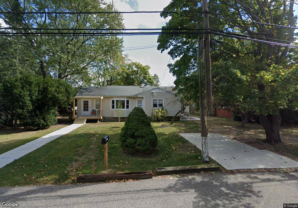
205 Powell Ave Central Islip, NY 11722
Estimated Value: $504,394 - $578,000
--
Bed
--
Bath
1,132
Sq Ft
$480/Sq Ft
Est. Value
About This Home
This home is located at 205 Powell Ave, Central Islip, NY 11722 and is currently estimated at $543,599, approximately $480 per square foot. 205 Powell Ave is a home located in Suffolk County with nearby schools including Anthony Alfano Elementary School and Central Islip Senior High School.
Ownership History
Date
Name
Owned For
Owner Type
Purchase Details
Closed on
Sep 5, 2017
Sold by
Suarez Oscar and Suarez Leonor
Bought by
Suarez Oscar and Suarez Leonor
Current Estimated Value
Purchase Details
Closed on
Nov 12, 2012
Sold by
Suarez Oscar and Suarez Oscar M
Bought by
Suarez Oscar and Suarez Leonor
Purchase Details
Closed on
Aug 25, 1999
Sold by
Little Clifton and Little Linda
Bought by
Suarez Oscar and Suarez Oscar M
Home Financials for this Owner
Home Financials are based on the most recent Mortgage that was taken out on this home.
Original Mortgage
$122,300
Interest Rate
7.73%
Mortgage Type
FHA
Create a Home Valuation Report for This Property
The Home Valuation Report is an in-depth analysis detailing your home's value as well as a comparison with similar homes in the area
Home Values in the Area
Average Home Value in this Area
Purchase History
| Date | Buyer | Sale Price | Title Company |
|---|---|---|---|
| Suarez Oscar | -- | None Available | |
| Suarez Oscar | -- | Judicial Title Ins Agen Llc | |
| Suarez Oscar | $123,000 | Title Trust Agency |
Source: Public Records
Mortgage History
| Date | Status | Borrower | Loan Amount |
|---|---|---|---|
| Previous Owner | Suarez Oscar | $122,300 |
Source: Public Records
Tax History Compared to Growth
Tax History
| Year | Tax Paid | Tax Assessment Tax Assessment Total Assessment is a certain percentage of the fair market value that is determined by local assessors to be the total taxable value of land and additions on the property. | Land | Improvement |
|---|---|---|---|---|
| 2024 | $8,838 | $31,100 | $7,500 | $23,600 |
| 2023 | $8,838 | $31,100 | $7,500 | $23,600 |
| 2022 | $7,909 | $31,100 | $7,500 | $23,600 |
| 2021 | $7,909 | $31,100 | $7,500 | $23,600 |
| 2020 | $8,413 | $31,100 | $7,500 | $23,600 |
| 2019 | $8,413 | $0 | $0 | $0 |
| 2018 | -- | $31,100 | $7,500 | $23,600 |
| 2017 | $8,003 | $31,100 | $7,500 | $23,600 |
| 2016 | $7,939 | $31,100 | $7,500 | $23,600 |
| 2015 | -- | $31,100 | $7,500 | $23,600 |
| 2014 | -- | $31,100 | $7,500 | $23,600 |
Source: Public Records
Map
Nearby Homes
- 202 Powell Ave
- 170 Sugarwood Ln
- 39 2nd Place
- 189 Whitetail Ln
- 232 Sugarwood Ln
- 257 Fruitwood Ln
- 29 Boulevard Ave
- 30 Milano Ave
- 25 Hawthorne Ave
- 37 E Maple St
- 35 Nicoll Ave
- 13 Poplar St
- 74 E Suffolk Ave
- 101 Miller Ave
- 39 E Walnut St
- 21 E Walnut St
- 14 E Walnut St
- 71 Adams Rd Unit 1G
- 71 Adams Rd Unit E 2A
- 30 Oakdale Ave