Estimated Value: $222,000 - $234,000
3
Beds
2
Baths
1,196
Sq Ft
$191/Sq Ft
Est. Value
About This Home
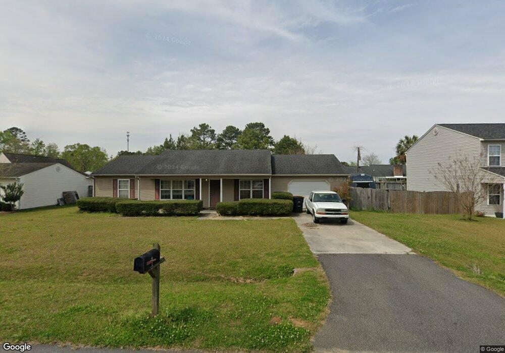
This home is located at 205 Rail St, Longs, SC 29568 and is currently estimated at $228,958, approximately $191 per square foot. 205 Rail St is a home with nearby schools including Daisy Elementary School, Loris Middle School, and Loris High School.
Ownership History
Date
Name
Owned For
Owner Type
Purchase Details
Closed on
Jan 23, 2008
Sold by
Keatts Brian D and Keatts Shannon A
Bought by
Keatts Brian D
Current Estimated Value
Purchase Details
Closed on
Jun 22, 2000
Sold by
B P Properties Inc
Bought by
Keatts Brian D and Keatts Shannon A
Home Financials for this Owner
Home Financials are based on the most recent Mortgage that was taken out on this home.
Original Mortgage
$97,750
Outstanding Balance
$35,466
Interest Rate
8.63%
Mortgage Type
Purchase Money Mortgage
Estimated Equity
$193,492
Purchase Details
Closed on
Jun 21, 2000
Sold by
Branch James E
Bought by
B P Properties Inc
Home Financials for this Owner
Home Financials are based on the most recent Mortgage that was taken out on this home.
Original Mortgage
$97,750
Outstanding Balance
$35,466
Interest Rate
8.63%
Mortgage Type
Purchase Money Mortgage
Estimated Equity
$193,492
Create a Home Valuation Report for This Property
The Home Valuation Report is an in-depth analysis detailing your home's value as well as a comparison with similar homes in the area
Home Values in the Area
Average Home Value in this Area
Purchase History
| Date | Buyer | Sale Price | Title Company |
|---|---|---|---|
| Keatts Brian D | -- | -- | |
| Keatts Brian D | $102,900 | -- | |
| B P Properties Inc | -- | -- |
Source: Public Records
Mortgage History
| Date | Status | Borrower | Loan Amount |
|---|---|---|---|
| Open | Keatts Brian D | $97,750 | |
| Closed | B P Properties Inc | $97,750 |
Source: Public Records
Tax History Compared to Growth
Tax History
| Year | Tax Paid | Tax Assessment Tax Assessment Total Assessment is a certain percentage of the fair market value that is determined by local assessors to be the total taxable value of land and additions on the property. | Land | Improvement |
|---|---|---|---|---|
| 2024 | $534 | $8,148 | $2,000 | $6,148 |
| 2023 | $534 | $4,211 | $871 | $3,340 |
| 2021 | $488 | $4,211 | $871 | $3,340 |
| 2020 | $411 | $4,211 | $871 | $3,340 |
| 2019 | $411 | $4,211 | $871 | $3,340 |
| 2018 | $415 | $4,141 | $613 | $3,528 |
| 2017 | $400 | $4,141 | $613 | $3,528 |
| 2016 | -- | $4,141 | $613 | $3,528 |
| 2015 | $400 | $4,142 | $614 | $3,528 |
| 2014 | $371 | $4,142 | $614 | $3,528 |
Source: Public Records
Map
Nearby Homes
- 251 Red Maple Loop
- 351 Jeff Waters Cir
- 401 Quinta St
- 228 Lakota Loop
- 10625 S Highway 905
- 296 Lakota Loop
- 1146 Joywood Dr
- 509 Covewood Ct
- 623 Burnt Ash Dr
- 155 Sid Patrick Rd
- 568 Mossbank Loop
- 12264 S Carolina 905
- 315 Mistletoe Way
- Gerson Plan at Birchwood
- Lookout Plan at Birchwood
- Woodhaven Plan at Birchwood
- Whitetail Plan at Birchwood
- Brower Plan at Birchwood
- 224 Jeff Waters Cir
- 255 Lakota Loop