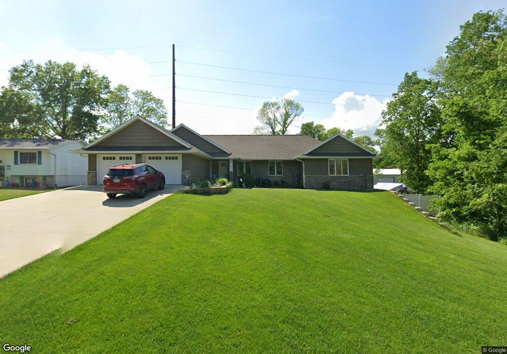
205 Robinwood Dr Robins, IA 52328
Estimated Value: $384,000 - $458,000
3
Beds
--
Bath
1,634
Sq Ft
$258/Sq Ft
Est. Value
About This Home
This home is located at 205 Robinwood Dr, Robins, IA 52328 and is currently estimated at $421,602, approximately $258 per square foot. 205 Robinwood Dr is a home located in Linn County with nearby schools including Nixon Elementary School, Harding Middle School, and John F. Kennedy High School.
Ownership History
Date
Name
Owned For
Owner Type
Purchase Details
Closed on
Mar 17, 2020
Sold by
Wandler Leo and Wandler Diane J
Bought by
Wandler Scott A and Leo And Diane Wandler Family T
Current Estimated Value
Purchase Details
Closed on
Aug 2, 2010
Sold by
Winter Larry P
Bought by
Wandler Leo and Wandler Diane J
Purchase Details
Closed on
Nov 25, 2008
Sold by
Yearous Jonna L
Bought by
Winter Larry P
Create a Home Valuation Report for This Property
The Home Valuation Report is an in-depth analysis detailing your home's value as well as a comparison with similar homes in the area
Home Values in the Area
Average Home Value in this Area
Purchase History
| Date | Buyer | Sale Price | Title Company |
|---|---|---|---|
| Wandler Scott A | -- | None Available | |
| Wandler Leo | $117,500 | None Available | |
| Winter Larry P | -- | None Available |
Source: Public Records
Tax History Compared to Growth
Tax History
| Year | Tax Paid | Tax Assessment Tax Assessment Total Assessment is a certain percentage of the fair market value that is determined by local assessors to be the total taxable value of land and additions on the property. | Land | Improvement |
|---|---|---|---|---|
| 2025 | $5,056 | $436,700 | $66,700 | $370,000 |
| 2024 | $4,496 | $400,800 | $66,700 | $334,100 |
| 2023 | $4,496 | $400,800 | $66,700 | $334,100 |
| 2022 | $4,786 | $307,300 | $66,700 | $240,600 |
| 2021 | $5,108 | $307,300 | $66,700 | $240,600 |
| 2020 | $5,108 | $303,900 | $66,700 | $237,200 |
| 2019 | $4,838 | $303,900 | $66,700 | $237,200 |
| 2018 | $4,754 | $293,400 | $66,700 | $226,700 |
| 2017 | $4,858 | $289,700 | $66,700 | $223,000 |
| 2016 | $4,928 | $289,700 | $66,700 | $223,000 |
| 2015 | $4,895 | $284,900 | $66,700 | $218,200 |
| 2014 | $4,710 | $61,800 | $43,300 | $18,500 |
| 2013 | $1,044 | $61,800 | $43,300 | $18,500 |
Source: Public Records
Map
Nearby Homes
- Lot 45 Village Way
- Lot 44 Village Way
- Lot 10 Kervin Ct
- Lot 9 Kervin Ct
- 3000 Trailside Dr
- 70.78 Acres M L Quass Rd
- 70.78 Acres M/L Quass Rd
- 26.35 Acres M/L Quass Rd
- 535 Hampton St
- 545 Hampton St
- 515 Hampton St
- 620 Hampton St
- 610 Hampton St
- 600 Hampton St
- 590 Hampton St
- 580 Hampton St
- 570 Hampton St
- 560 Hampton St
- 550 Hampton St
- 540 Hampton St
- 185 Robinwood Dr
- 185 N Robinwood Dr
- 165 Robinwood Dr
- 305 Robinwood Dr
- 280 W Main St
- 170 Robinwood Dr
- 145 Robinwood Dr
- 250 Robinwood Dr
- 125 Robinwood Dr
- 300 W Main St
- 75 Robinwood Dr
- 80 Robinwood Dr
- 250 W Main St
- 25 Robinwood Dr
- 375 Woodland Dr
- 1 W Knoll Dr
- 390 Robinwood Dr
- 500 W Main St
- 395 Woodland Dr
- 400 Robinwood Dr
