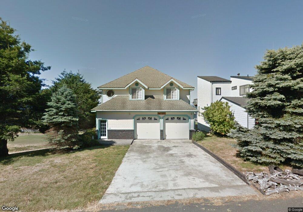
205 Sea View Rd Whitethorn, CA 95589
Shelter Cove NeighborhoodEstimated Value: $467,000 - $758,000
3
Beds
3
Baths
1,622
Sq Ft
$335/Sq Ft
Est. Value
About This Home
This home is located at 205 Sea View Rd, Whitethorn, CA 95589 and is currently estimated at $544,058, approximately $335 per square foot. 205 Sea View Rd is a home located in Humboldt County.
Ownership History
Date
Name
Owned For
Owner Type
Purchase Details
Closed on
Nov 2, 2017
Sold by
Porterfield Russell W and Porterfield Joyce A
Bought by
Franklin Paul A
Current Estimated Value
Purchase Details
Closed on
Aug 2, 2002
Sold by
Howell Jack L and Howell Roberta R
Bought by
Porterfield Russell W and Porterfield Joyce A
Create a Home Valuation Report for This Property
The Home Valuation Report is an in-depth analysis detailing your home's value as well as a comparison with similar homes in the area
Home Values in the Area
Average Home Value in this Area
Purchase History
| Date | Buyer | Sale Price | Title Company |
|---|---|---|---|
| Franklin Paul A | $350,000 | Humboldt Land Title Company | |
| Porterfield Russell W | $285,000 | Humboldt Land Title Company |
Source: Public Records
Tax History Compared to Growth
Tax History
| Year | Tax Paid | Tax Assessment Tax Assessment Total Assessment is a certain percentage of the fair market value that is determined by local assessors to be the total taxable value of land and additions on the property. | Land | Improvement |
|---|---|---|---|---|
| 2025 | $4,508 | $398,236 | $136,537 | $261,699 |
| 2024 | $4,508 | $390,428 | $133,860 | $256,568 |
| 2023 | $4,525 | $382,774 | $131,236 | $251,538 |
| 2022 | $4,458 | $375,269 | $128,663 | $246,606 |
| 2021 | $4,296 | $367,912 | $126,141 | $241,771 |
| 2020 | $4,321 | $364,140 | $124,848 | $239,292 |
| 2019 | $4,218 | $357,000 | $122,400 | $234,600 |
| 2018 | $4,149 | $350,000 | $120,000 | $230,000 |
| 2017 | $4,110 | $355,647 | $62,388 | $293,259 |
| 2016 | $4,086 | $348,674 | $61,165 | $287,509 |
| 2015 | $4,066 | $343,438 | $60,247 | $283,191 |
| 2014 | $3,889 | $336,711 | $59,067 | $277,644 |
Source: Public Records
Map
Nearby Homes
- 235 Sea View Rd
- 371 Upper Pacific Dr
- 134 Sea View Rd
- 88 Shaker Rd
- 104 Sea View Rd
- 60 Spruce Rd
- 156 Shaker Rd
- 190 Shaker Rd
- 79 Sea View Rd
- 112 Seafoam Rd
- 1325&1335 Upper Pacific Dr
- 26 Rd
- 680 Lower Pacific Dr
- 58 Lower Pacific Dr
- 806 Lower Pacific Dr
- 16 Bambi Dr
- 76 Lower Pacific Dr
- 36 Bambi Dr
- 11 Sail Ct
- 37 Spur Ct
- 197 Sea View Rd
- 223 Sea View Rd
- 181 Sea View Rd
- 208 Sea View Rd
- 216 Sea View Rd
- 228 Sea View Rd
- 186 Sea View Rd
- 173 Sea View Rd
- 253 Sea View Rd
- 1151 Upper Pacific Dr
- 152 Sea View Rd
- 163 Sea View Rd
- 248 Sea View Rd
- 1191 Upper Pacific Dr
- 153 Sea View Rd
- 1181 Upper Pacific Dr
- 148 Sea View Rd
- 258 Sea View Rd
- 1161 Upper Pacific Dr
- 271 Sea View Rd