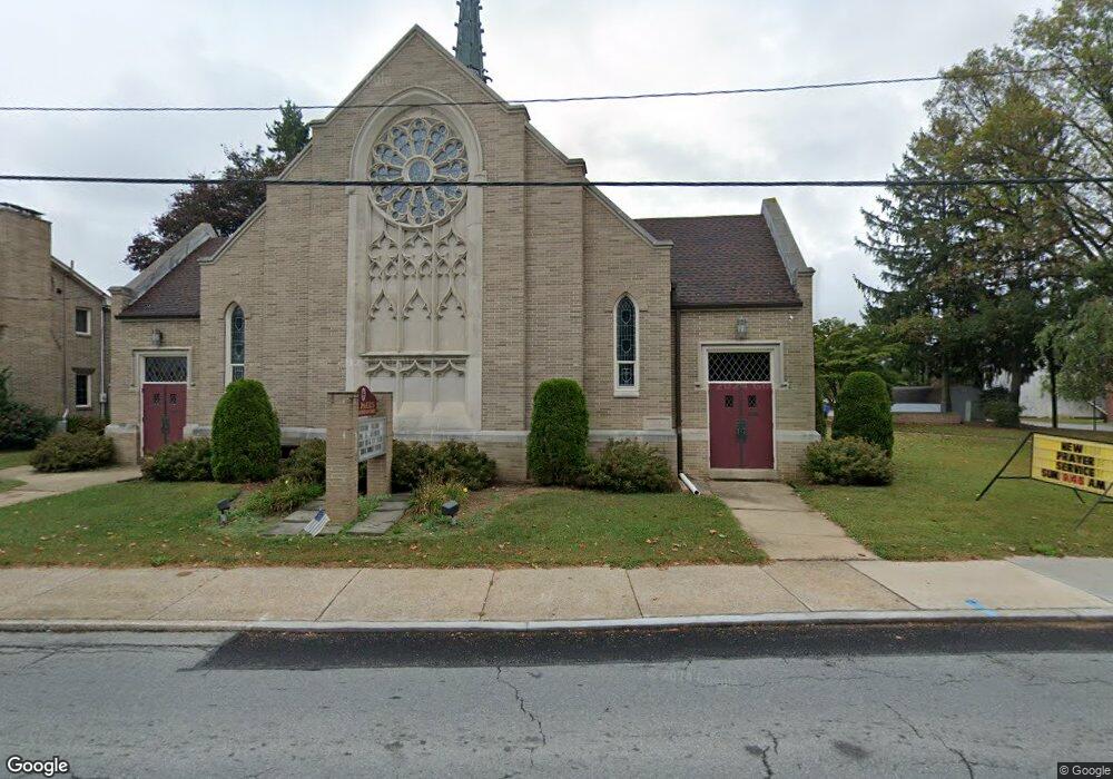
205 W Main St Dallastown, PA 17313
Estimated Value: $359,011
4
Beds
2
Baths
14,704
Sq Ft
$24/Sq Ft
Est. Value
About This Home
This home is located at 205 W Main St, Dallastown, PA 17313 and is currently estimated at $359,011, approximately $24 per square foot. 205 W Main St is a home located in York County with nearby schools including Dallastown Elementary School, Dallastown Area Middle School, and Dallastown Area High School.
Ownership History
Date
Name
Owned For
Owner Type
Purchase Details
Closed on
Apr 30, 2024
Sold by
St Pauls United Church Of Christ Of Dall
Bought by
Rodkey Christopher D and Rodkey Traci L
Current Estimated Value
Purchase Details
Closed on
May 1, 2023
Sold by
St Pauls Reformed Church
Bought by
Allegheny East Conference Corporation Of Seve
Purchase Details
Closed on
Jun 12, 2005
Sold by
St Pauls United Church Of Christ Of Dall
Bought by
St Pauls United Church Of Christ Of Dall
Create a Home Valuation Report for This Property
The Home Valuation Report is an in-depth analysis detailing your home's value as well as a comparison with similar homes in the area
Home Values in the Area
Average Home Value in this Area
Purchase History
| Date | Buyer | Sale Price | Title Company |
|---|---|---|---|
| Rodkey Christopher D | $50,000 | None Listed On Document | |
| Allegheny East Conference Corporation Of Seve | $318,750 | None Listed On Document | |
| Allegheny East Conference Corporation Of Seve | $318,750 | None Listed On Document | |
| St Pauls United Church Of Christ Of Dall | -- | -- |
Source: Public Records
Tax History Compared to Growth
Tax History
| Year | Tax Paid | Tax Assessment Tax Assessment Total Assessment is a certain percentage of the fair market value that is determined by local assessors to be the total taxable value of land and additions on the property. | Land | Improvement |
|---|---|---|---|---|
| 2025 | -- | $0 | $0 | $0 |
| 2024 | $22,895 | $659,120 | $78,670 | $580,450 |
| 2023 | $5,389 | $155,130 | $23,280 | $131,850 |
| 2022 | $5,217 | $155,130 | $23,280 | $131,850 |
| 2021 | $4,919 | $155,130 | $23,280 | $131,850 |
| 2020 | $4,919 | $155,130 | $23,280 | $131,850 |
| 2019 | $4,904 | $155,130 | $23,280 | $131,850 |
| 2018 | $4,904 | $155,130 | $23,280 | $131,850 |
| 2017 | $4,713 | $155,130 | $23,280 | $131,850 |
| 2016 | $0 | $155,130 | $23,280 | $131,850 |
| 2015 | -- | $155,130 | $23,280 | $131,850 |
| 2014 | -- | $155,130 | $23,280 | $131,850 |
Source: Public Records
Map
Nearby Homes
- 263 W Main St
- 53 S Franklin St
- 79 S Franklin St
- 18 E Howard St
- 2981 Sunset Dr
- 0 Lot 15 Gary Dr
- 197 S Main St
- 117 S Park St
- 430 E Maple St
- 74 S Main St
- 141 W Water St
- 1 N Duke St
- 705 Summit Dr
- 2960 Starfire Dr
- 114 Heather Glen Dr
- 680 Hampstead Ct
- 55 Belmar Dr
- 227 Jutland Way
- 630 Woodland Ave
- 195 Coventry Rd