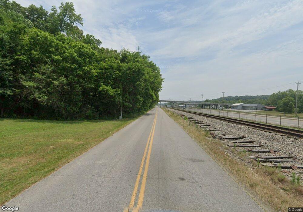
205 W Railroad St Waverly, TN 37185
Estimated Value: $69,237 - $177,000
--
Bed
--
Bath
--
Sq Ft
0.27
Acres
About This Home
This home is located at 205 W Railroad St, Waverly, TN 37185 and is currently estimated at $134,559. 205 W Railroad St is a home located in Humphreys County.
Ownership History
Date
Name
Owned For
Owner Type
Purchase Details
Closed on
Feb 8, 2007
Sold by
David Bramlett
Bought by
Rumsey Paul G
Current Estimated Value
Home Financials for this Owner
Home Financials are based on the most recent Mortgage that was taken out on this home.
Original Mortgage
$12,489
Interest Rate
6.17%
Mortgage Type
Cash
Purchase Details
Closed on
Feb 8, 2006
Bought by
Rumsey Paul G and Rumsey Patricia
Purchase Details
Closed on
Mar 2, 1978
Bought by
Bramlett David and Bramlett Frances
Purchase Details
Closed on
Aug 22, 1972
Purchase Details
Closed on
Mar 24, 1970
Create a Home Valuation Report for This Property
The Home Valuation Report is an in-depth analysis detailing your home's value as well as a comparison with similar homes in the area
Home Values in the Area
Average Home Value in this Area
Purchase History
| Date | Buyer | Sale Price | Title Company |
|---|---|---|---|
| Rumsey Paul G | $12,488 | -- | |
| Rumsey Paul G | $12,500 | -- | |
| Bramlett David | -- | -- | |
| -- | -- | -- | |
| -- | -- | -- |
Source: Public Records
Mortgage History
| Date | Status | Borrower | Loan Amount |
|---|---|---|---|
| Closed | Not Available | $12,489 |
Source: Public Records
Tax History Compared to Growth
Tax History
| Year | Tax Paid | Tax Assessment Tax Assessment Total Assessment is a certain percentage of the fair market value that is determined by local assessors to be the total taxable value of land and additions on the property. | Land | Improvement |
|---|---|---|---|---|
| 2025 | $87 | $2,875 | $0 | $0 |
| 2024 | $87 | $2,875 | $1,600 | $1,275 |
| 2023 | $88 | $2,875 | $1,600 | $1,275 |
| 2022 | $117 | $3,650 | $1,325 | $2,325 |
| 2021 | $117 | $3,650 | $1,325 | $2,325 |
| 2020 | $117 | $3,650 | $1,325 | $2,325 |
| 2019 | $107 | $3,250 | $1,300 | $1,950 |
| 2018 | $107 | $3,250 | $1,300 | $1,950 |
| 2017 | $107 | $3,250 | $1,300 | $1,950 |
| 2016 | $111 | $3,125 | $1,300 | $1,825 |
| 2015 | $111 | $3,125 | $1,300 | $1,825 |
| 2014 | $111 | $3,130 | $0 | $0 |
Source: Public Records
Map
Nearby Homes
- 312 N Maple Ave
- 314 N Maple Ave
- 221 Carroll Ave
- Lot #18 Foxwood Dr
- 0 Mill St
- 213 E Wyly St
- 0 Bear Hollow Dr Unit RTC3002566
- 0 Bear Hollow Dr Unit 24022394
- 0 Bear Hollow Dr Unit 24022393
- 0 Bear Hollow Dr Unit RTC2817194
- 0 Bear Hollow Dr Unit RTC2747935
- 307 E Commerce St
- 120 Joe St
- 128 Washington Cir
- 0 Hwy 13 N Unit RTC2991975
- 101 Slayden Ave
- 230 E Little Richland Rd
- 270 E Little Richland Rd
- W Blue Creek Rd
- 437 W Main St
- 213 W Railroad St
- 217 W Railroad St
- 105 Daniel St
- 311 N Maple Ave
- 325 Mill St
- 103 Daniel St
- 107 Daniel St
- 375 Highway 13 N
- 309 N Maple Ave
- 385 Highway 13 N
- 338 Durham Hill Ln
- 395 Highway 13 N
- 225 W Railroad St
- 310 N Maple Ave
- 307 N Maple Ave
- 310 Mill St
- 309 Mill St
- 308 N Maple Ave
- 305 N Maple Ave
- 220 Carroll Ave
