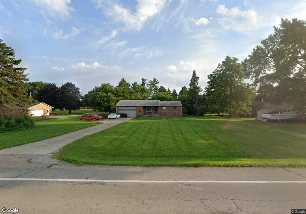
205 W State Route 571 Tipp City, OH 45371
Estimated Value: $285,154 - $356,000
3
Beds
2
Baths
1,298
Sq Ft
$245/Sq Ft
Est. Value
About This Home
This home is located at 205 W State Route 571, Tipp City, OH 45371 and is currently estimated at $318,539, approximately $245 per square foot. 205 W State Route 571 is a home located in Miami County with nearby schools including Broadway Elementary School, Nevin Coppock Elementary School, and L. T. Ball Intermediate School.
Ownership History
Date
Name
Owned For
Owner Type
Purchase Details
Closed on
May 7, 1999
Sold by
Prazak Raymond W and Prazak Gail P
Bought by
Graham James N
Current Estimated Value
Purchase Details
Closed on
Jan 1, 1990
Bought by
Prazak Raymond W
Create a Home Valuation Report for This Property
The Home Valuation Report is an in-depth analysis detailing your home's value as well as a comparison with similar homes in the area
Home Values in the Area
Average Home Value in this Area
Purchase History
| Date | Buyer | Sale Price | Title Company |
|---|---|---|---|
| Graham James N | $104,000 | -- | |
| Prazak Raymond W | -- | -- |
Source: Public Records
Mortgage History
| Date | Status | Borrower | Loan Amount |
|---|---|---|---|
| Closed | Graham James N | -- |
Source: Public Records
Tax History Compared to Growth
Tax History
| Year | Tax Paid | Tax Assessment Tax Assessment Total Assessment is a certain percentage of the fair market value that is determined by local assessors to be the total taxable value of land and additions on the property. | Land | Improvement |
|---|---|---|---|---|
| 2024 | $3,819 | $72,490 | $23,630 | $48,860 |
| 2023 | $3,819 | $72,490 | $23,630 | $48,860 |
| 2022 | $3,500 | $72,490 | $23,630 | $48,860 |
| 2021 | $2,769 | $53,690 | $17,500 | $36,190 |
| 2020 | $2,802 | $53,690 | $17,500 | $36,190 |
| 2019 | $2,827 | $53,690 | $17,500 | $36,190 |
| 2018 | $2,485 | $43,970 | $11,030 | $32,940 |
| 2017 | $2,494 | $43,970 | $11,030 | $32,940 |
| 2016 | $2,391 | $43,970 | $11,030 | $32,940 |
| 2015 | $2,022 | $39,240 | $9,840 | $29,400 |
| 2014 | $2,022 | $39,240 | $9,840 | $29,400 |
| 2013 | $2,031 | $39,240 | $9,840 | $29,400 |
Source: Public Records
Map
Nearby Homes
- 6201 S Co Road 25a
- 512 Cider Mill Way
- 295 Coach Dr
- 000 Kinna Dr
- 5700 S Co Road 25a
- 5998 Sterling Ct
- 389 N Garber Dr
- 527 Bellaire Dr
- 397 Miles Ave
- 28 Warner Dr
- 703 Nelson Ct
- 704 Shoshoni Way
- 1013 Arapaho Trail
- 403 Sydney Dr
- 6060 Detrick Rd
- The Prescott Plan at Fieldstone Place
- The Lynwood Plan at Emerson Crossing
- The Concord Plan at Emerson Crossing
- The Magnolia Plan at Fieldstone Place
- The Cambridge Plan at Emerson Crossing
- 233 W State Route 571
- 185 W State Route 571
- 255 W State Route 571
- 277 W State Route 571
- 125 W State Route 571
- 5295 David Dr
- 295 W State Route 571
- 5255 David Dr
- 81 W State Route 571
- 5225 David Dr
- 335 W State Route 571
- 5355 David Dr
- 5185 David Dr
- 5270 David Dr
- 345 W State Route 571
- 5395 David Dr
- 5240 David Dr
- 5310 David Dr
- 5200 David Dr
- 5340 David Dr