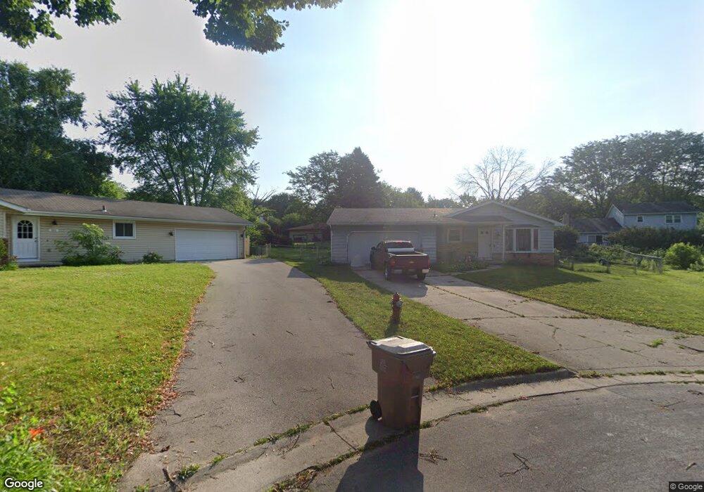
205 Windsor Ct Madison, WI 53714
Heritage Heights NeighborhoodEstimated Value: $357,918 - $384,000
3
Beds
2
Baths
1,518
Sq Ft
$244/Sq Ft
Est. Value
About This Home
This home is located at 205 Windsor Ct, Madison, WI 53714 and is currently estimated at $370,230, approximately $243 per square foot. 205 Windsor Ct is a home located in Dane County with nearby schools including Kennedy Elementary School, Whitehorse Middle School, and La Follette High School.
Ownership History
Date
Name
Owned For
Owner Type
Purchase Details
Closed on
Aug 26, 2005
Sold by
Foss Thomas A and Heil Judith L
Bought by
Lutzen Ryan S
Current Estimated Value
Home Financials for this Owner
Home Financials are based on the most recent Mortgage that was taken out on this home.
Original Mortgage
$25,250
Outstanding Balance
$13,543
Interest Rate
5.89%
Mortgage Type
Credit Line Revolving
Estimated Equity
$356,687
Create a Home Valuation Report for This Property
The Home Valuation Report is an in-depth analysis detailing your home's value as well as a comparison with similar homes in the area
Home Values in the Area
Average Home Value in this Area
Purchase History
| Date | Buyer | Sale Price | Title Company |
|---|---|---|---|
| Lutzen Ryan S | $170,000 | None Available |
Source: Public Records
Mortgage History
| Date | Status | Borrower | Loan Amount |
|---|---|---|---|
| Open | Lutzen Ryan S | $25,250 |
Source: Public Records
Tax History
| Year | Tax Paid | Tax Assessment Tax Assessment Total Assessment is a certain percentage of the fair market value that is determined by local assessors to be the total taxable value of land and additions on the property. | Land | Improvement |
|---|---|---|---|---|
| 2024 | $10,547 | $317,800 | $69,300 | $248,500 |
| 2023 | $4,914 | $291,600 | $63,600 | $228,000 |
| 2022 | $9,325 | $253,600 | $63,600 | $190,000 |
| 2021 | $4,524 | $228,500 | $57,300 | $171,200 |
| 2020 | $4,571 | $215,600 | $54,100 | $161,500 |
| 2019 | $4,290 | $203,400 | $51,000 | $152,400 |
| 2018 | $3,898 | $184,900 | $51,000 | $133,900 |
| 2017 | $3,891 | $176,100 | $39,200 | $136,900 |
| 2016 | $3,828 | $169,300 | $37,700 | $131,600 |
| 2015 | $3,737 | $155,000 | $37,700 | $117,300 |
| 2014 | $3,546 | $155,000 | $37,700 | $117,300 |
| 2013 | $3,544 | $155,000 | $37,700 | $117,300 |
Source: Public Records
Map
Nearby Homes
- 5309 Portsmouth Way
- 5902 Saturn Dr
- 410 Orion Trail
- 401 Orion Trail
- 417 Orion Trail
- The Atwood Plan at Grandview Commons - North
- 218 Milky Way
- 6011 Caldera St
- 21 Meadowlark Dr
- 5 Daffodil Ln
- 6062 Driscoll Dr
- 5026 Piccadilly Dr
- 6107 Ragan St
- 718 Orion Trail
- 713 Apollo Way
- 1002 Ellen Ave
- 125 Cameo Ln
- 3748 Fairview Dr
- 6106 Fredericksburg Ln
- Lot 3 Bellevine Ct
- 201 Windsor Ct
- 209 Windsor Ct
- 218 Saint Albans Ave
- 214 Saint Albans Ave
- 222 Saint Albans Ave
- 202 Windsor Ct
- 213 Windsor Ct
- 210 Saint Albans Ave
- 5409 Brookshire Ln
- 230 Saint Albans Ave
- 210 St Albans Ave
- 5413 Brookshire Ln
- 206 Windsor Ct
- 5405 Brookshire Ln
- 210 Windsor Ct
- 217 Windsor Ct
- 214 Windsor Ct
- 202 Saint Albans Ave
- 234 Saint Albans Ave
- 221 St Albans Ave
Your Personal Tour Guide
Ask me questions while you tour the home.