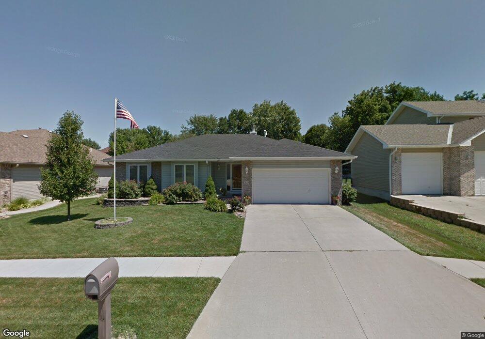
205 Woodcliff Cir Council Bluffs, IA 51503
Eastern Council Bluffs NeighborhoodEstimated Value: $368,000 - $438,563
3
Beds
3
Baths
3,288
Sq Ft
$124/Sq Ft
Est. Value
About This Home
This home is located at 205 Woodcliff Cir, Council Bluffs, IA 51503 and is currently estimated at $407,641, approximately $123 per square foot. 205 Woodcliff Cir is a home located in Pottawattamie County with nearby schools including E.A. Kreft Primary School, Titan Hill Intermediate School, and Lewis Central Middle School.
Ownership History
Date
Name
Owned For
Owner Type
Purchase Details
Closed on
May 12, 2011
Sold by
Johns Kevin C and Filippi Johns Aili T
Bought by
Johns Kevin C and Filippi Johns Aili T
Current Estimated Value
Home Financials for this Owner
Home Financials are based on the most recent Mortgage that was taken out on this home.
Original Mortgage
$237,653
Interest Rate
4.96%
Mortgage Type
FHA
Create a Home Valuation Report for This Property
The Home Valuation Report is an in-depth analysis detailing your home's value as well as a comparison with similar homes in the area
Home Values in the Area
Average Home Value in this Area
Purchase History
| Date | Buyer | Sale Price | Title Company |
|---|---|---|---|
| Johns Kevin C | -- | Lsi |
Source: Public Records
Mortgage History
| Date | Status | Borrower | Loan Amount |
|---|---|---|---|
| Closed | Johns Kevin C | $237,653 |
Source: Public Records
Tax History Compared to Growth
Tax History
| Year | Tax Paid | Tax Assessment Tax Assessment Total Assessment is a certain percentage of the fair market value that is determined by local assessors to be the total taxable value of land and additions on the property. | Land | Improvement |
|---|---|---|---|---|
| 2025 | $6,670 | $422,000 | $51,200 | $370,800 |
| 2024 | $6,670 | $383,500 | $44,600 | $338,900 |
| 2023 | $6,454 | $383,500 | $44,600 | $338,900 |
| 2022 | $5,792 | $295,600 | $43,500 | $252,100 |
| 2021 | $8,844 | $295,600 | $43,500 | $252,100 |
| 2020 | $5,660 | $295,600 | $43,500 | $252,100 |
| 2019 | $5,888 | $264,800 | $39,734 | $225,066 |
| 2018 | $5,754 | $264,800 | $39,734 | $225,066 |
| 2017 | $5,856 | $264,800 | $39,734 | $225,066 |
| 2015 | $5,252 | $242,464 | $39,734 | $202,730 |
| 2014 | $5,282 | $242,464 | $39,734 | $202,730 |
Source: Public Records
Map
Nearby Homes
- 212 Woodcliff Cir
- 310 Wildwood Rd
- 219 Red Bud Ln
- 206 Parkview Dr
- 200 Timber Dr
- 208 Red Bud Ln
- 128 Charles Park Dr
- 1715 Blackthorn St
- 1711 Blackthorn St
- 1759 Blackthorn St
- 1742 Blackthorn St
- 1768 Blackthorn St
- LOT 12 Mcpherson Ave
- 1780 Blackthorn St
- 1835 Balsam St
- 1847 Balsam St
- 1873 Hemlock St
- 1893 Hemlock St
- 1843 Sycamore St
- 1877 Hemlock St
- 209 Woodcliff Cir
- 213 Woodcliff Cir
- 308 Marinda Dr
- 316 Wildwood Rd
- 304 Marinda Dr
- 141 Woodcliff Cir
- 318 Wildwood Rd
- 101 Woodcliff Cir
- 312 Wildwood Rd
- 101 Cambridge Cir
- 320 Wildwood Rd
- 217 Woodcliff Cir
- 208 Woodcliff Cir
- 204 Woodcliff Cir
- 216 Woodcliff Cir
- 404 Cambridge Cir
- 105 Cambridge Cir
- 307 Wildwood Rd
- 309 Wildwood Rd
- 322 Wildwood Rd