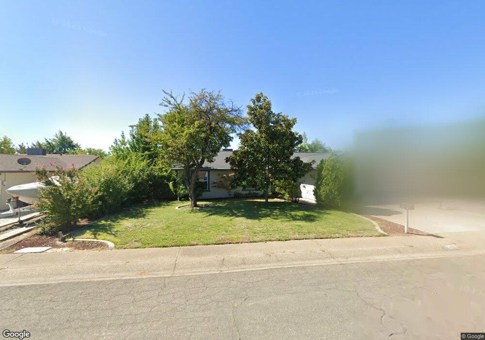
205 Woodhill Dr Unit 1 Redding, CA 96003
North Hilltop NeighborhoodEstimated Value: $344,773 - $388,000
3
Beds
2
Baths
1,507
Sq Ft
$246/Sq Ft
Est. Value
About This Home
This home is located at 205 Woodhill Dr Unit 1, Redding, CA 96003 and is currently estimated at $370,443, approximately $245 per square foot. 205 Woodhill Dr Unit 1 is a home located in Shasta County with nearby schools including Turtle Bay, Sequoia Middle School, and Shasta High School.
Ownership History
Date
Name
Owned For
Owner Type
Purchase Details
Closed on
Feb 9, 2010
Sold by
The Bank Of New York Mellon
Bought by
Bennett Kirkley W and Bennett Susan A
Current Estimated Value
Home Financials for this Owner
Home Financials are based on the most recent Mortgage that was taken out on this home.
Original Mortgage
$140,250
Interest Rate
4.94%
Mortgage Type
New Conventional
Purchase Details
Closed on
Nov 30, 2009
Sold by
Beck Jeff A
Bought by
The Bank Of New York Mellon
Purchase Details
Closed on
Dec 9, 2003
Sold by
Herrera Joe L and Herrera Debra R
Bought by
Beck Jeff A
Home Financials for this Owner
Home Financials are based on the most recent Mortgage that was taken out on this home.
Original Mortgage
$212,180
Interest Rate
5.92%
Mortgage Type
VA
Create a Home Valuation Report for This Property
The Home Valuation Report is an in-depth analysis detailing your home's value as well as a comparison with similar homes in the area
Home Values in the Area
Average Home Value in this Area
Purchase History
| Date | Buyer | Sale Price | Title Company |
|---|---|---|---|
| Bennett Kirkley W | $187,000 | Chicago Title Company | |
| The Bank Of New York Mellon | $195,000 | First American Title Ins Co | |
| Beck Jeff A | $206,000 | Placer Title Company |
Source: Public Records
Mortgage History
| Date | Status | Borrower | Loan Amount |
|---|---|---|---|
| Previous Owner | Bennett Kirkley W | $140,250 | |
| Previous Owner | Beck Jeff A | $212,180 |
Source: Public Records
Tax History Compared to Growth
Tax History
| Year | Tax Paid | Tax Assessment Tax Assessment Total Assessment is a certain percentage of the fair market value that is determined by local assessors to be the total taxable value of land and additions on the property. | Land | Improvement |
|---|---|---|---|---|
| 2025 | $2,509 | $241,367 | $64,533 | $176,834 |
| 2024 | $2,470 | $236,635 | $63,268 | $173,367 |
| 2023 | $2,470 | $231,996 | $62,028 | $169,968 |
| 2022 | $2,429 | $227,448 | $60,812 | $166,636 |
| 2021 | $2,417 | $222,989 | $59,620 | $163,369 |
| 2020 | $2,449 | $220,703 | $59,009 | $161,694 |
| 2019 | $2,325 | $216,376 | $57,852 | $158,524 |
| 2018 | $2,346 | $212,134 | $56,718 | $155,416 |
| 2017 | $2,334 | $207,975 | $55,606 | $152,369 |
| 2016 | $2,259 | $203,898 | $54,516 | $149,382 |
| 2015 | $2,231 | $200,837 | $53,698 | $147,139 |
| 2014 | $2,216 | $196,904 | $52,647 | $144,257 |
Source: Public Records
Map
Nearby Homes
- 404 Woodhill Dr
- 200 Ridgetop Dr Unit 4
- 488 Ridgecrest Trail Unit 132
- 488 Ridgecrest Trail Unit 133
- 481 Twin View Blvd
- 538 Alamine Dr
- 719 Saint Thomas Pkwy
- 5334 Valleyridge Dr
- 525 N Boulder Dr
- 4893 Hardwood Blvd Unit 23
- 575 N Boulder Dr
- 667 Brookridge Dr
- 395 Buckeye Terrace
- 592 Mill Valley Pkwy
- 4649 Underwood Dr
- 4672 Underwood Dr
- 1550 Barbara Rd
- 410 Buckeye Terrace
- 4862 Pecan Dr Unit 49
- 301 Sapwood Dr Unit 280
- 205 Woodhill Dr
- 185 Woodhill Dr
- 219 Woodhill Dr
- 163 Woodhill Dr
- 233 Woodhill Dr
- 202 Woodhill Dr
- 216 Woodhill Dr
- 188 Woodhill Dr
- 151 Woodhill Dr
- 230 Woodhill Dr
- 251 Woodhill Dr
- 174 Woodhill Dr
- 244 Woodhill Dr
- 160 Woodhill Dr
- 207 Woodcliff Dr
- 221 Woodcliff Dr
- 143 Woodhill Dr
- 179 Woodcliff Dr
- 235 Woodcliff Dr
- 263 Woodhill Dr