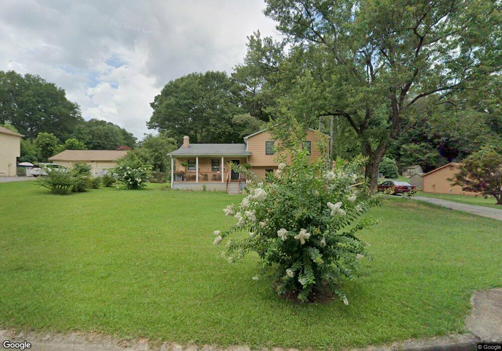
2050 Branch View Dr Marietta, GA 30062
Eastern Marietta NeighborhoodEstimated Value: $340,596 - $398,000
3
Beds
2
Baths
1,304
Sq Ft
$285/Sq Ft
Est. Value
About This Home
This home is located at 2050 Branch View Dr, Marietta, GA 30062 and is currently estimated at $371,399, approximately $284 per square foot. 2050 Branch View Dr is a home located in Cobb County with nearby schools including Kincaid Elementary School, Simpson Middle School, and Sprayberry High School.
Ownership History
Date
Name
Owned For
Owner Type
Purchase Details
Closed on
Apr 24, 2002
Sold by
Crawford Mark D
Bought by
Boga Cossatta D
Current Estimated Value
Home Financials for this Owner
Home Financials are based on the most recent Mortgage that was taken out on this home.
Original Mortgage
$139,900
Interest Rate
7.75%
Mortgage Type
New Conventional
Create a Home Valuation Report for This Property
The Home Valuation Report is an in-depth analysis detailing your home's value as well as a comparison with similar homes in the area
Home Values in the Area
Average Home Value in this Area
Purchase History
| Date | Buyer | Sale Price | Title Company |
|---|---|---|---|
| Boga Cossatta D | $139,900 | -- |
Source: Public Records
Mortgage History
| Date | Status | Borrower | Loan Amount |
|---|---|---|---|
| Previous Owner | Boga Cossatta D | $139,900 |
Source: Public Records
Tax History Compared to Growth
Tax History
| Year | Tax Paid | Tax Assessment Tax Assessment Total Assessment is a certain percentage of the fair market value that is determined by local assessors to be the total taxable value of land and additions on the property. | Land | Improvement |
|---|---|---|---|---|
| 2025 | $3,095 | $129,772 | $36,000 | $93,772 |
| 2024 | $3,034 | $126,808 | $36,000 | $90,808 |
| 2023 | $2,227 | $114,648 | $28,000 | $86,648 |
| 2022 | $2,791 | $114,648 | $28,000 | $86,648 |
| 2021 | $2,241 | $89,512 | $22,000 | $67,512 |
| 2020 | $2,016 | $79,248 | $22,000 | $57,248 |
| 2019 | $2,016 | $79,248 | $22,000 | $57,248 |
| 2018 | $1,633 | $62,824 | $16,800 | $46,024 |
| 2017 | $1,550 | $62,824 | $16,800 | $46,024 |
| 2016 | $1,265 | $52,896 | $16,800 | $36,096 |
| 2015 | $1,298 | $52,896 | $16,800 | $36,096 |
| 2014 | $1,090 | $45,528 | $0 | $0 |
Source: Public Records
Map
Nearby Homes
- 1599 Cambridge Place
- 1582 Cambridge
- 1834 Butterfly NE
- 1834 Butterfly Way
- 1800 Chardin Way
- 1838 Butterfly NE
- 1490 Longwing Ln
- 2252 Carefree Cir Unit 3
- 1854 Butterfly Way
- 1850 Butterfly Way NE
- Robie Plan at The Village at Sandy Plains
- Harbor Plan at The Village at Sandy Plains
- Hanover Plan at The Village at Sandy Plains
- Bowen Plan at The Village at Sandy Plains
- Elston Plan at The Village at Sandy Plains
- BALDWIN Plan at The Village at Sandy Plains
- 1900 Branch View Dr
- 1519 Evanston Ln
- 1972 Granite Mill Rd
- 2060 Branch View Dr Unit 2
- 2040 Branch View Dr
- 2070 Branch View Dr
- 2051 Branch View Dr
- 2061 Branch View Dr
- 2030 Branch View Dr
- 1810 Scufflegrit Rd
- 2001 Branch View Dr
- 1792 Scufflegrit Rd
- 2080 Branch View Dr
- 1830 Scufflegrit Rd
- 2081 Branch View Dr
- 2020 Branch View Dr Unit 2
- 1787 Wingard Dr
- 2010 Branch View Dr
- 0 Branch View Dr Unit 8298252
- 0 Branch View Dr Unit 3247318
- 0 Branch View Dr Unit 8733383
- 0 Branch View Dr Unit 9002897
- 0 Branch View Dr Unit 9047902