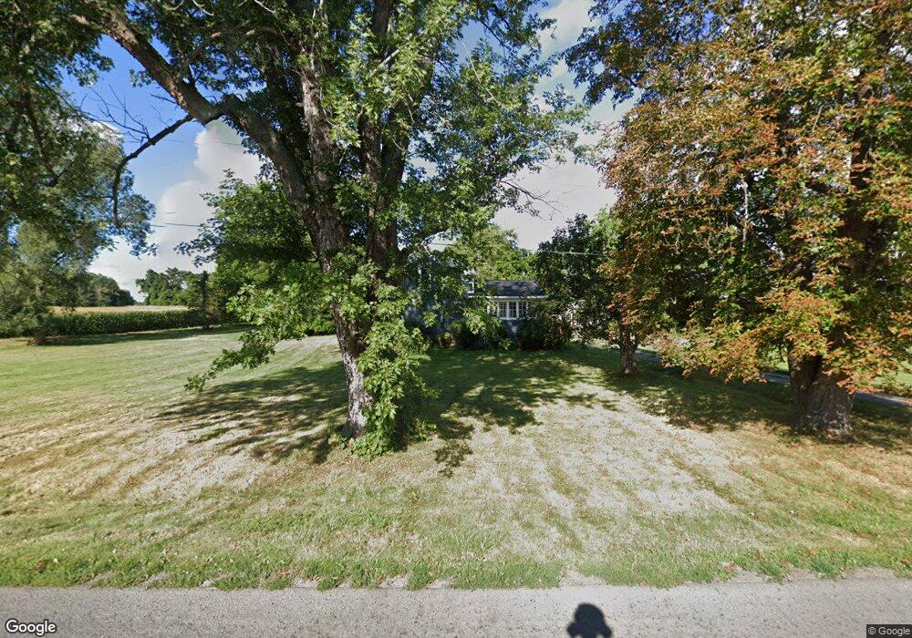
2050 Center Rd Kendall, NY 14476
Estimated Value: $307,000 - $340,046
4
Beds
2
Baths
1,943
Sq Ft
$167/Sq Ft
Est. Value
About This Home
This home is located at 2050 Center Rd, Kendall, NY 14476 and is currently estimated at $323,512, approximately $166 per square foot. 2050 Center Rd is a home located in Orleans County with nearby schools including Kendall Elementary School and Kendall Junior/Senior High School.
Ownership History
Date
Name
Owned For
Owner Type
Purchase Details
Closed on
Jul 29, 2022
Sold by
Billings Earl C
Bought by
Morehouse Joseph and Morehouse Blake
Current Estimated Value
Home Financials for this Owner
Home Financials are based on the most recent Mortgage that was taken out on this home.
Original Mortgage
$252,879
Outstanding Balance
$242,274
Interest Rate
5.78%
Mortgage Type
FHA
Estimated Equity
$81,238
Purchase Details
Closed on
Dec 27, 2000
Purchase Details
Closed on
Dec 29, 1998
Create a Home Valuation Report for This Property
The Home Valuation Report is an in-depth analysis detailing your home's value as well as a comparison with similar homes in the area
Home Values in the Area
Average Home Value in this Area
Purchase History
| Date | Buyer | Sale Price | Title Company |
|---|---|---|---|
| Morehouse Joseph | $260,000 | None Available | |
| -- | -- | -- | |
| -- | $100 | -- |
Source: Public Records
Mortgage History
| Date | Status | Borrower | Loan Amount |
|---|---|---|---|
| Open | Morehouse Joseph | $252,879 |
Source: Public Records
Tax History Compared to Growth
Tax History
| Year | Tax Paid | Tax Assessment Tax Assessment Total Assessment is a certain percentage of the fair market value that is determined by local assessors to be the total taxable value of land and additions on the property. | Land | Improvement |
|---|---|---|---|---|
| 2024 | $5,745 | $241,700 | $24,800 | $216,900 |
| 2023 | $5,727 | $241,700 | $24,800 | $216,900 |
| 2022 | $5,000 | $143,200 | $18,300 | $124,900 |
| 2021 | $4,961 | $143,200 | $18,300 | $124,900 |
| 2020 | $4,510 | $143,200 | $18,300 | $124,900 |
| 2019 | $4,330 | $143,200 | $18,300 | $124,900 |
| 2018 | $4,330 | $133,700 | $17,300 | $116,400 |
| 2017 | $4,339 | $133,700 | $17,300 | $116,400 |
| 2016 | $4,280 | $133,700 | $17,300 | $116,400 |
| 2015 | -- | $147,800 | $14,700 | $133,100 |
| 2014 | -- | $147,800 | $14,700 | $133,100 |
Source: Public Records
Map
Nearby Homes
- 16762 Roosevelt Hwy
- 15927 Ed Rose Shrs Rd
- 2340 Kendall Rd
- 1510 Kendall Rd
- 16305 Ridge Rd W
- 0 Transit Rd Unit R1630494
- 615 Morton Rd
- 2123 E Kent Rd
- 2143 E Kent Rd
- 1359 Transit Rd
- 16961 Ridge Rd
- 3243 Fancher Rd
- 0 Tibet Dr Unit ONEH6319279
- 15951 Ed Rose Shores
- 17071 Ridge Rd
- 250 Danielle Ln
- 3282 Hindsburg Rd
- 15675 Thompson Dr
- 0 Densmore Rd
- 3544 Hurd Rd
- 2029 Center Rd
- 16399 Roosevelt Hwy
- 1993 Center Rd
- 1976 Center Rd
- 16476 Roosevelt Hwy
- 16337 Roosevelt Hwy
- 16479 Roosevelt Hwy
- 2136 Center Rd
- 16309 Roosevelt Hwy
- 1942 Center Rd
- 16511 Roosevelt Hwy
- 16299 Roosevelt Hwy
- 1929 Center Rd
- 2191 Center Rd
- 1902 Center Rd
- 16269 Roosevelt Hwy
- 16258 Roosevelt Hwy
- 16249 Roosevelt Hwy
- 2227 Center Rd
- 16226 Roosevelt Hwy