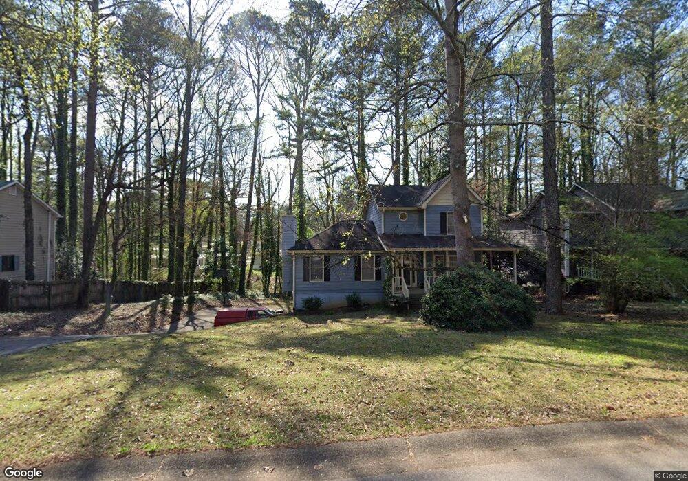
2050 Kolb Ridge Ct SW Marietta, GA 30008
Southwestern Marietta NeighborhoodEstimated Value: $355,284 - $380,000
3
Beds
3
Baths
1,732
Sq Ft
$213/Sq Ft
Est. Value
About This Home
This home is located at 2050 Kolb Ridge Ct SW, Marietta, GA 30008 and is currently estimated at $368,321, approximately $212 per square foot. 2050 Kolb Ridge Ct SW is a home located in Cobb County with nearby schools including Cheatham Hill Elementary School, Smitha Middle School, and Osborne High School.
Ownership History
Date
Name
Owned For
Owner Type
Purchase Details
Closed on
Oct 30, 1997
Sold by
Lee Mildred I
Bought by
Anderson Robert D and Anderson Joyce A
Current Estimated Value
Home Financials for this Owner
Home Financials are based on the most recent Mortgage that was taken out on this home.
Original Mortgage
$108,300
Outstanding Balance
$17,186
Interest Rate
7.31%
Mortgage Type
New Conventional
Estimated Equity
$351,135
Create a Home Valuation Report for This Property
The Home Valuation Report is an in-depth analysis detailing your home's value as well as a comparison with similar homes in the area
Home Values in the Area
Average Home Value in this Area
Purchase History
| Date | Buyer | Sale Price | Title Company |
|---|---|---|---|
| Anderson Robert D | $114,000 | -- |
Source: Public Records
Mortgage History
| Date | Status | Borrower | Loan Amount |
|---|---|---|---|
| Open | Anderson Robert D | $108,300 |
Source: Public Records
Tax History Compared to Growth
Tax History
| Year | Tax Paid | Tax Assessment Tax Assessment Total Assessment is a certain percentage of the fair market value that is determined by local assessors to be the total taxable value of land and additions on the property. | Land | Improvement |
|---|---|---|---|---|
| 2025 | $895 | $141,604 | $12,800 | $128,804 |
| 2024 | $898 | $141,604 | $12,800 | $128,804 |
| 2023 | $692 | $141,604 | $12,800 | $128,804 |
| 2022 | $783 | $103,240 | $12,800 | $90,440 |
| 2021 | $714 | $80,188 | $12,800 | $67,388 |
| 2020 | $679 | $68,268 | $12,800 | $55,468 |
| 2019 | $679 | $68,268 | $12,800 | $55,468 |
| 2018 | $613 | $60,884 | $11,200 | $49,684 |
| 2017 | $532 | $60,884 | $11,200 | $49,684 |
| 2016 | $435 | $50,920 | $11,200 | $39,720 |
| 2015 | $375 | $42,236 | $12,960 | $29,276 |
| 2014 | $383 | $42,236 | $0 | $0 |
Source: Public Records
Map
Nearby Homes
- 1951 Bergerac Ct SW
- 1830 Kolb Farm Cir SW Unit 7
- 1927 Kolb Farm Cir SW Unit 90
- 1472 Chapel Hill Ln SW
- 1906 Kolb Farm Cir SW Unit 51
- 2121 Cumberland Creek Trail SW
- 1718 Rifle Ridge SW
- 1784 Hammond Woods Cir SW
- 2001 MacLand Square Dr Unit 11
- 1467 Glynn Oaks Cir SW
- 1799 Hammond Woods Cir SW
- 2002 MacLand Square Dr Unit 1
- 2379 Moseley Place SW
- 1946 MacLand Rd SW
- 1697 Dyeson Rd SW
- 2381 Lakeside Place SW
- 2389 Jack Creek Rd SW
- 2060 Kolb Ridge Ct SW
- 2048 Kolb Ridge Ct SW
- 2046 Kolb Ridge Ct SW
- 2070 Kolb Ridge Ct SW
- 2059 Kolb Ridge Ct SW
- 2061 Kolb Ridge Ct SW
- 1502 Kolb Ridge Dr SW
- 2044 Kolb Ridge Ct SW
- 2063 Kolb Ridge Ct SW
- 2074 Kolb Ridge Ct SW
- 1501 Kolb Ridge Dr SW
- 2065 Kolb Ridge Ct SW
- 2053 Kolb Ridge Ct SW
- 2042 Kolb Ridge Ct SW
- 2078 Kolb Ridge Ct SW
- 1500 Kolb Ridge Dr SW
- 2067 Kolb Ridge Ct SW
- 1954 Bergerac Ct SW
- 1499 Kolb Ridge Dr SW
- 1952 Bergerac Ct SW