Estimated Value: $124,000 - $142,000
3
Beds
2
Baths
1,052
Sq Ft
$125/Sq Ft
Est. Value
About This Home
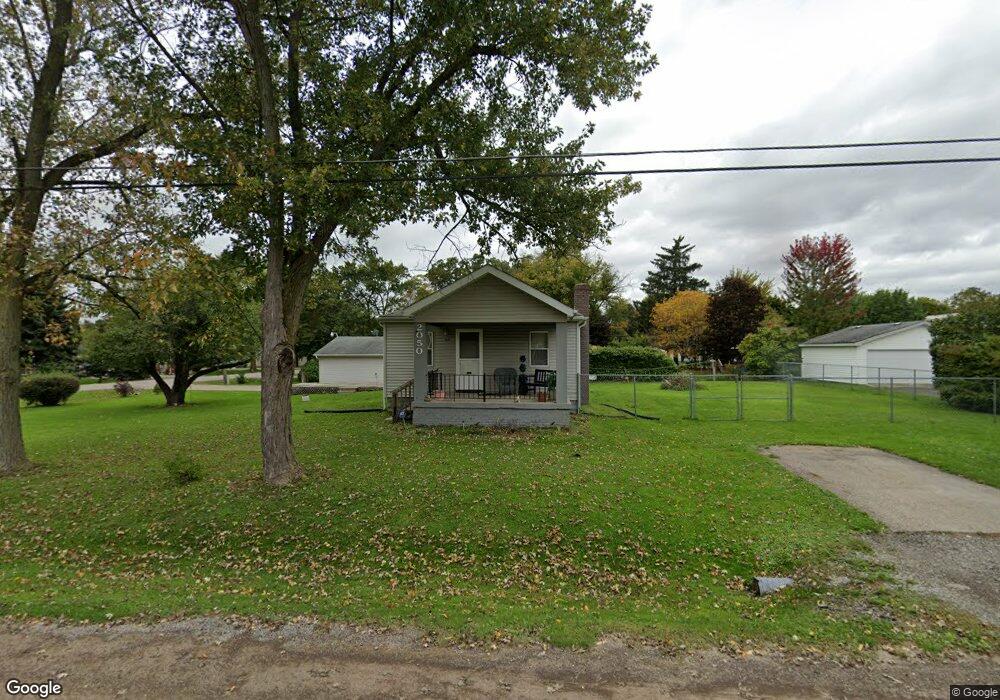
This home is located at 2050 Pound Dr, Flint, MI 48532 and is currently estimated at $131,895, approximately $125 per square foot. 2050 Pound Dr is a home located in Genesee County with nearby schools including Carman-Ainsworth High School, Genesee STEM Academy, and St. Paul Lutheran School.
Ownership History
Date
Name
Owned For
Owner Type
Purchase Details
Closed on
Sep 11, 2014
Sold by
Tickle Clarence and Tickle Shirley
Bought by
Tickle Clarence and Tickle Shirley
Current Estimated Value
Purchase Details
Closed on
Feb 28, 2011
Sold by
Citi Property Holdings Inc
Bought by
Tickle Clarence and Tickle Shirley
Purchase Details
Closed on
Nov 5, 2010
Sold by
Lutz William B and Lutz Stephanie C
Bought by
Citi Property Holdings Inc
Purchase Details
Closed on
Aug 18, 2010
Sold by
Lutz William B and Lutz Stephanie C
Bought by
Citi Property Holdings Inc
Purchase Details
Closed on
Apr 5, 2005
Sold by
Lutz William B and Lutz Stephanie C
Bought by
Lutz William B and Lutz Stephanie C
Home Financials for this Owner
Home Financials are based on the most recent Mortgage that was taken out on this home.
Original Mortgage
$90,950
Interest Rate
12.1%
Mortgage Type
New Conventional
Create a Home Valuation Report for This Property
The Home Valuation Report is an in-depth analysis detailing your home's value as well as a comparison with similar homes in the area
Home Values in the Area
Average Home Value in this Area
Purchase History
| Date | Buyer | Sale Price | Title Company |
|---|---|---|---|
| Tickle Clarence | -- | None Available | |
| Tickle Clarence | $15,500 | Parks Title | |
| Citi Property Holdings Inc | -- | None Available | |
| Citi Property Holdings Inc | $28,000 | None Available | |
| Lutz William B | -- | Northwest Title & Escrow |
Source: Public Records
Mortgage History
| Date | Status | Borrower | Loan Amount |
|---|---|---|---|
| Previous Owner | Lutz William B | $90,950 |
Source: Public Records
Tax History Compared to Growth
Tax History
| Year | Tax Paid | Tax Assessment Tax Assessment Total Assessment is a certain percentage of the fair market value that is determined by local assessors to be the total taxable value of land and additions on the property. | Land | Improvement |
|---|---|---|---|---|
| 2025 | $2,276 | $73,000 | $0 | $0 |
| 2024 | $1,457 | $63,900 | $0 | $0 |
| 2023 | $1,377 | $59,300 | $0 | $0 |
| 2022 | $739 | $43,400 | $0 | $0 |
| 2021 | $724 | $37,200 | $0 | $0 |
| 2020 | $1,244 | $35,100 | $0 | $0 |
| 2019 | $1,229 | $31,500 | $0 | $0 |
| 2018 | $1,867 | $32,500 | $0 | $0 |
| 2017 | $1,817 | $32,500 | $0 | $0 |
| 2016 | $1,846 | $32,300 | $0 | $0 |
| 2015 | $1,662 | $29,600 | $0 | $0 |
| 2014 | $678 | $28,400 | $0 | $0 |
| 2012 | -- | $33,500 | $33,500 | $0 |
Source: Public Records
Map
Nearby Homes
- 1540 Pound Dr
- 18.41 Taft Rd
- 3277 Whitney Ave
- 3321 Hogarth Ave
- 10 Acres T A Mansour Blvd
- 1600 Houran St
- 1574 Houran St
- 1260 Gilbert St
- VL Clairmont St
- 3320 Timberview St
- 3493 Ridgecliffe Dr
- 4474 Corunna Rd
- 4480 Corunna Rd
- 3288 Tall Oaks Ct
- 2468 Ketzler Dr
- 0 Charter Dr Unit 50153638
- 2470 Tandy Dr
- 3522 Ridgecliffe Dr
- 3477 Ridgecliffe Dr
- 959 Tacken St