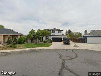
2050 S Mackenzie Cir Sparks, NV 89431
Oddie Boulevard NeighborhoodEstimated Value: $442,000 - $613,000
4
Beds
3
Baths
2,183
Sq Ft
$251/Sq Ft
Est. Value
About This Home
This home is located at 2050 S Mackenzie Cir, Sparks, NV 89431 and is currently estimated at $547,172, approximately $250 per square foot. 2050 S Mackenzie Cir is a home located in Washoe County with nearby schools including Agnes Risley Elementary School, Sparks Middle School, and High Desert Montessori Charter School.
Ownership History
Date
Name
Owned For
Owner Type
Purchase Details
Closed on
Sep 1, 2004
Sold by
Sheehan David M and Sheehan Gloria M
Bought by
Sheehan David and Sheehan Gloria
Current Estimated Value
Purchase Details
Closed on
Aug 29, 2001
Sold by
Arribillaga Richard R and Arribillaga Carla R
Bought by
Sheehan David M and Sheehan Gloria M
Home Financials for this Owner
Home Financials are based on the most recent Mortgage that was taken out on this home.
Original Mortgage
$130,000
Interest Rate
7.09%
Purchase Details
Closed on
Aug 26, 1998
Sold by
Meadowview Homes
Bought by
Arribillaga Richard R and Arribillaga Carla R
Home Financials for this Owner
Home Financials are based on the most recent Mortgage that was taken out on this home.
Original Mortgage
$199,500
Interest Rate
6.91%
Create a Home Valuation Report for This Property
The Home Valuation Report is an in-depth analysis detailing your home's value as well as a comparison with similar homes in the area
Home Values in the Area
Average Home Value in this Area
Purchase History
| Date | Buyer | Sale Price | Title Company |
|---|---|---|---|
| Sheehan David | -- | -- | |
| Sheehan David M | $210,000 | First Centennial Title Co | |
| Arribillaga Richard R | $210,000 | First Centennial Title Co |
Source: Public Records
Mortgage History
| Date | Status | Borrower | Loan Amount |
|---|---|---|---|
| Open | Sheehan David M | $212,000 | |
| Closed | Sheehan David M | $80,000 | |
| Closed | Sheenan David M | $132,000 | |
| Closed | Sheehan David M | $130,000 | |
| Previous Owner | Arribillaga Richard R | $199,500 |
Source: Public Records
Tax History Compared to Growth
Tax History
| Year | Tax Paid | Tax Assessment Tax Assessment Total Assessment is a certain percentage of the fair market value that is determined by local assessors to be the total taxable value of land and additions on the property. | Land | Improvement |
|---|---|---|---|---|
| 2025 | $2,632 | $116,656 | $32,445 | $84,211 |
| 2024 | $2,508 | $112,864 | $27,545 | $85,320 |
| 2023 | $2,508 | $105,828 | $26,250 | $79,578 |
| 2022 | $2,435 | $90,215 | $23,905 | $66,310 |
| 2021 | $2,364 | $86,078 | $19,915 | $66,163 |
| 2020 | $2,294 | $86,639 | $20,230 | $66,409 |
| 2019 | $2,227 | $85,948 | $21,595 | $64,353 |
| 2018 | $2,151 | $77,107 | $14,525 | $62,582 |
| 2017 | $2,089 | $75,637 | $12,845 | $62,792 |
| 2016 | $2,036 | $74,673 | $10,710 | $63,963 |
| 2015 | $2,032 | $66,510 | $8,855 | $57,655 |
| 2014 | $1,899 | $57,218 | $7,210 | $50,008 |
| 2013 | -- | $50,793 | $6,825 | $43,968 |
Source: Public Records
Map
Nearby Homes
- 2165 Capurro Way
- 1770 Manchester Way
- 2562 Garfield Dr
- 1697 York Way
- 2621 Fanto Ct Unit 10
- 3230 Wedekind Rd Unit 59
- 3230 Wedekind Rd Unit 21
- 3230 Wedekind Rd Unit 102
- 3131 Wedekind Rd
- 1686 Sue Way
- 1645 Meadowvale Way
- 1672 Sue Way
- 1616 Greenbrae Dr
- 3177 Sterling Ridge Cir
- 2390 Oppio St
- 2267 Rock Blvd
- 1640 Gault Way Unit C
- 2997 Silver River Ln
- 2541 Orovada St
- 3231 Sterling Ridge Cir
- 2050 S Mackenzie Cir
- 2048 S Mackenzie Cir
- 2060 S Mackenzie Cir
- 2101 Sullivan Ln
- 2070 S Mackenzie Cir
- 2046 S Mackenzie Cir
- 2059 S Mackenzie Cir
- 2080 S Mackenzie Cir
- 2069 S Mackenzie Cir
- 2044 S Mackenzie Cir
- 2104 Ponderosa Dr
- 2100 Ponderosa Dr
- 2079 S Mackenzie Cir
- 2090 S Mackenzie Cir
- 2019 S Mackenzie Cir
- 2089 S Mackenzie Cir
- 2040 S Mackenzie Cir
- 2009 S Mackenzie Cir
- 2106 Ponderosa Dr
- 2099 S Mackenzie Cir