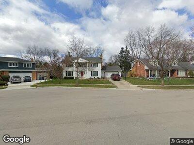
2050 Winsted Blvd Ann Arbor, MI 48103
Estimated Value: $658,000 - $819,000
--
Bed
2
Baths
2,487
Sq Ft
$289/Sq Ft
Est. Value
About This Home
This home is located at 2050 Winsted Blvd, Ann Arbor, MI 48103 and is currently estimated at $718,463, approximately $288 per square foot. 2050 Winsted Blvd is a home located in Washtenaw County with nearby schools including Lawton Elementary School, Slauson Middle School, and Pioneer High School.
Ownership History
Date
Name
Owned For
Owner Type
Purchase Details
Closed on
Apr 6, 2018
Sold by
Derrenberger Matthew L and Derrenberger Martha A
Bought by
Beaver Mark and Teall Margaret
Current Estimated Value
Home Financials for this Owner
Home Financials are based on the most recent Mortgage that was taken out on this home.
Original Mortgage
$422,400
Interest Rate
4.43%
Mortgage Type
New Conventional
Purchase Details
Closed on
Feb 5, 1996
Sold by
Lymburner Daniel R
Bought by
Derrenberger Matthew L and Derrenberger Martha
Create a Home Valuation Report for This Property
The Home Valuation Report is an in-depth analysis detailing your home's value as well as a comparison with similar homes in the area
Home Values in the Area
Average Home Value in this Area
Purchase History
| Date | Buyer | Sale Price | Title Company |
|---|---|---|---|
| Beaver Mark | $528,000 | None Available | |
| Derrenberger Matthew L | $239,500 | -- |
Source: Public Records
Mortgage History
| Date | Status | Borrower | Loan Amount |
|---|---|---|---|
| Open | Beaver Mark | $409,550 | |
| Closed | Beaver Mark | $422,400 | |
| Previous Owner | Derrenberger Matthew L | $120,650 |
Source: Public Records
Tax History Compared to Growth
Tax History
| Year | Tax Paid | Tax Assessment Tax Assessment Total Assessment is a certain percentage of the fair market value that is determined by local assessors to be the total taxable value of land and additions on the property. | Land | Improvement |
|---|---|---|---|---|
| 2024 | $13,281 | $329,000 | $0 | $0 |
| 2023 | $12,246 | $303,100 | $0 | $0 |
| 2022 | $13,344 | $279,300 | $0 | $0 |
| 2021 | $13,030 | $271,700 | $0 | $0 |
| 2020 | $12,766 | $264,300 | $0 | $0 |
| 2019 | $12,150 | $245,800 | $245,800 | $0 |
| 2018 | $8,431 | $217,700 | $0 | $0 |
| 2017 | $8,202 | $212,700 | $0 | $0 |
| 2016 | $6,986 | $164,011 | $0 | $0 |
| 2015 | $7,536 | $163,521 | $0 | $0 |
| 2014 | $7,536 | $158,412 | $0 | $0 |
| 2013 | -- | $158,412 | $0 | $0 |
Source: Public Records
Map
Nearby Homes
- 2055 Mershon Dr
- 1721 Hanover Rd
- 2015 Rugby Ct
- 2002 Brampton Ct
- 1420 Northbrook Dr
- 2038 S 7th St
- 2142 Spring Ridge Dr
- 1511 Catalina Dr
- 1850 Northbrook Dr
- 2245 Chaucer Dr
- 2250 Ann Arbor-Saline Rd
- 1740 S Maple Rd Unit 2
- 2548 Oxford Cir
- 2503 Jade Ct Unit 1
- 2545 Country Village Ct
- 3060 Green Valley Dr Unit 71
- 1231 Meadowbrook Ave
- 564 Galen Cir Unit 32
- 2667 Oxford Cir
- 1851 Harley Dr
- 2050 Winsted Blvd
- 2044 Winsted Blvd
- 2056 Winsted Blvd
- 2069 Delaware Dr
- 2079 Delaware Dr
- 2059 Delaware Dr
- 2038 Winsted Blvd
- 2094 Delaware Dr
- 2062 Winsted Blvd
- 2049 Delaware Dr
- 2114 Delaware Dr
- 2049 Winsted Blvd
- 2043 Winsted Blvd
- 2032 Winsted Blvd
- 2055 Winsted Blvd
- 2134 Delaware Dr
- 2039 Delaware Dr
- 2037 Winsted Blvd
- 2154 Delaware Dr
- 2026 Winsted Blvd
