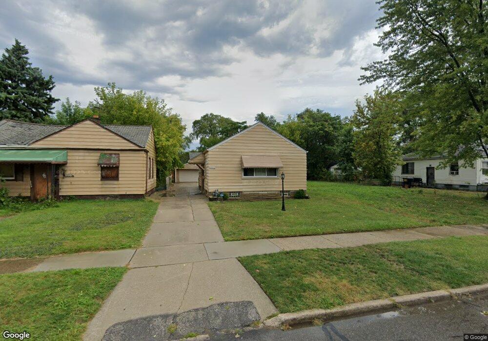
20500 Carrie St Detroit, MI 48234
Sherwood NeighborhoodEstimated Value: $65,000 - $101,000
--
Bed
1
Bath
839
Sq Ft
$96/Sq Ft
Est. Value
About This Home
This home is located at 20500 Carrie St, Detroit, MI 48234 and is currently estimated at $80,361, approximately $95 per square foot. 20500 Carrie St is a home located in Wayne County with nearby schools including Marion Law Academy, Edward 'Duke' Ellington Conservatory of Music and Art, and Charles L. Spain Elementary-Middle School.
Ownership History
Date
Name
Owned For
Owner Type
Purchase Details
Closed on
May 7, 2015
Sold by
Walk Torrelle
Bought by
Wesley Erma
Current Estimated Value
Purchase Details
Closed on
Oct 24, 2005
Sold by
Estate Of Donald James Robotnik
Bought by
Walk Martha Fae
Home Financials for this Owner
Home Financials are based on the most recent Mortgage that was taken out on this home.
Original Mortgage
$59,500
Interest Rate
12%
Mortgage Type
Fannie Mae Freddie Mac
Create a Home Valuation Report for This Property
The Home Valuation Report is an in-depth analysis detailing your home's value as well as a comparison with similar homes in the area
Home Values in the Area
Average Home Value in this Area
Purchase History
| Date | Buyer | Sale Price | Title Company |
|---|---|---|---|
| Wesley Erma | -- | None Available | |
| Walk Martha Fae | $70,000 | Wilson Title Agency Llc |
Source: Public Records
Mortgage History
| Date | Status | Borrower | Loan Amount |
|---|---|---|---|
| Previous Owner | Walk Martha Fae | $59,500 |
Source: Public Records
Tax History Compared to Growth
Tax History
| Year | Tax Paid | Tax Assessment Tax Assessment Total Assessment is a certain percentage of the fair market value that is determined by local assessors to be the total taxable value of land and additions on the property. | Land | Improvement |
|---|---|---|---|---|
| 2025 | $760 | $27,400 | $0 | $0 |
| 2024 | $760 | $23,100 | $0 | $0 |
| 2023 | $736 | $18,600 | $0 | $0 |
| 2022 | $776 | $15,000 | $0 | $0 |
| 2021 | $759 | $10,800 | $0 | $0 |
| 2020 | $758 | $10,400 | $0 | $0 |
| 2019 | $749 | $8,200 | $0 | $0 |
| 2018 | $672 | $6,700 | $0 | $0 |
| 2017 | $104 | $5,500 | $0 | $0 |
| 2016 | $1,094 | $17,100 | $0 | $0 |
| 2015 | $1,130 | $11,300 | $0 | $0 |
| 2013 | $1,407 | $14,069 | $0 | $0 |
| 2010 | -- | $20,627 | $695 | $19,932 |
Source: Public Records
Map
Nearby Homes
- 20400 Packard St
- 20485 Helen St
- 7052 Rivard Ave
- 20185 Carrie St
- 20170 Carrie St
- 20466 Spencer St
- 20514 Concord St
- 20151 Carrie St
- 7003 Rivard Ave
- 20161 Helen St
- 20215 Stotter St
- 7029 Jackson Ave
- 20043 Packard St
- 20124 Spencer St
- 20035 Carrie St
- 7534 Fisher Ave
- 19987 Carrie St
- 7028 Yacht Ave
- 20000 Concord St
- 20009 Concord St
- 20508 Carrie St
- 20490 Carrie St
- 20484 Carrie St
- 20516 Carrie St
- 20522 Carrie St
- 20474 Carrie St
- 20483 Rogge St
- 20501 Rogge St
- 20491 Rogge St
- 20509 Rogge St
- 20475 Rogge St
- 20530 Carrie St
- 20466 Carrie St
- 20515 Rogge St
- 20495 Carrie St
- 20505 Carrie St
- 20525 Rogge St
- 20493 Carrie St
- 20467 Rogge St
- 20515 Carrie St