Estimated Value: $70,555 - $102,000
2
Beds
1
Bath
720
Sq Ft
$129/Sq Ft
Est. Value
About This Home
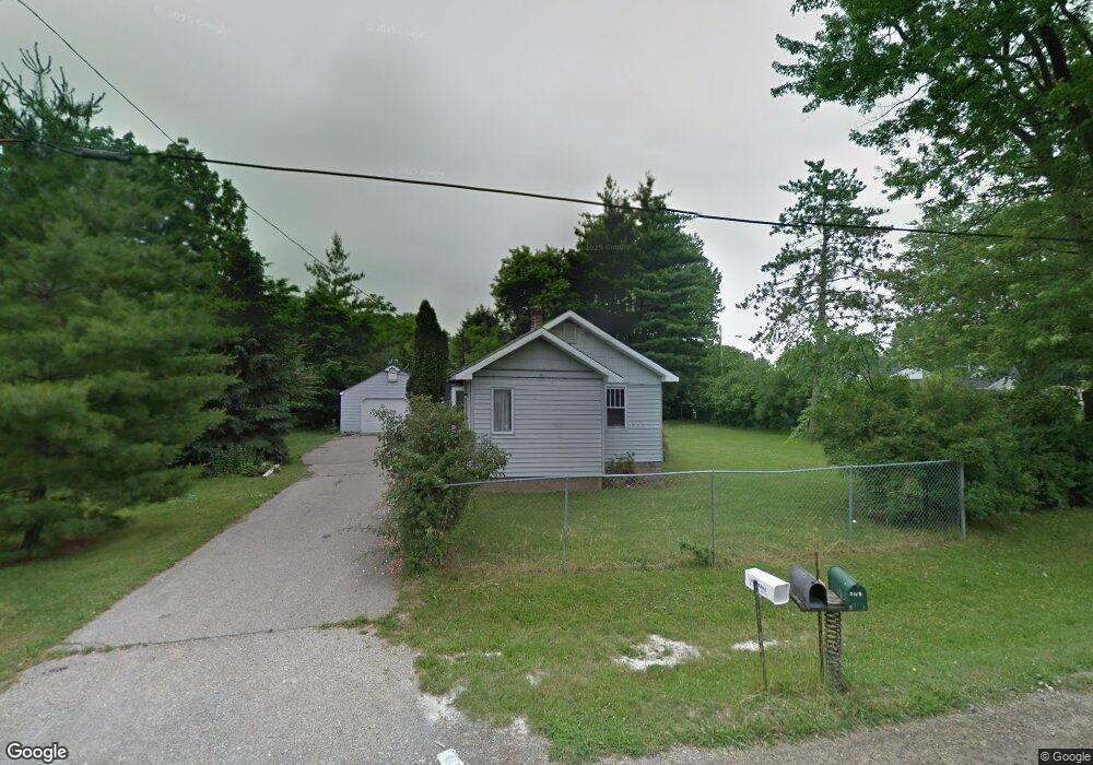
This home is located at 2051 Anoka St, Flint, MI 48532 and is currently estimated at $92,639, approximately $128 per square foot. 2051 Anoka St is a home located in Genesee County with nearby schools including Carman-Ainsworth High School, Genesee STEM Academy, and St. Paul Lutheran School.
Ownership History
Date
Name
Owned For
Owner Type
Purchase Details
Closed on
Jan 13, 2022
Sold by
David Carey
Bought by
Bass Derrick
Current Estimated Value
Purchase Details
Closed on
Aug 12, 2010
Sold by
Usa Rental Funds Llc
Bought by
Carey Janet and Carey David
Purchase Details
Closed on
Oct 12, 2009
Sold by
Mortgage Electronic Registration Systems
Bought by
Federal National Mortgage Association
Purchase Details
Closed on
Sep 2, 2009
Sold by
Abeare Jeffery V and Abeare Brenda L
Bought by
Mortgage Electronic Registration Systems
Create a Home Valuation Report for This Property
The Home Valuation Report is an in-depth analysis detailing your home's value as well as a comparison with similar homes in the area
Home Values in the Area
Average Home Value in this Area
Purchase History
| Date | Buyer | Sale Price | Title Company |
|---|---|---|---|
| Bass Derrick | -- | None Listed On Document | |
| Carey Janet | $8,000 | Continental Title Agency | |
| Federal National Mortgage Association | -- | None Available | |
| Mortgage Electronic Registration Systems | $55,409 | None Available |
Source: Public Records
Tax History Compared to Growth
Tax History
| Year | Tax Paid | Tax Assessment Tax Assessment Total Assessment is a certain percentage of the fair market value that is determined by local assessors to be the total taxable value of land and additions on the property. | Land | Improvement |
|---|---|---|---|---|
| 2025 | $1,021 | $33,900 | $0 | $0 |
| 2024 | $419 | $29,800 | $0 | $0 |
| 2023 | $400 | $24,700 | $0 | $0 |
| 2022 | $540 | $22,700 | $0 | $0 |
| 2021 | $906 | $21,200 | $0 | $0 |
| 2020 | $359 | $18,300 | $0 | $0 |
| 2019 | $354 | $15,900 | $0 | $0 |
| 2018 | $994 | $19,000 | $0 | $0 |
| 2017 | $859 | $19,000 | $0 | $0 |
| 2016 | $1,180 | $16,900 | $0 | $0 |
| 2015 | $930 | $16,500 | $0 | $0 |
| 2014 | $666 | $15,900 | $0 | $0 |
| 2012 | -- | $18,900 | $18,900 | $0 |
Source: Public Records
Map
Nearby Homes
- 1540 Pound Dr
- 18.41 Taft Rd
- 10 Acres T A Mansour Blvd
- 4474 Corunna Rd
- 4480 Corunna Rd
- 1260 Gilbert St
- 3277 Whitney Ave
- 0 Charter Dr Unit 50153638
- 1455 S Linden Rd
- 3321 Hogarth Ave
- 1600 Houran St
- 1574 Houran St
- 3.9 Acres W Court St
- 3493 Ridgecliffe Dr
- VL Clairmont St
- 3320 Timberview St
- 2470 Tandy Dr
- 2468 Ketzler Dr
- 2 Charter Dr
- 3288 Tall Oaks Ct