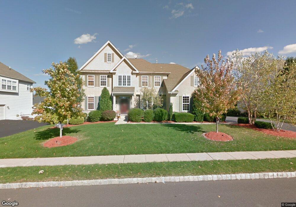
2051 Buckinghamshire Rd Furlong, PA 18925
Estimated Value: $1,092,000 - $1,201,000
4
Beds
5
Baths
4,718
Sq Ft
$240/Sq Ft
Est. Value
About This Home
This home is located at 2051 Buckinghamshire Rd, Furlong, PA 18925 and is currently estimated at $1,134,098, approximately $240 per square foot. 2051 Buckinghamshire Rd is a home located in Bucks County with nearby schools including Bridge Valley Elementary School, Holicong Middle School, and Central Bucks High School - East.
Ownership History
Date
Name
Owned For
Owner Type
Purchase Details
Closed on
Apr 28, 2005
Sold by
Orleans Corp
Bought by
Kosick Richard and Kosick Tiziana
Current Estimated Value
Home Financials for this Owner
Home Financials are based on the most recent Mortgage that was taken out on this home.
Original Mortgage
$150,000
Interest Rate
5.84%
Mortgage Type
Credit Line Revolving
Create a Home Valuation Report for This Property
The Home Valuation Report is an in-depth analysis detailing your home's value as well as a comparison with similar homes in the area
Home Values in the Area
Average Home Value in this Area
Purchase History
| Date | Buyer | Sale Price | Title Company |
|---|---|---|---|
| Kosick Richard | $700,615 | None Available |
Source: Public Records
Mortgage History
| Date | Status | Borrower | Loan Amount |
|---|---|---|---|
| Previous Owner | Kosick Richard | $150,000 |
Source: Public Records
Tax History Compared to Growth
Tax History
| Year | Tax Paid | Tax Assessment Tax Assessment Total Assessment is a certain percentage of the fair market value that is determined by local assessors to be the total taxable value of land and additions on the property. | Land | Improvement |
|---|---|---|---|---|
| 2025 | $10,254 | $62,980 | $10,500 | $52,480 |
| 2024 | $10,254 | $62,980 | $10,500 | $52,480 |
| 2023 | $9,906 | $62,980 | $10,500 | $52,480 |
| 2022 | $9,788 | $62,980 | $10,500 | $52,480 |
| 2021 | $9,671 | $62,980 | $10,500 | $52,480 |
| 2020 | $9,671 | $62,980 | $10,500 | $52,480 |
| 2019 | $2,909 | $62,980 | $10,500 | $52,480 |
| 2018 | $9,608 | $62,980 | $10,500 | $52,480 |
| 2017 | $9,529 | $62,980 | $10,500 | $52,480 |
| 2016 | $9,623 | $62,980 | $10,500 | $52,480 |
| 2015 | -- | $62,980 | $10,500 | $52,480 |
| 2014 | -- | $62,980 | $10,500 | $52,480 |
Source: Public Records
Map
Nearby Homes
- 2080 Bedfordshire Rd
- 0 Old York Rd Unit PABU2103356
- 2209 Swamp Rd
- 1948 Forest Grove Rd
- 3657 Powder Horn Dr
- 3017 Dorchester St E Unit 125
- 2113 Redbud Ln
- 3772 Powder Horn Dr
- 2310 S Whittmore St
- 2443 Sugar Bottom Rd
- lot #3 next to 3739 York Rd
- 547 Mccarty Dr
- 106 Saddle Dr
- 4549 Lower Mountain Rd
- 2807 Mountain Laurel Dr
- 1515 Sugar Bottom Rd
- 108 Eagle Ct Unit 105
- 2479 Wheatfield Ln
- 1249 Pebble Hill Rd
- 3889 Robin Rd
- 2043 Buckinghamshire Rd
- 2056 Bedfordshire Rd
- 2048 Bedfordshire Rd
- 2064 Bedfordshire Rd
- 2035 Buckinghamshire Rd
- 2067 Buckinghamshire Rd
- 2072 Bedfordshire Rd
- 2030 Bedfordshire Rd
- 2075 Buckinghamshire Rd
- 2027 Buckinghamshire Rd
- 2057 Bedfordshire Rd
- 2049 Bedfordshire Rd
- 2065 Bedfordshire Rd
- 2073 Bedfordshire Rd
- 2088 Bedfordshire Rd
- 2041 Bedfordshire Rd
- 2059 Brookshire Rd
- 2017 Bedfordshire Rd
- 2067 Brookshire Rd
- 2051 Brookshire Rd