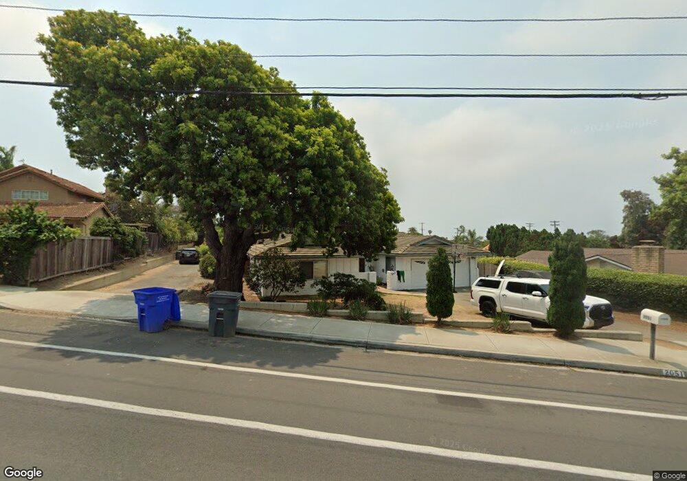
2051 Chestnut Ave Carlsbad, CA 92008
Olde Carlsbad NeighborhoodEstimated Value: $1,336,260 - $1,795,000
4
Beds
2
Baths
1,549
Sq Ft
$1,012/Sq Ft
Est. Value
About This Home
This home is located at 2051 Chestnut Ave, Carlsbad, CA 92008 and is currently estimated at $1,568,315, approximately $1,012 per square foot. 2051 Chestnut Ave is a home located in San Diego County with nearby schools including Magnolia Elementary, Carlsbad High School, and Sage Creek High.
Ownership History
Date
Name
Owned For
Owner Type
Purchase Details
Closed on
Apr 18, 2001
Sold by
Mollgaard Harry D and Mollgaard Melanie R
Bought by
Mollgaard Harry D
Current Estimated Value
Purchase Details
Closed on
Sep 22, 1994
Sold by
Mollgaard Harry D
Bought by
Mollgaard Harry D and Mollgaard Melanie R
Purchase Details
Closed on
Nov 22, 1993
Sold by
Mollgaard Harry D
Bought by
Mollgaard Harry D
Create a Home Valuation Report for This Property
The Home Valuation Report is an in-depth analysis detailing your home's value as well as a comparison with similar homes in the area
Home Values in the Area
Average Home Value in this Area
Purchase History
| Date | Buyer | Sale Price | Title Company |
|---|---|---|---|
| Mollgaard Harry D | -- | -- | |
| Mollgaard Harry D | -- | -- | |
| Mollgaard Harry D | -- | First American Title Co |
Source: Public Records
Tax History
| Year | Tax Paid | Tax Assessment Tax Assessment Total Assessment is a certain percentage of the fair market value that is determined by local assessors to be the total taxable value of land and additions on the property. | Land | Improvement |
|---|---|---|---|---|
| 2025 | $1,600 | $144,567 | $47,564 | $97,003 |
| 2024 | $1,600 | $141,733 | $46,632 | $95,101 |
| 2023 | $1,591 | $138,955 | $45,718 | $93,237 |
| 2022 | $1,567 | $136,231 | $44,822 | $91,409 |
| 2021 | $1,556 | $133,561 | $43,944 | $89,617 |
| 2020 | $1,546 | $132,193 | $43,494 | $88,699 |
| 2019 | $1,520 | $129,602 | $42,642 | $86,960 |
| 2018 | $1,459 | $127,061 | $41,806 | $85,255 |
| 2017 | $1,435 | $124,571 | $40,987 | $83,584 |
| 2016 | $1,379 | $122,130 | $40,184 | $81,946 |
| 2015 | $1,374 | $120,297 | $39,581 | $80,716 |
| 2014 | $1,353 | $117,941 | $38,806 | $79,135 |
Source: Public Records
Map
Nearby Homes
- 3736 Donna Ct
- 3768 Skyline Rd
- 3630 Donna Dr
- 3920 Holly Brae Ln
- 3354 Seacrest Dr
- 1733 Schooner Way Unit 1
- 1896 E Pointe Ave
- 1199 Tamarack Ave
- 4623 Telescope Ave
- 2334 Kimberly Ct
- 3880 Adams St
- 2622 Half Dome Place
- 4269 Hillside Dr
- 3747 Adams St
- 4332 Adams St
- 4340 Adams St
- 4640 Coralwood Cir
- 3235 Donna Dr
- 4390 Yuki Ln
- 4669 Coralwood Cir
- 2025 Chestnut Ave
- 3676 Monroe St
- 2055 Chestnut Ave
- 2053 Chestnut Ave
- 3660 Monroe St
- 3650 Monroe St
- 2057 Chestnut Ave
- 2034 Chestnut Ave
- 2040 Chestnut Ave
- 2015 Chestnut Ave
- 3690 Monroe St
- 2030 Chestnut Ave
- VACANT LOT Donna Ct
- 2044 Chestnut Ave
- 2030 Karren Ln
- 2020 Karren Ln
- 2041 Charleen Cir
- 2035 Charleen Cir
- 2097 Chestnut Ave
- 2045 Charleen Cir
Your Personal Tour Guide
Ask me questions while you tour the home.