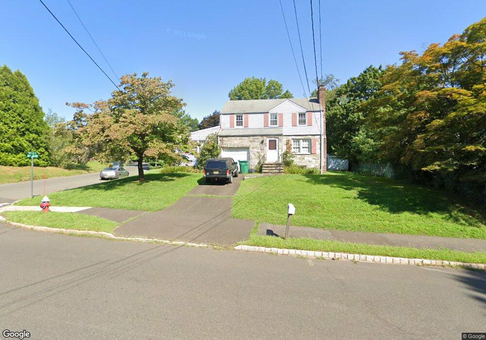
2051 W Broad St Scotch Plains, NJ 07076
Estimated Value: $618,004 - $969,000
--
Bed
--
Bath
1,784
Sq Ft
$445/Sq Ft
Est. Value
About This Home
This home is located at 2051 W Broad St, Scotch Plains, NJ 07076 and is currently estimated at $793,751, approximately $444 per square foot. 2051 W Broad St is a home located in Union County with nearby schools including William J. McGinn Elementary School, Terrill Middle School, and Scotch Plains-Fanwood High School.
Ownership History
Date
Name
Owned For
Owner Type
Purchase Details
Closed on
May 14, 2019
Sold by
Finger Frederick W and Finger Susanna B
Bought by
Buban Michael
Current Estimated Value
Home Financials for this Owner
Home Financials are based on the most recent Mortgage that was taken out on this home.
Original Mortgage
$100,000
Outstanding Balance
$79,026
Interest Rate
4.1%
Mortgage Type
Future Advance Clause Open End Mortgage
Estimated Equity
$714,725
Purchase Details
Closed on
Mar 13, 2008
Sold by
Buban Michael
Bought by
Buban Michael and Finger Susanna B
Purchase Details
Closed on
Nov 17, 1993
Sold by
Moylan Wm T
Bought by
Buban Theresa J
Home Financials for this Owner
Home Financials are based on the most recent Mortgage that was taken out on this home.
Original Mortgage
$130,000
Interest Rate
6.78%
Mortgage Type
VA
Create a Home Valuation Report for This Property
The Home Valuation Report is an in-depth analysis detailing your home's value as well as a comparison with similar homes in the area
Home Values in the Area
Average Home Value in this Area
Purchase History
| Date | Buyer | Sale Price | Title Company |
|---|---|---|---|
| Buban Michael | -- | None Available | |
| Buban Michael | -- | None Available | |
| Buban Theresa J | $165,000 | -- |
Source: Public Records
Mortgage History
| Date | Status | Borrower | Loan Amount |
|---|---|---|---|
| Open | Buban Michael | $100,000 | |
| Previous Owner | Buban Theresa J | $130,000 |
Source: Public Records
Tax History Compared to Growth
Tax History
| Year | Tax Paid | Tax Assessment Tax Assessment Total Assessment is a certain percentage of the fair market value that is determined by local assessors to be the total taxable value of land and additions on the property. | Land | Improvement |
|---|---|---|---|---|
| 2025 | $12,604 | $107,100 | $33,000 | $74,100 |
| 2024 | $12,232 | $107,100 | $33,000 | $74,100 |
| 2023 | $12,232 | $107,100 | $33,000 | $74,100 |
| 2022 | $12,086 | $107,100 | $33,000 | $74,100 |
| 2021 | $12,066 | $107,100 | $33,000 | $74,100 |
| 2020 | $12,008 | $107,100 | $33,000 | $74,100 |
| 2019 | $11,919 | $107,100 | $33,000 | $74,100 |
| 2018 | $11,719 | $107,100 | $33,000 | $74,100 |
| 2017 | $11,459 | $107,100 | $33,000 | $74,100 |
| 2016 | $11,238 | $107,100 | $33,000 | $74,100 |
| 2015 | $11,054 | $107,100 | $33,000 | $74,100 |
| 2014 | $10,690 | $107,100 | $33,000 | $74,100 |
Source: Public Records
Map
Nearby Homes
- 1933 W Broad St
- 2154 W Broad St
- 2 Brookside Ct
- 1933 Mary Ellen Ln
- 119 Lamberts Mill Rd
- 2116 Newark Ave
- 1466 Lamberts Mill Rd
- 314 Highgate Ave
- 2212 Shady Ln
- 187 King St
- 57 Rambling Dr
- 5 Robin Rd
- 2 Dutch Ln
- 524 Edgar Rd
- 120 S Martine Ave
- 2314 Longfellow Ave
- 525 Edgar Rd
- 345 La Grande Ave
- 2219 North Ave Unit 6
- 350 W Dudley Ave
- 2057 W Broad St
- 1293 White Oak Rd
- 2039 W Broad St
- 2063 W Broad St
- 1284 Woodside Rd
- 1291 White Oak Rd
- 1290 Woodside Rd
- 2069 W Broad St
- 2052 W Broad St
- 2033 W Broad St
- 2036 W Broad St
- 1290 White Oak Rd
- 2075 W Broad St
- 1278 Woodside Rd
- 1289 White Oak Rd
- 2027 W Broad St
- 1 Ravine Ct
- 2081 W Broad St
- 1286 White Oak Rd
- 1289 Woodside Rd