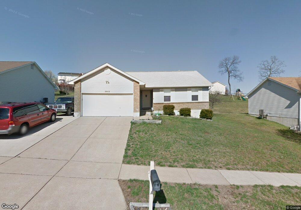
2053 Rosedale Ct Arnold, MO 63010
Estimated Value: $282,000 - $339,000
--
Bed
--
Bath
1,284
Sq Ft
$244/Sq Ft
Est. Value
About This Home
This home is located at 2053 Rosedale Ct, Arnold, MO 63010 and is currently estimated at $313,752, approximately $244 per square foot. 2053 Rosedale Ct is a home located in Jefferson County with nearby schools including Lone Dell Elementary School, Fox Middle School, and Fox Senior High School.
Ownership History
Date
Name
Owned For
Owner Type
Purchase Details
Closed on
Apr 1, 2015
Sold by
Taylor Anthony R and Hansel Taylor Mary H
Bought by
Taylor Anthony R and Hansel Taylor Mary H
Current Estimated Value
Home Financials for this Owner
Home Financials are based on the most recent Mortgage that was taken out on this home.
Original Mortgage
$124,000
Interest Rate
3.88%
Mortgage Type
New Conventional
Purchase Details
Closed on
Feb 2, 2005
Sold by
Taylor Anthony R and Taylor Lisa M
Bought by
Taylor Anthony R
Home Financials for this Owner
Home Financials are based on the most recent Mortgage that was taken out on this home.
Original Mortgage
$119,000
Interest Rate
5.85%
Mortgage Type
New Conventional
Purchase Details
Closed on
Feb 26, 2002
Sold by
Taylor Anthony Robert and Taylor Lisa Marie
Bought by
Taylor Anthony R and Taylor Lisa M
Purchase Details
Closed on
Jun 15, 1999
Sold by
Taylor Joy Ann
Bought by
Taylor Anthony Robert
Create a Home Valuation Report for This Property
The Home Valuation Report is an in-depth analysis detailing your home's value as well as a comparison with similar homes in the area
Home Values in the Area
Average Home Value in this Area
Purchase History
| Date | Buyer | Sale Price | Title Company |
|---|---|---|---|
| Taylor Anthony R | -- | None Available | |
| Taylor Anthony R | -- | Commonwealth Land Title | |
| Taylor Anthony R | -- | -- | |
| Taylor Anthony Robert | -- | -- |
Source: Public Records
Mortgage History
| Date | Status | Borrower | Loan Amount |
|---|---|---|---|
| Closed | Taylor Anthony R | $124,000 | |
| Closed | Taylor Anthony R | $119,000 |
Source: Public Records
Tax History Compared to Growth
Tax History
| Year | Tax Paid | Tax Assessment Tax Assessment Total Assessment is a certain percentage of the fair market value that is determined by local assessors to be the total taxable value of land and additions on the property. | Land | Improvement |
|---|---|---|---|---|
| 2025 | $2,441 | $37,400 | $4,800 | $32,600 |
| 2024 | $2,441 | $34,900 | $4,800 | $30,100 |
| 2023 | $2,441 | $34,900 | $4,800 | $30,100 |
| 2022 | $2,297 | $32,200 | $4,800 | $27,400 |
| 2021 | $2,297 | $32,200 | $4,800 | $27,400 |
| 2020 | $2,135 | $28,400 | $4,200 | $24,200 |
| 2019 | $2,142 | $28,400 | $4,200 | $24,200 |
| 2018 | $2,128 | $28,400 | $4,200 | $24,200 |
| 2017 | $2,160 | $28,400 | $4,200 | $24,200 |
| 2016 | $1,866 | $26,300 | $3,600 | $22,700 |
| 2015 | $1,871 | $26,300 | $3,600 | $22,700 |
| 2013 | -- | $26,200 | $3,600 | $22,600 |
Source: Public Records
Map
Nearby Homes
- 3174 Rosedale Dr
- 3170 Rosedale Dr
- 1 Hickory Square Pkwy
- 2128 Santiago Dr
- 2558 Frederitzi Ln
- 2156 Long Glen Ln Unit 16B
- 2009 Buck Dr
- 3026 Brentmoor Dr
- 344 Bramtonn Place
- 3320 Meadowfield Dr
- 14 & 15 Valmont Lots
- 2823 Glen Haven Dr
- 2811 Vineyard Dr
- 18 Pleasant Valley Terrace
- 2877 Fox Meadow Ln
- 1924 Jennifer Lynn Ln
- 3529 Swan Cir S
- 45 Wampler Dr
- 170 Bogey Blvd
- 217 Slover Ln
- 2057 Rosedale Ct
- 2049 Rosedale Ct
- 3178 Rosedale Dr
- 3182 Rosedale Dr
- 2045 Rosedale Ct
- 2061 Rosedale Ct
- 2052 Rosedale Ct
- 3186 Rosedale Dr
- 2048 Rosedale Ct
- 2044 Rosedale Ct
- 2056 Rosedale Ct
- 2060 Rosedale Ct
- 2067 Rosedale Ct
- 2037 Rosedale Ct
- 3190 Rosedale Dr
- 2040 Rosedale Ct
- 2025 Rosedale Ct
- 2064 Rosedale Ct
- 2019 Rosedale Ct
- 2075 Rosedale Ct