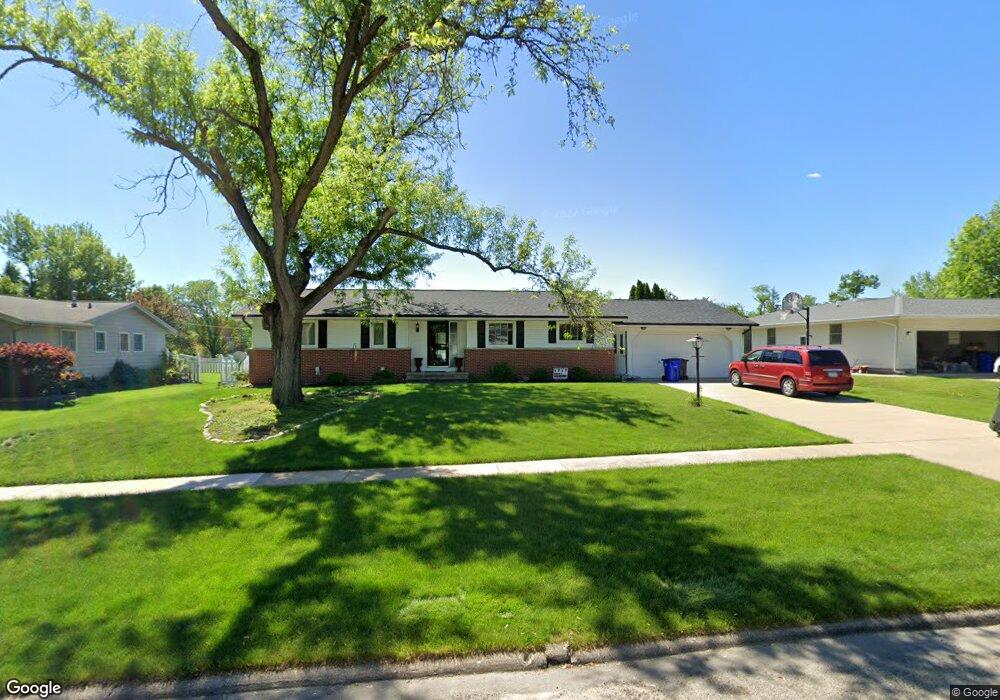
2053 Sunland Dr SE Cedar Rapids, IA 52403
Estimated Value: $312,000 - $334,000
4
Beds
3
Baths
1,591
Sq Ft
$204/Sq Ft
Est. Value
About This Home
This home is located at 2053 Sunland Dr SE, Cedar Rapids, IA 52403 and is currently estimated at $324,655, approximately $204 per square foot. 2053 Sunland Dr SE is a home located in Linn County with nearby schools including Arthur Elementary School, Franklin Middle School, and George Washington High School.
Ownership History
Date
Name
Owned For
Owner Type
Purchase Details
Closed on
Nov 27, 2017
Sold by
Schwartz Cynthia K
Bought by
Ballou Jackson Tom L and Ballou Jackson Rhonda L
Current Estimated Value
Home Financials for this Owner
Home Financials are based on the most recent Mortgage that was taken out on this home.
Original Mortgage
$155,000
Outstanding Balance
$130,496
Interest Rate
3.94%
Mortgage Type
New Conventional
Estimated Equity
$194,159
Purchase Details
Closed on
Jun 4, 1999
Sold by
Salvay Steven H and Salvay Helen S
Bought by
Schwartz Grant J and Schwartz Cynthia K
Home Financials for this Owner
Home Financials are based on the most recent Mortgage that was taken out on this home.
Original Mortgage
$140,550
Interest Rate
7.29%
Mortgage Type
Balloon
Create a Home Valuation Report for This Property
The Home Valuation Report is an in-depth analysis detailing your home's value as well as a comparison with similar homes in the area
Home Values in the Area
Average Home Value in this Area
Purchase History
| Date | Buyer | Sale Price | Title Company |
|---|---|---|---|
| Ballou Jackson Tom L | $215,000 | None Available | |
| Schwartz Grant J | $175,500 | -- |
Source: Public Records
Mortgage History
| Date | Status | Borrower | Loan Amount |
|---|---|---|---|
| Open | Ballou Jackson Tom L | $155,000 | |
| Previous Owner | Schwartz Grant J | $140,550 |
Source: Public Records
Tax History Compared to Growth
Tax History
| Year | Tax Paid | Tax Assessment Tax Assessment Total Assessment is a certain percentage of the fair market value that is determined by local assessors to be the total taxable value of land and additions on the property. | Land | Improvement |
|---|---|---|---|---|
| 2025 | $5,550 | $357,500 | $53,100 | $304,400 |
| 2024 | $5,434 | $359,600 | $46,800 | $312,800 |
| 2023 | $5,434 | $313,600 | $46,800 | $266,800 |
| 2022 | $5,336 | $257,600 | $46,800 | $210,800 |
| 2021 | $5,550 | $257,600 | $46,800 | $210,800 |
| 2020 | $5,550 | $251,500 | $42,500 | $209,000 |
| 2019 | $5,012 | $232,500 | $42,500 | $190,000 |
| 2018 | $4,690 | $232,500 | $42,500 | $190,000 |
| 2017 | $4,393 | $212,800 | $42,500 | $170,300 |
| 2016 | $4,393 | $206,700 | $42,500 | $164,200 |
| 2015 | $4,221 | $198,358 | $42,501 | $155,857 |
| 2014 | $4,036 | $204,510 | $42,501 | $162,009 |
| 2013 | $4,072 | $204,510 | $42,501 | $162,009 |
Source: Public Records
Map
Nearby Homes
- 3618 Kegler Ct SE
- 237 34th St SE
- 4725 Green Valley Dr SE
- 380 Indiandale Rd SE
- 3830 Skylark Ln SE
- 5029 Broadlawn Dr SE
- 2227 Kestrel Dr SE
- 2403 Kestrel Dr SE
- 2416 Kestrel Dr SE
- 2226 Kestrel Dr SE
- 3112 Peregrine Ct SE
- 2306 Kestrel Dr SE
- 2420 Kestrel Dr SE
- 2409 Kestrel Dr SE
- 2421 Kestrel Dr SE
- 2221 Kestrel Dr SE
- 2319 Kestrel Dr SE
- 2415 Kestrel Dr SE
- 2325 Kestrel Dr SE
- 2312 Kestrel Dr SE
- 2043 Sunland Dr SE
- 2065 Sunland Dr SE
- 2035 Sunland Dr SE
- 2077 Sunland Dr SE
- 4221 Fox Meadow Dr SE
- 2048 Sunland Dr SE
- 2027 Sunland Dr SE
- 2030 Sunland Dr SE
- 4220 Fox Meadow Dr SE
- 2089 Sunland Dr SE
- 3745 Cottage Grove Ave SE
- 4224 Sunland Ct SE
- 2019 Sunland Dr SE
- 4231 Fox Meadow Dr SE
- 4230 Fox Meadow Dr SE
- 4232 Sunland Ct SE
- 2092 Sunland Dr SE
- 2020 Sunland Dr SE
- 4225 Sunland Ct SE
- 4245 Fox Meadow Dr SE