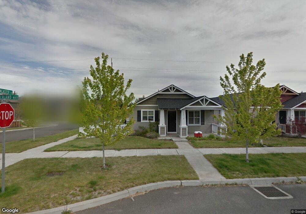
20534 Sunderland Way Bend, OR 97701
Boyd Acres NeighborhoodEstimated Value: $474,000 - $494,000
3
Beds
2
Baths
1,096
Sq Ft
$440/Sq Ft
Est. Value
About This Home
This home is located at 20534 Sunderland Way, Bend, OR 97701 and is currently estimated at $482,107, approximately $439 per square foot. 20534 Sunderland Way is a home located in Deschutes County with nearby schools including Lava Ridge Elementary School, Sky View Middle School, and Mountain View Senior High School.
Ownership History
Date
Name
Owned For
Owner Type
Purchase Details
Closed on
Oct 25, 2012
Sold by
Thomason William D and Thomason Ann R
Bought by
Thomason William D and Thomason Ann R
Current Estimated Value
Purchase Details
Closed on
Feb 2, 2005
Sold by
The Hollman Co
Bought by
Thomason William D and Thomason Ann R
Home Financials for this Owner
Home Financials are based on the most recent Mortgage that was taken out on this home.
Original Mortgage
$147,351
Interest Rate
4.5%
Mortgage Type
Unknown
Create a Home Valuation Report for This Property
The Home Valuation Report is an in-depth analysis detailing your home's value as well as a comparison with similar homes in the area
Home Values in the Area
Average Home Value in this Area
Purchase History
| Date | Buyer | Sale Price | Title Company |
|---|---|---|---|
| Thomason William D | -- | None Available | |
| Thomason William D | $184,189 | Amerititle |
Source: Public Records
Mortgage History
| Date | Status | Borrower | Loan Amount |
|---|---|---|---|
| Previous Owner | Thomason William D | $147,351 |
Source: Public Records
Tax History Compared to Growth
Tax History
| Year | Tax Paid | Tax Assessment Tax Assessment Total Assessment is a certain percentage of the fair market value that is determined by local assessors to be the total taxable value of land and additions on the property. | Land | Improvement |
|---|---|---|---|---|
| 2025 | $2,842 | $168,220 | -- | -- |
| 2024 | $2,735 | $163,330 | -- | -- |
| 2023 | $2,535 | $158,580 | $0 | $0 |
| 2022 | $2,365 | $149,490 | $0 | $0 |
| 2021 | $2,369 | $145,140 | $0 | $0 |
| 2020 | $2,248 | $145,140 | $0 | $0 |
| 2019 | $2,185 | $140,920 | $0 | $0 |
| 2018 | $2,123 | $136,820 | $0 | $0 |
| 2017 | $2,061 | $132,840 | $0 | $0 |
| 2016 | $1,966 | $128,980 | $0 | $0 |
| 2015 | $1,911 | $125,230 | $0 | $0 |
| 2014 | $1,855 | $121,590 | $0 | $0 |
Source: Public Records
Map
Nearby Homes
- 20585 Fred Meyers Rd
- 20570 Fred Meyers Rd
- 63143 Beaufort Ct
- 63131 NE De Haviland St
- 20577 NE Sierra Dr
- 63117 De Haviland Ct
- 20560 Boyd Ct
- 20629 Whitewing Ct
- 20514 NE Empire Ave
- 20528 NE Empire Ave
- 20532 NE Empire Ave
- 20530 NE Empire Ave
- 20663 NE Sierra Dr
- 63190 Carly Ln
- 63217 Carly Ln
- 63221 Carly Ln
- 63225 Carly Ln
- 63210 Carly Ln
- 63229 NE Carly Ln
- 63233 Carly Ln
- 20538 Sunderland Way
- 63200 Lancaster St
- 20542 Sunderland Way
- 0 Sunderland Way
- 63204 Lancaster St
- 63193 Boyd Acres Rd
- 63201 Boyd Acres Rd
- 20535 Sunderland Way
- 20539 Sunderland Way
- 20543 Sunderland Way
- 20528 NE Lysander
- 20528 Lysander Place
- 63205 Boyd Acres Rd
- 63193 Lancaster St
- 63207 Lancaster St
- 20523 Lysander Place
- 63208 Lancaster St
- 63189 Boyd Acres Rd
- 63207 Boyd Acres Rd