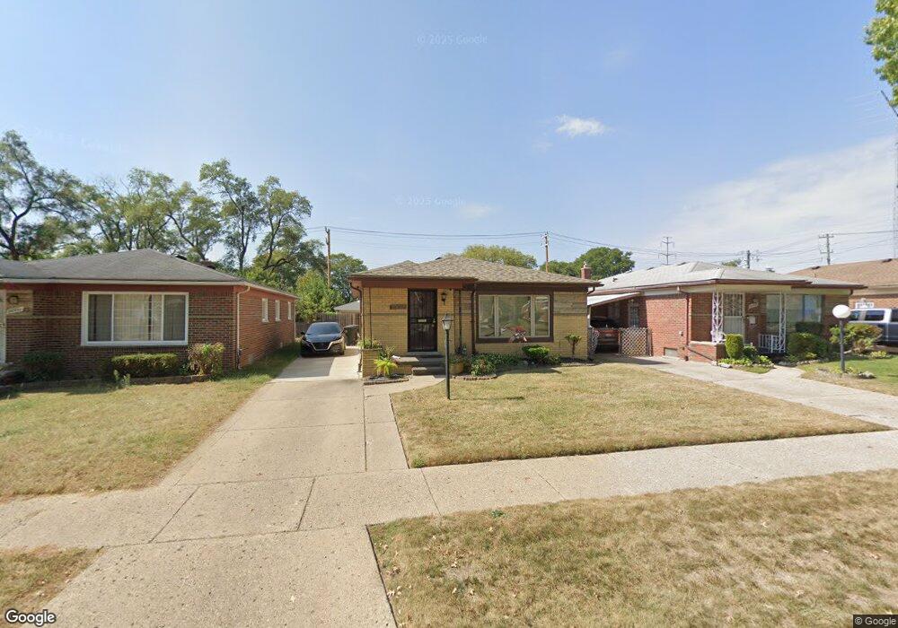
20537 Westmoreland Rd Detroit, MI 48219
O'Hair Park NeighborhoodEstimated Value: $130,000 - $155,349
3
Beds
3
Baths
1,199
Sq Ft
$122/Sq Ft
Est. Value
About This Home
This home is located at 20537 Westmoreland Rd, Detroit, MI 48219 and is currently estimated at $146,087, approximately $121 per square foot. 20537 Westmoreland Rd is a home located in Wayne County with nearby schools including Ralph W. Emerson Elementary-Middle School, Charles L. Spain Elementary-Middle School, and Edward 'Duke' Ellington Conservatory of Music and Art.
Ownership History
Date
Name
Owned For
Owner Type
Purchase Details
Closed on
Jul 14, 2017
Sold by
Edwards Darryl
Bought by
Edwards Darryl
Current Estimated Value
Purchase Details
Closed on
Dec 30, 2011
Sold by
Armstead Phenocia
Bought by
Edwards Darryl
Purchase Details
Closed on
Mar 22, 2007
Sold by
Armstead Phenocia and Armsted Phenocia
Bought by
Armstead Phenocia
Home Financials for this Owner
Home Financials are based on the most recent Mortgage that was taken out on this home.
Original Mortgage
$138,690
Interest Rate
6.22%
Mortgage Type
VA
Purchase Details
Closed on
Oct 20, 2006
Sold by
Oliver Mershira P
Bought by
Armsted Phenocia
Create a Home Valuation Report for This Property
The Home Valuation Report is an in-depth analysis detailing your home's value as well as a comparison with similar homes in the area
Home Values in the Area
Average Home Value in this Area
Purchase History
| Date | Buyer | Sale Price | Title Company |
|---|---|---|---|
| Edwards Darryl | -- | None Available | |
| Edwards Darryl | $20,000 | None Available | |
| Armstead Phenocia | -- | Complete Title Services Of S | |
| Armsted Phenocia | $130,000 | Complete Title Services Of S |
Source: Public Records
Mortgage History
| Date | Status | Borrower | Loan Amount |
|---|---|---|---|
| Previous Owner | Armstead Phenocia | $138,690 |
Source: Public Records
Tax History Compared to Growth
Tax History
| Year | Tax Paid | Tax Assessment Tax Assessment Total Assessment is a certain percentage of the fair market value that is determined by local assessors to be the total taxable value of land and additions on the property. | Land | Improvement |
|---|---|---|---|---|
| 2025 | $1,412 | $70,200 | $0 | $0 |
| 2024 | $1,412 | $61,700 | $0 | $0 |
| 2023 | $1,491 | $48,500 | $0 | $0 |
| 2022 | $1,592 | $40,900 | $0 | $0 |
| 2021 | $1,596 | $32,600 | $0 | $0 |
| 2020 | $1,578 | $29,200 | $0 | $0 |
| 2019 | $1,553 | $23,300 | $0 | $0 |
| 2018 | $1,312 | $19,900 | $0 | $0 |
| 2017 | $339 | $19,200 | $0 | $0 |
| 2016 | $1,493 | $20,800 | $0 | $0 |
| 2015 | $2,065 | $20,800 | $0 | $0 |
| 2013 | $2,000 | $26,000 | $0 | $0 |
| 2010 | -- | $38,511 | $1,185 | $37,326 |
Source: Public Records
Map
Nearby Homes
- 20569 Evergreen Rd
- 20310 Annchester Rd
- 20553 Vaughan St
- 20534 Grandville Ave
- 20980 Evergreen Rd
- 20210 Westhampton Ave
- 20041 Heyden St
- 20566 Patton St
- 19947 Heyden St
- 19811 Plainview Ave
- 20500 Braile St
- 20232 Braile St
- 20705 Westhampton Ave
- 20120 Braile St
- 20711 Westhaven Ave
- 19720 Evergreen Rd
- 21450 Evergreen Rd
- 19719 Vaughan St
- 20511 Pierson St
- 19025 Melrose Ave
- 20531 Westmoreland Rd
- 20538 Plainview Ave
- 20530 Plainview Ave
- 20553 Westmoreland Rd
- 20545 Westmoreland Rd
- 20546 Plainview Ave
- 20521 Westmoreland Rd
- 20520 Plainview Ave
- 20554 Plainview Ave
- 20511 Westmoreland Rd
- 20510 Plainview Ave
- 20563 Westmoreland Rd
- 20562 Plainview Ave
- 20501 Westmoreland Rd
- 20571 Westmoreland Rd
- 20502 Plainview Ave
- 20570 Plainview Ave
- 20536 Westmoreland Rd
- 20530 Westmoreland Rd
- 20541 Plainview Ave