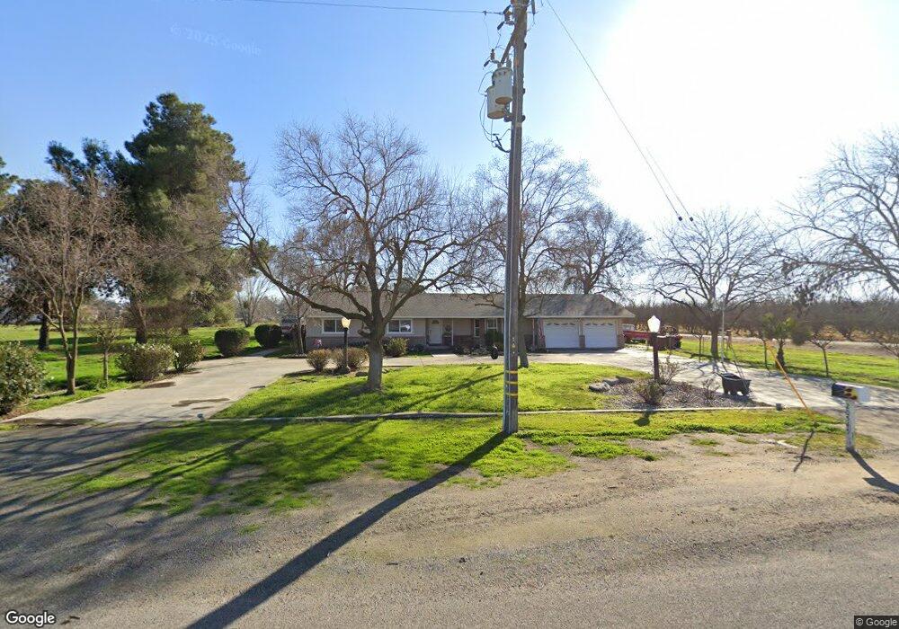
20545 Flint Ave Lemoore, CA 93245
Estimated Value: $502,588 - $628,000
3
Beds
2
Baths
1,998
Sq Ft
$286/Sq Ft
Est. Value
About This Home
This home is located at 20545 Flint Ave, Lemoore, CA 93245 and is currently estimated at $571,147, approximately $285 per square foot. 20545 Flint Ave is a home located in Kings County with nearby schools including Lemoore High School and Island Elementary School.
Ownership History
Date
Name
Owned For
Owner Type
Purchase Details
Closed on
Aug 26, 2013
Sold by
Franks Lisa L
Bought by
Rhoads Thomas J and Rhoads Molly M
Current Estimated Value
Home Financials for this Owner
Home Financials are based on the most recent Mortgage that was taken out on this home.
Original Mortgage
$275,510
Outstanding Balance
$204,012
Interest Rate
4.36%
Mortgage Type
New Conventional
Estimated Equity
$367,135
Create a Home Valuation Report for This Property
The Home Valuation Report is an in-depth analysis detailing your home's value as well as a comparison with similar homes in the area
Purchase History
| Date | Buyer | Sale Price | Title Company |
|---|---|---|---|
| Rhoads Thomas J | $270,000 | Chicago Title Company |
Source: Public Records
Mortgage History
| Date | Status | Borrower | Loan Amount |
|---|---|---|---|
| Open | Rhoads Thomas J | $275,510 |
Source: Public Records
Tax History
| Year | Tax Paid | Tax Assessment Tax Assessment Total Assessment is a certain percentage of the fair market value that is determined by local assessors to be the total taxable value of land and additions on the property. | Land | Improvement |
|---|---|---|---|---|
| 2025 | $3,214 | $330,979 | $122,584 | $208,395 |
| 2023 | $3,214 | $318,128 | $117,825 | $200,303 |
| 2022 | $3,388 | $311,891 | $115,515 | $196,376 |
| 2021 | $3,306 | $305,776 | $113,250 | $192,526 |
| 2020 | $3,281 | $302,641 | $112,089 | $190,552 |
| 2019 | $3,246 | $296,707 | $109,891 | $186,816 |
| 2018 | $3,121 | $290,889 | $107,736 | $183,153 |
| 2017 | $3,114 | $285,186 | $105,624 | $179,562 |
| 2016 | $2,928 | $279,594 | $103,553 | $176,041 |
| 2015 | $2,914 | $275,395 | $101,998 | $173,397 |
| 2014 | $1,666 | $161,926 | $32,488 | $129,438 |
Source: Public Records
Map
Nearby Homes
- 0 Highway 41
- 9368 22nd Ave
- 0 Everett Ave
- 9415 21st Ave
- 22750 Fairfax Ave
- 8313 23rd Ave
- 18896 Grangeville Blvd
- 22311 Grangeville Blvd
- 8350 17 1 2 Ave
- 0 24th Ave
- 21465 S Wyatt Ave
- 0 W Glendale Ave
- 21435 S Pleasant Ave
- 18429 W Lacey Blvd
- 16710 Flint Ave
- 1523 Quartz Ave
- 1513 Quartz Ave
- 1505 Quartz Ave
- 1528 Quartz Ave
- 1542 Quartz Ave
- 20525 Flint Ave
- 7090 20 1 2 Ave
- 7090 20 1/2 Ave
- 20741 Flint Ave
- 20488 Flint Ave
- 7138 20 1/2 Ave
- 20721 Flint Ave
- 7228 20 1 2 Ave
- 7228 20 1/2 Ave
- 20357 Flint Ave
- 20750 Fremont Ave
- 20558 Flint Ave
- 7311 20 1/2 Ave
- 20283 Flint Ave
- 7325 20 1/2 Ave
- 7339 20 1/2 Ave
- 6851 21st Ave
- 20584 Flint Ave
- 20255 Flint Ave
- 7371 20 1/2 Ave
Your Personal Tour Guide
Ask me questions while you tour the home.