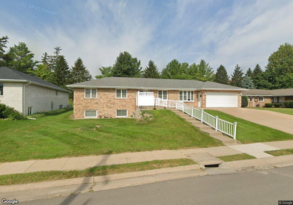
2055 Bunker Hill Rd Dubuque, IA 52001
Estimated Value: $288,000 - $414,000
--
Bed
7
Baths
2,267
Sq Ft
$155/Sq Ft
Est. Value
About This Home
This home is located at 2055 Bunker Hill Rd, Dubuque, IA 52001 and is currently estimated at $352,073, approximately $155 per square foot. 2055 Bunker Hill Rd is a home located in Dubuque County with nearby schools including Irving Elementary School, George Washington Middle School, and Dubuque Senior High School.
Ownership History
Date
Name
Owned For
Owner Type
Purchase Details
Closed on
Nov 8, 2024
Sold by
Crimmins Jacqueline M and Sendt Donny
Bought by
Crimmins Jacqueline M
Current Estimated Value
Purchase Details
Closed on
May 6, 2021
Sold by
Crimmins Jacqueline M
Bought by
Crimmins Jacqueline M and Crimmins Jill
Create a Home Valuation Report for This Property
The Home Valuation Report is an in-depth analysis detailing your home's value as well as a comparison with similar homes in the area
Home Values in the Area
Average Home Value in this Area
Purchase History
| Date | Buyer | Sale Price | Title Company |
|---|---|---|---|
| Crimmins Jacqueline M | -- | None Listed On Document | |
| Crimmins Jacqueline M | -- | None Listed On Document | |
| Crimmins Jacqueline M | -- | None Available |
Source: Public Records
Tax History Compared to Growth
Tax History
| Year | Tax Paid | Tax Assessment Tax Assessment Total Assessment is a certain percentage of the fair market value that is determined by local assessors to be the total taxable value of land and additions on the property. | Land | Improvement |
|---|---|---|---|---|
| 2025 | $4,952 | $400,800 | $38,700 | $362,100 |
| 2024 | $4,952 | $376,700 | $35,000 | $341,700 |
| 2023 | $4,894 | $376,700 | $35,000 | $341,700 |
| 2022 | $4,706 | $296,920 | $33,150 | $263,770 |
| 2021 | $4,706 | $296,920 | $33,150 | $263,770 |
| 2020 | $4,552 | $268,070 | $31,310 | $236,760 |
| 2019 | $4,372 | $268,070 | $31,310 | $236,760 |
| 2018 | $4,300 | $246,950 | $29,470 | $217,480 |
| 2017 | $4,068 | $246,950 | $29,470 | $217,480 |
| 2016 | $3,980 | $222,460 | $29,470 | $192,990 |
| 2015 | $3,980 | $222,460 | $29,470 | $192,990 |
| 2014 | $3,804 | $218,680 | $29,470 | $189,210 |
Source: Public Records
Map
Nearby Homes
- 1896 Floraview Dr
- 1949 Saint Ambrose St
- 1821 Glendale Ct
- 2095 Mullin Rd
- 1730 Chaney Rd
- 2341 Cir
- 1650 Drexel Ave
- 1568 Fairfax Ave
- 2347 Coventry Park Unit C-011
- 1762 Churchill Dr
- 1865 Wood St
- 1395 Brown Ave
- 1735 Wood St
- 2625 New Haven St
- 2276 Woodlawn St
- 1790 Horizon Ct
- 1455 Adair St
- 1425 Adair St
- 3080 Saint Anne Dr
- 1445 Wood St
- 2025 Bunker Hill Rd
- 2085 Bunker Hill Rd
- 2040 Bunker Hill Rd
- 2020 Bunker Hill Rd
- 2105 Bunker Hill Rd
- 2060 Bunker Hill Rd
- 2100 Asbury Rd Unit Ste D
- 2100 Asbury Rd Unit Suite 3
- 2185 Clarke Dr
- 1986 Asbury Rd
- 1988 Asbury Rd
- 1984 Asbury Rd
- 2196 Sunnyview Dr
- 1982 Asbury Rd
- 2188 Sunnyview Dr
- 2175 Clarke Dr
- 2196 Clarke Dr
- 1980 Asbury Rd
- 1980 Bunker Hill Rd
- 2145 Bunker Hill Rd