Estimated Value: $201,000 - $213,433
3
Beds
2
Baths
1,341
Sq Ft
$155/Sq Ft
Est. Value
About This Home
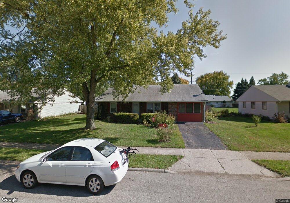
This home is located at 2055 Commonwealth Dr, Xenia, OH 45385 and is currently estimated at $207,858, approximately $155 per square foot. 2055 Commonwealth Dr is a home located in Greene County with nearby schools including Xenia High School, Summit Academy Community School for Alternative Learners - Xenia, and Legacy Christian Academy.
Ownership History
Date
Name
Owned For
Owner Type
Purchase Details
Closed on
Sep 26, 2023
Sold by
Cummings Scott P and Cummings Andrew L
Bought by
Jackowski Corey
Current Estimated Value
Home Financials for this Owner
Home Financials are based on the most recent Mortgage that was taken out on this home.
Original Mortgage
$184,203
Outstanding Balance
$180,560
Interest Rate
7.09%
Mortgage Type
New Conventional
Estimated Equity
$27,298
Purchase Details
Closed on
Jun 8, 2022
Sold by
Given Not
Bought by
Cummings Mark W and Cummings Karen Sue
Purchase Details
Closed on
Mar 10, 2019
Sold by
Cummings Mark W and Cummings Karen S
Bought by
Cummings Mark W and Cummings Karen S
Purchase Details
Closed on
Oct 1, 1985
Bought by
Cummings Mark W and Cummings Cummings
Create a Home Valuation Report for This Property
The Home Valuation Report is an in-depth analysis detailing your home's value as well as a comparison with similar homes in the area
Home Values in the Area
Average Home Value in this Area
Purchase History
| Date | Buyer | Sale Price | Title Company |
|---|---|---|---|
| Jackowski Corey | $189,900 | None Listed On Document | |
| Cummings Mark W | -- | -- | |
| Cummings Mark W | -- | None Available | |
| Cummings Mark W | $35,000 | -- |
Source: Public Records
Mortgage History
| Date | Status | Borrower | Loan Amount |
|---|---|---|---|
| Open | Jackowski Corey | $184,203 |
Source: Public Records
Tax History Compared to Growth
Tax History
| Year | Tax Paid | Tax Assessment Tax Assessment Total Assessment is a certain percentage of the fair market value that is determined by local assessors to be the total taxable value of land and additions on the property. | Land | Improvement |
|---|---|---|---|---|
| 2024 | $2,104 | $49,160 | $11,210 | $37,950 |
| 2023 | $2,104 | $49,160 | $11,210 | $37,950 |
| 2022 | $1,751 | $34,900 | $6,590 | $28,310 |
| 2021 | $1,774 | $34,900 | $6,590 | $28,310 |
| 2020 | $1,700 | $34,900 | $6,590 | $28,310 |
| 2019 | $1,554 | $30,830 | $6,440 | $24,390 |
| 2018 | $1,560 | $30,830 | $6,440 | $24,390 |
| 2017 | $1,405 | $30,830 | $6,440 | $24,390 |
| 2016 | $1,405 | $27,270 | $6,440 | $20,830 |
| 2015 | $1,409 | $27,270 | $6,440 | $20,830 |
| 2014 | $1,348 | $27,270 | $6,440 | $20,830 |
Source: Public Records
Map
Nearby Homes
- 1255 Colorado Dr
- 1750 Roxbury Dr
- 2499 Jenny Marie Dr
- 1403 Texas Dr
- 2421 Louisiana Dr
- 1348 Berkshire Dr
- 1321 Massachusetts Dr
- 1778 Arapaho Dr
- 0 Berkshire Dr Unit 949217
- 1272 Bellbrook Ave
- 2784 Greystoke Dr
- 2142 Michigan Dr
- 2102 High Wheel Dr
- 920 Wright Cycle Blvd
- 926 Wright Cycle Blvd
- 1874 Pennsylvania Dr
- 2821 Raxit Ct
- 414 Whisper Ln
- 1318 Prem Place
- 1248 Prem Place
- 2069 Commonwealth Dr
- 2041 Commonwealth Dr
- 2056 Drummond Dr
- 2042 Drummond Dr
- 2072 Drummond Dr
- 2083 Commonwealth Dr
- 2027 Commonwealth Dr
- 2056 Commonwealth Dr
- 2042 Commonwealth Dr
- 2028 Drummond Dr
- 2072 Commonwealth Dr
- 2086 Drummond Dr
- 2028 Commonwealth Dr
- 2015 Commonwealth Dr
- 2095 Commonwealth Dr
- 2014 Drummond Dr
- 2104 Drummond Dr
- 2014 Commonwealth Dr
- 2096 Commonwealth Dr
- 2035 Roxbury Dr