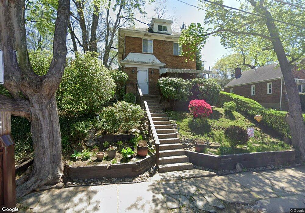
2055 Dartmore St Pittsburgh, PA 15210
Carrick NeighborhoodEstimated Value: $141,000 - $185,000
3
Beds
1
Bath
1,336
Sq Ft
$118/Sq Ft
Est. Value
About This Home
This home is located at 2055 Dartmore St, Pittsburgh, PA 15210 and is currently estimated at $158,015, approximately $118 per square foot. 2055 Dartmore St is a home located in Allegheny County with nearby schools including Pittsburgh Concord K-5, Pittsburgh South Brook, and Pittsburgh Carrick High School.
Ownership History
Date
Name
Owned For
Owner Type
Purchase Details
Closed on
Sep 25, 2000
Sold by
Baum George J and Patricia Baum M
Bought by
Baum George J and Patricia Baum M
Current Estimated Value
Purchase Details
Closed on
Sep 20, 2000
Sold by
Baum George J and Baum Mary M
Bought by
Baum George J
Purchase Details
Closed on
Jun 27, 1994
Sold by
The City Of Pittsburgh
Bought by
Baum George J and Patricia Baum M
Create a Home Valuation Report for This Property
The Home Valuation Report is an in-depth analysis detailing your home's value as well as a comparison with similar homes in the area
Home Values in the Area
Average Home Value in this Area
Purchase History
| Date | Buyer | Sale Price | Title Company |
|---|---|---|---|
| Baum George J | -- | -- | |
| Baum George J | -- | -- | |
| Baum George J | $350 | -- |
Source: Public Records
Tax History Compared to Growth
Tax History
| Year | Tax Paid | Tax Assessment Tax Assessment Total Assessment is a certain percentage of the fair market value that is determined by local assessors to be the total taxable value of land and additions on the property. | Land | Improvement |
|---|---|---|---|---|
| 2025 | $825 | $35,800 | $14,600 | $21,200 |
| 2024 | $825 | $35,800 | $14,600 | $21,200 |
| 2023 | $825 | $35,800 | $14,600 | $21,200 |
| 2022 | $814 | $35,800 | $14,600 | $21,200 |
| 2021 | $726 | $35,800 | $14,600 | $21,200 |
| 2020 | $810 | $35,800 | $14,600 | $21,200 |
| 2019 | $810 | $35,800 | $14,600 | $21,200 |
| 2018 | $557 | $35,800 | $14,600 | $21,200 |
| 2017 | $810 | $35,800 | $14,600 | $21,200 |
| 2016 | $169 | $35,800 | $14,600 | $21,200 |
| 2015 | $169 | $35,800 | $14,600 | $21,200 |
| 2014 | $792 | $35,800 | $14,600 | $21,200 |
Source: Public Records
Map
Nearby Homes
- 42 Queenston St
- 2082 Walton Ave
- 2220 Jacob St
- 2032 Jacob St
- 1928 Dartmore St
- 331 Redwood St
- 21 Briggs St
- 404 Ariston Ave
- 373 Copperfield Ave
- 400 Ariston Ave
- 309 Parkfield St
- 1572 Brookline Blvd
- 755 Maytide St
- 713 Maytide St
- 304 Parklyn St
- 1725 Hallowell St
- 419 Maytide St
- 2020 Brownsville Rd
- 28 Lodge St
- 2000 Brownsville Rd
- 2057 Dartmore St
- 2057 Dartmore St
- 2129 Dartmore St
- 113 Yale Dr
- 2054 Dartmore St
- 2121 Dartmore St
- 2060 Dartmore St
- 2060 Dartmore St
- 2063 Dartmore St
- 117 Yale Dr
- 2119 Dartmore St
- 2148 Dartmore St
- 2117 Dartmore St
- 2056 Dartmore St
- 2065 Dartmore St
- 2134 Fairland St
- 2048 Dartmore St
- 2134 Dartmore St
- 2052 Dartmore St
- 2062 Dartmore St