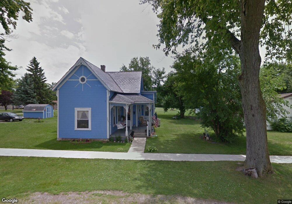
20553 Cr 265 Ridgeway, OH 43345
Estimated Value: $336,000 - $589,067
4
Beds
1
Bath
2,100
Sq Ft
$235/Sq Ft
Est. Value
About This Home
This home is located at 20553 Cr 265, Ridgeway, OH 43345 and is currently estimated at $493,022, approximately $234 per square foot. 20553 Cr 265 is a home located in Hardin County with nearby schools including Ridgemont Elementary School, Ridgemont High School, and Little Acorn.
Ownership History
Date
Name
Owned For
Owner Type
Purchase Details
Closed on
Mar 26, 2018
Sold by
Greer Michael R and Greer Charon E
Bought by
Rose Paul J and Rose Ann K
Current Estimated Value
Purchase Details
Closed on
Apr 7, 2017
Sold by
Price David D and Price Bernice Susan
Bought by
Greer Michael R and Greer Charon E
Home Financials for this Owner
Home Financials are based on the most recent Mortgage that was taken out on this home.
Original Mortgage
$239,920
Interest Rate
4.16%
Mortgage Type
New Conventional
Purchase Details
Closed on
Apr 20, 1994
Bought by
Price David D and Price Bernice
Purchase Details
Closed on
Feb 15, 1994
Bought by
Price David D and Price Bernice
Purchase Details
Closed on
Feb 21, 1992
Create a Home Valuation Report for This Property
The Home Valuation Report is an in-depth analysis detailing your home's value as well as a comparison with similar homes in the area
Home Values in the Area
Average Home Value in this Area
Purchase History
| Date | Buyer | Sale Price | Title Company |
|---|---|---|---|
| Rose Paul J | $304,900 | Title First Agency Inc | |
| Greer Michael R | $299,900 | None Available | |
| Price David D | $31,000 | -- | |
| Price David D | $25,000 | -- | |
| -- | -- | -- |
Source: Public Records
Mortgage History
| Date | Status | Borrower | Loan Amount |
|---|---|---|---|
| Previous Owner | Greer Michael R | $239,920 |
Source: Public Records
Tax History Compared to Growth
Tax History
| Year | Tax Paid | Tax Assessment Tax Assessment Total Assessment is a certain percentage of the fair market value that is determined by local assessors to be the total taxable value of land and additions on the property. | Land | Improvement |
|---|---|---|---|---|
| 2024 | $5,501 | $147,760 | $13,270 | $134,490 |
| 2023 | $5,501 | $147,760 | $13,270 | $134,490 |
| 2022 | $5,613 | $130,940 | $9,220 | $121,720 |
| 2021 | $5,582 | $129,140 | $9,220 | $119,920 |
| 2020 | $5,590 | $129,140 | $9,220 | $119,920 |
| 2019 | $4,262 | $105,690 | $9,020 | $96,670 |
| 2018 | $3,985 | $97,680 | $9,020 | $88,660 |
| 2017 | $3,274 | $98,710 | $10,050 | $88,660 |
| 2016 | $2,795 | $76,540 | $9,530 | $67,010 |
| 2015 | $2,777 | $76,540 | $9,530 | $67,010 |
| 2014 | $2,785 | $76,540 | $9,530 | $67,010 |
| 2013 | $1,539 | $73,330 | $9,530 | $63,800 |
Source: Public Records
Map
Nearby Homes
- 217 W Mansfield Rd
- 210 N Main St
- 341 S Main St
- 0 S Main St
- 13450 State Route 292
- 11279 Township Road 180
- 320 Letson Ave
- 727 S Detroit St
- 639 S Main St
- 920 Cooper St
- 510 Decatur St
- 508 Decatur St
- 115 Scioto St
- 11896 Parklane Dr
- 0 C R 103 Unit 225000597
- 530 E Franklin St
- 121 S High St
- 513 E Franklin St
- 39 Grape St
- 79 Broadway St
- 20553 County Road 265
- 20654 Co Rd
- 20654 County Road 265
- 18214 State Route 292
- 20621 County Road 265
- 0 County Road 200
- 20283 Twp Rd
- 00 County Road 200
- 20283 Township Road 265
- 15615 County Road 200
- 20821 County Road 265
- 20221 Township Road 265
- 15500 County Road 200
- 20169 Township Rd
- 20169 Township Road 265
- 20930 County Road 265
- 20127 Township Road 265
- 20127 Twp Rd 265