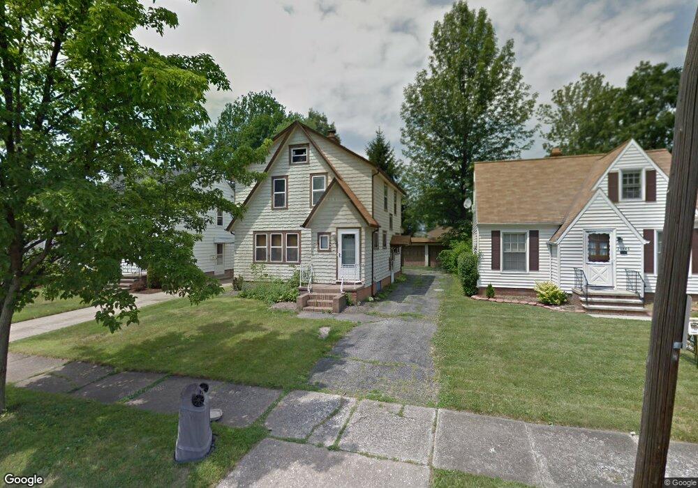
20554 Stanford Ave Cleveland, OH 44126
Estimated Value: $242,197 - $276,000
4
Beds
1
Bath
1,581
Sq Ft
$165/Sq Ft
Est. Value
About This Home
This home is located at 20554 Stanford Ave, Cleveland, OH 44126 and is currently estimated at $260,799, approximately $164 per square foot. 20554 Stanford Ave is a home located in Cuyahoga County with nearby schools including Gilles-Sweet Elementary School, Lewis F Mayer Middle School, and Fairview High School.
Ownership History
Date
Name
Owned For
Owner Type
Purchase Details
Closed on
Jan 6, 2003
Sold by
Buchanan Shirley G
Bought by
Likakis Emmanuel
Current Estimated Value
Home Financials for this Owner
Home Financials are based on the most recent Mortgage that was taken out on this home.
Original Mortgage
$120,700
Outstanding Balance
$51,905
Interest Rate
6.13%
Estimated Equity
$208,894
Purchase Details
Closed on
May 8, 1987
Sold by
Roth Mark A
Bought by
Buchanan James B
Purchase Details
Closed on
Nov 28, 1978
Sold by
Petras Stephen J and Petras Vera C
Bought by
Roth Mark A
Purchase Details
Closed on
Jan 1, 1975
Bought by
Petras Stephen J and Petras Vera C
Create a Home Valuation Report for This Property
The Home Valuation Report is an in-depth analysis detailing your home's value as well as a comparison with similar homes in the area
Home Values in the Area
Average Home Value in this Area
Purchase History
| Date | Buyer | Sale Price | Title Company |
|---|---|---|---|
| Likakis Emmanuel | $142,000 | Progressive Land Title | |
| Buchanan James B | $56,000 | -- | |
| Buchanan James B | -- | -- | |
| Roth Mark A | $60,000 | -- | |
| Petras Stephen J | -- | -- |
Source: Public Records
Mortgage History
| Date | Status | Borrower | Loan Amount |
|---|---|---|---|
| Open | Likakis Emmanuel | $120,700 |
Source: Public Records
Tax History Compared to Growth
Tax History
| Year | Tax Paid | Tax Assessment Tax Assessment Total Assessment is a certain percentage of the fair market value that is determined by local assessors to be the total taxable value of land and additions on the property. | Land | Improvement |
|---|---|---|---|---|
| 2024 | $4,693 | $67,655 | $11,795 | $55,860 |
| 2023 | $4,868 | $60,310 | $10,010 | $50,300 |
| 2022 | $4,747 | $60,310 | $10,010 | $50,300 |
| 2021 | $4,844 | $60,310 | $10,010 | $50,300 |
| 2020 | $4,459 | $48,650 | $8,090 | $40,570 |
| 2019 | $3,966 | $139,000 | $23,100 | $115,900 |
| 2018 | $3,846 | $48,650 | $8,090 | $40,570 |
| 2017 | $3,904 | $44,280 | $7,210 | $37,070 |
| 2016 | $3,878 | $44,280 | $7,210 | $37,070 |
| 2015 | $3,661 | $44,280 | $7,210 | $37,070 |
| 2014 | $3,661 | $42,180 | $6,860 | $35,320 |
Source: Public Records
Map
Nearby Homes
- 20688 Belvidere Ave
- 20778 Woodstock Ave
- 3826 W 210th St
- 20187 Grannis Rd
- 3712 Addington Ct
- 21236 Northwood Ave
- 21143 Westwood Rd
- 3420 W 210th St
- 21237 Westwood Rd
- 4243 W 212th St
- 3340 W 210th St
- 4336 W 196th St
- 3167 Linden Rd Unit 503
- 3167 Linden Rd Unit 309
- 3167 Linden Rd Unit 103
- 3167 Linden Rd Unit 508
- 19510 Lorain Rd Unit 201
- 0 V L Center Ridge Rd Unit 5163668
- 19575 Henry Rd
- 3733 River Ln
- 20546 Stanford Ave
- 20562 Stanford Ave
- 20538 Stanford Ave
- 20570 Stanford Ave
- 20608 Stanford Ave
- 20549 Belvidere Ave
- 20541 Belvidere Ave
- 20565 Belvidere Ave
- 20618 Stanford Ave
- 3996 Elmore Rd
- 20533 Belvidere Ave
- 20553 Stanford Ave
- 3992 Elmore Rd
- 4000 Elmore Rd
- 20573 Belvidere Ave
- 20561 Stanford Ave
- 20525 Belvidere Ave
- 20569 Stanford Ave
- 20537 Stanford Ave
- 20628 Stanford Ave