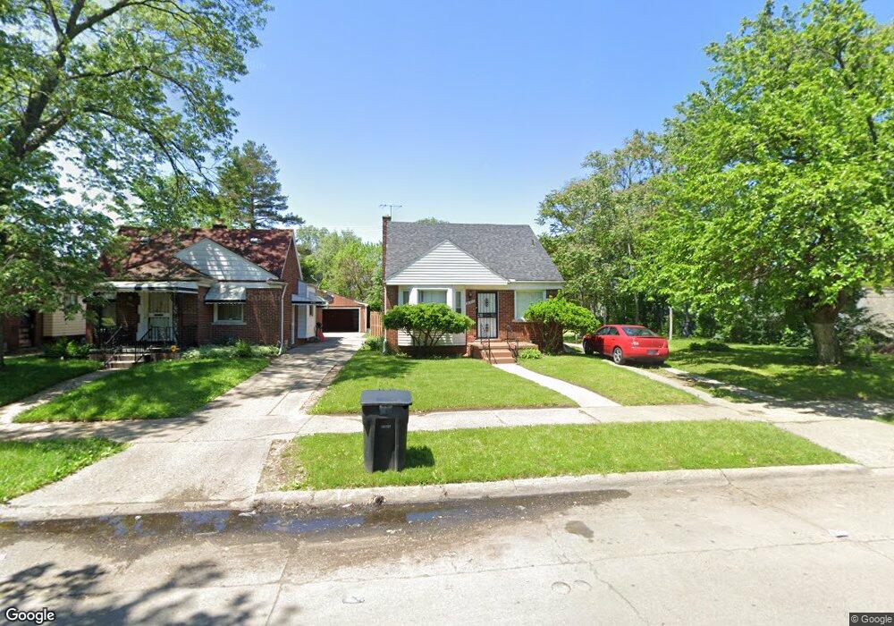
20567 Glastonbury Rd Detroit, MI 48219
O'Hair Park NeighborhoodEstimated Value: $84,000 - $99,000
3
Beds
1
Bath
834
Sq Ft
$109/Sq Ft
Est. Value
About This Home
This home is located at 20567 Glastonbury Rd, Detroit, MI 48219 and is currently estimated at $90,981, approximately $109 per square foot. 20567 Glastonbury Rd is a home located in Wayne County with nearby schools including Ralph W. Emerson Elementary-Middle School, Charles L. Spain Elementary-Middle School, and Edward 'Duke' Ellington Conservatory of Music and Art.
Ownership History
Date
Name
Owned For
Owner Type
Purchase Details
Closed on
Dec 1, 2024
Sold by
Sam One Investment Properties Llc
Bought by
Schaffer Mark
Current Estimated Value
Purchase Details
Closed on
Aug 23, 2021
Sold by
Gardner Property
Bought by
Sam One Investment Properties Llc
Purchase Details
Closed on
Dec 15, 2010
Sold by
Spinx & Co
Bought by
Gardner Property Management Inc
Purchase Details
Closed on
Nov 29, 2010
Sold by
Wojtowicz Raymond J
Bought by
Spinx & Co
Create a Home Valuation Report for This Property
The Home Valuation Report is an in-depth analysis detailing your home's value as well as a comparison with similar homes in the area
Home Values in the Area
Average Home Value in this Area
Purchase History
| Date | Buyer | Sale Price | Title Company |
|---|---|---|---|
| Schaffer Mark | $1,000 | None Listed On Document | |
| Schaffer Mark | $1,000 | None Listed On Document | |
| Sam One Investment Properties Llc | $1,000 | None Available | |
| Gardner Property Management Inc | -- | None Available | |
| Spinx & Co | $7,508 | None Available |
Source: Public Records
Tax History Compared to Growth
Tax History
| Year | Tax Paid | Tax Assessment Tax Assessment Total Assessment is a certain percentage of the fair market value that is determined by local assessors to be the total taxable value of land and additions on the property. | Land | Improvement |
|---|---|---|---|---|
| 2025 | $1,340 | $39,300 | $0 | $0 |
| 2024 | $1,340 | $33,600 | $0 | $0 |
| 2023 | $1,301 | $26,900 | $0 | $0 |
| 2022 | $2,181 | $22,200 | $0 | $0 |
| 2021 | $1,349 | $17,800 | $0 | $0 |
| 2020 | $1,349 | $17,000 | $0 | $0 |
| 2019 | $1,328 | $13,800 | $0 | $0 |
| 2018 | $1,165 | $12,200 | $0 | $0 |
| 2017 | $223 | $12,300 | $0 | $0 |
| 2016 | $1,277 | $17,800 | $0 | $0 |
| 2015 | $1,163 | $17,800 | $0 | $0 |
| 2013 | $1,126 | $24,997 | $0 | $0 |
| 2010 | -- | $35,816 | $1,072 | $34,744 |
Source: Public Records
Map
Nearby Homes
- 20285 Glastonbury Rd
- 20542 Ashton Ave
- 18155 Westhaven Ave
- 20201 Ashton Ave
- 20220 Ashton Ave
- 20093 Faust Ave
- 18249 Westover Ave
- 20092 Avon Ave
- 20052 Avon Ave
- 20510 Fenmore St
- 20044 Avon Ave
- 18252 Westland Ave
- 20245 Archdale St
- 19940 Faust Ave
- 20014 Southfield Rd
- 20004 Southfield Fwy
- 20210 Archdale St
- 20558 Oakfield St
- 20542 Oakfield St
- 19922 Stahelin Ave
- 20569 Glastonbury Rd
- 20559 Glastonbury Rd
- 20551 Glastonbury Rd
- 18415 W 8 Mile Rd
- 20564 Faust Ave
- 20576 Faust Ave
- 20543 Glastonbury Rd
- 20554 Faust Ave
- 18433 W 8 Mile Rd
- 20535 Glastonbury Rd
- 20544 Faust Ave
- 18437 W 8 Mile Rd
- 20566 Glastonbury Rd
- 20572 Glastonbury Rd
- 20534 Faust Ave
- 18447 W 8 Mile Rd
- 20550 Glastonbury Rd
- 20527 Glastonbury Rd
- 20542 Glastonbury Rd
- 20524 Faust Ave