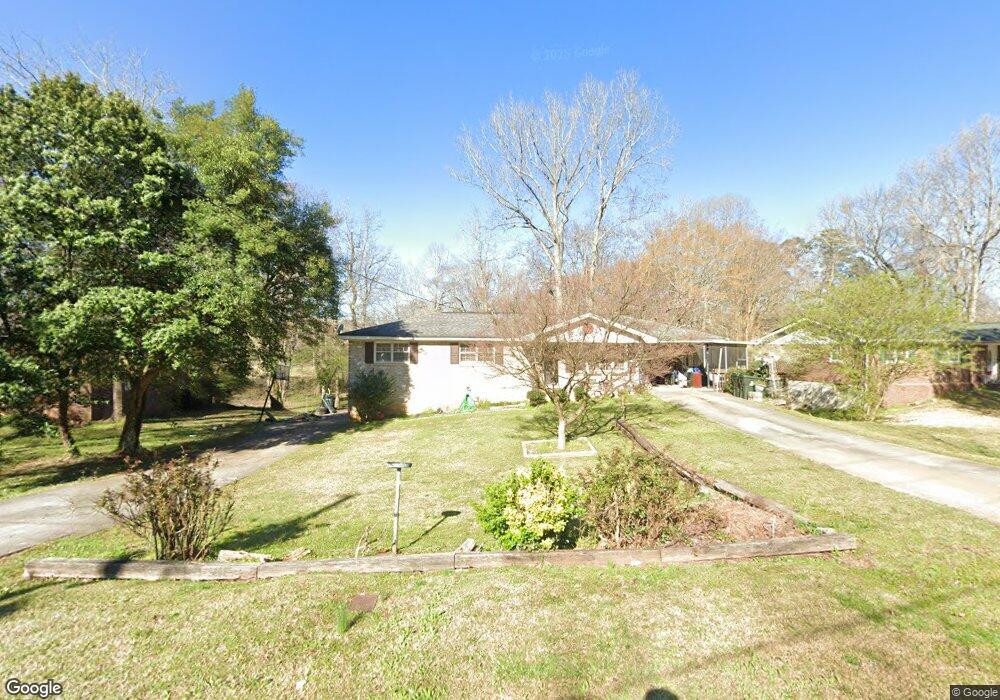
2057 Mulkey Rd SW Marietta, GA 30008
Estimated Value: $291,000 - $359,000
6
Beds
3
Baths
1,185
Sq Ft
$268/Sq Ft
Est. Value
About This Home
This home is located at 2057 Mulkey Rd SW, Marietta, GA 30008 and is currently estimated at $317,198, approximately $267 per square foot. 2057 Mulkey Rd SW is a home located in Cobb County with nearby schools including Sanders Elementary School, Garrett Middle School, and South Cobb High School.
Ownership History
Date
Name
Owned For
Owner Type
Purchase Details
Closed on
Sep 9, 2025
Sold by
English Ora W
Bought by
English Ora W and English Frankie
Current Estimated Value
Home Financials for this Owner
Home Financials are based on the most recent Mortgage that was taken out on this home.
Original Mortgage
$450,000
Outstanding Balance
$450,000
Interest Rate
6.58%
Mortgage Type
Reverse Mortgage Home Equity Conversion Mortgage
Estimated Equity
-$132,802
Purchase Details
Closed on
Aug 26, 1997
Sold by
Reynolds Mark W
Bought by
English Ora W
Home Financials for this Owner
Home Financials are based on the most recent Mortgage that was taken out on this home.
Original Mortgage
$90,440
Interest Rate
7.46%
Mortgage Type
FHA
Purchase Details
Closed on
Apr 22, 1997
Sold by
Chambers Christine A
Bought by
Reynolds Mark W
Create a Home Valuation Report for This Property
The Home Valuation Report is an in-depth analysis detailing your home's value as well as a comparison with similar homes in the area
Home Values in the Area
Average Home Value in this Area
Purchase History
| Date | Buyer | Sale Price | Title Company |
|---|---|---|---|
| English Ora W | -- | Summit Settlement Services | |
| English Ora W | $90,000 | -- | |
| Reynolds Mark W | $90,000 | -- |
Source: Public Records
Mortgage History
| Date | Status | Borrower | Loan Amount |
|---|---|---|---|
| Open | English Ora W | $450,000 | |
| Closed | English Ora W | $450,000 | |
| Previous Owner | English Ora W | $90,440 |
Source: Public Records
Tax History Compared to Growth
Tax History
| Year | Tax Paid | Tax Assessment Tax Assessment Total Assessment is a certain percentage of the fair market value that is determined by local assessors to be the total taxable value of land and additions on the property. | Land | Improvement |
|---|---|---|---|---|
| 2025 | $1,365 | $137,808 | $26,000 | $111,808 |
| 2024 | $1,368 | $137,808 | $26,000 | $111,808 |
| 2023 | $3,752 | $124,428 | $26,000 | $98,428 |
| 2022 | $3,190 | $105,108 | $16,000 | $89,108 |
| 2021 | $2,201 | $72,528 | $13,200 | $59,328 |
| 2020 | $2,040 | $67,228 | $12,000 | $55,228 |
| 2019 | $1,629 | $53,660 | $12,000 | $41,660 |
| 2018 | $1,629 | $53,660 | $12,000 | $41,660 |
| 2017 | $1,137 | $39,564 | $9,600 | $29,964 |
| 2016 | $1,137 | $39,564 | $9,600 | $29,964 |
| 2015 | $1,010 | $34,300 | $7,200 | $27,100 |
| 2014 | $1,019 | $34,300 | $0 | $0 |
Source: Public Records
Map
Nearby Homes
- 2058 Mulkey Rd SW
- 2289 Clare Cottage Cove SW
- 3782 Mulkey Cir SW Unit 18
- 3530 Argent Way
- 3559 Ashley Station Dr SW
- 1763 Merry Oak Rd SW
- 1905 Azure Grove Ct
- 3580 Main Station Dr SW
- 4192 Rhinehart Dr
- 3726 Willingham Run SW
- 3730 Willingham Run SW
- 3722 Willingham Run SW
- 1810 Killarney Dr SW
- Reynolds Plan at Hampton Trace
- Forsyth Plan at Hampton Trace
- 1745 Lansmere St SW
- 1688 Lansmere St SW
- 3661 Willingham Run SW
- 1570 Halbrook Place SW
- 2517 Kolb Manor Cir SW
- 2059 Mulkey Rd SW
- 2055 Mulkey Rd SW
- 2056 Mulkey Rd SW
- 2061 Mulkey Rd SW
- 2054 Mulkey Rd SW
- 2048 Mulkey Rd SW
- 2051 Mulkey Rd SW
- 2060 Mulkey Rd SW
- 2063 Mulkey Rd SW
- 3780 Cherokee Trails Dr SW
- 2033 Calvary Hill Ct SW
- 2033 Calvary Hill Ct SW Unit 4
- 3770 Cherokee Trails Dr SW
- 2062 Mulkey Rd SW
- 3790 Cherokee Trails Dr SW
- 3760 Cherokee Trails Dr SW
- 2047 Mulkey Rd SW
- 3800 Cherokee Trails Dr SW
- 2065 Mulkey Rd SW
- 3750 Cherokee Trails Dr SW