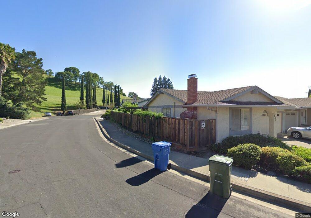
2057 Robb Rd Walnut Creek, CA 94596
Estimated Value: $987,000 - $1,280,000
3
Beds
2
Baths
1,810
Sq Ft
$629/Sq Ft
Est. Value
About This Home
This home is located at 2057 Robb Rd, Walnut Creek, CA 94596 and is currently estimated at $1,137,648, approximately $628 per square foot. 2057 Robb Rd is a home located in Contra Costa County with nearby schools including Murwood Elementary School, Walnut Creek Intermediate School, and Las Lomas High School.
Ownership History
Date
Name
Owned For
Owner Type
Purchase Details
Closed on
Feb 9, 2000
Sold by
Blenio Lucy J
Bought by
Blenio Lucy J
Current Estimated Value
Purchase Details
Closed on
Dec 27, 1995
Sold by
Stich Paul J and Stich Linda H
Bought by
Blenio Lucy J
Home Financials for this Owner
Home Financials are based on the most recent Mortgage that was taken out on this home.
Original Mortgage
$152,000
Outstanding Balance
$4,130
Interest Rate
7.36%
Mortgage Type
Purchase Money Mortgage
Estimated Equity
$1,133,518
Create a Home Valuation Report for This Property
The Home Valuation Report is an in-depth analysis detailing your home's value as well as a comparison with similar homes in the area
Home Values in the Area
Average Home Value in this Area
Purchase History
| Date | Buyer | Sale Price | Title Company |
|---|---|---|---|
| Blenio Lucy J | -- | -- | |
| Blenio Lucy J | $242,000 | Commonwealth Land Title Co |
Source: Public Records
Mortgage History
| Date | Status | Borrower | Loan Amount |
|---|---|---|---|
| Open | Blenio Lucy J | $152,000 |
Source: Public Records
Tax History
| Year | Tax Paid | Tax Assessment Tax Assessment Total Assessment is a certain percentage of the fair market value that is determined by local assessors to be the total taxable value of land and additions on the property. | Land | Improvement |
|---|---|---|---|---|
| 2025 | $5,513 | $402,002 | $270,362 | $131,640 |
| 2024 | $5,297 | $394,120 | $265,061 | $129,059 |
| 2023 | $5,297 | $386,393 | $259,864 | $126,529 |
| 2022 | $5,191 | $378,818 | $254,769 | $124,049 |
| 2021 | $5,050 | $371,391 | $249,774 | $121,617 |
| 2019 | $4,920 | $360,376 | $242,366 | $118,010 |
| 2018 | $4,755 | $353,311 | $237,614 | $115,697 |
| 2017 | $4,655 | $346,384 | $232,955 | $113,429 |
| 2016 | $4,555 | $339,593 | $228,388 | $111,205 |
| 2015 | $4,443 | $334,493 | $224,958 | $109,535 |
| 2014 | $4,378 | $327,942 | $220,552 | $107,390 |
Source: Public Records
Map
Nearby Homes
- 1109 Cardigan Dr
- 1950 Whitecliff Ct
- 2257 Gladwin Dr
- 1923 Whitecliff Way
- 44 Lariat Ct
- 837 Rosewood Ct
- 321 Livorna Heights Rd
- 908 Gibson Ct
- 421 Twin Oaks Ln
- 21 Margaret Dr
- 320 Miranda Ln
- 2129 Youngs Valley Rd
- 930 Pinto Ct
- 154 Rudgear Dr
- 209 Gerry Ct
- 218 Erselia Trail
- 2216 Blackwood Dr
- 137 Rudgear Dr
- 401 Legacy Dr
- 138 Rudgear Dr
- 2055 Robb Rd
- 2137 Meriweather Ct
- 2053 Robb Rd
- 2139 Meriweather Ct
- 2118 Meriweather Ct
- 2116 Meriweather Ct
- 2061 Robb Rd
- 2051 Robb Rd
- 1282 Kristin Way
- 2063 Robb Rd
- 2151 Meriweather Ct
- 2065 Robb Rd
- 2153 Meriweather Ct
- 1280 Kristin Way
- 2067 Robb Rd
- 2049 Robb Rd
- 2069 Robb Rd
- 2103 Darby Ct
- 2047 Robb Rd
- 2105 Darby Ct
Your Personal Tour Guide
Ask me questions while you tour the home.