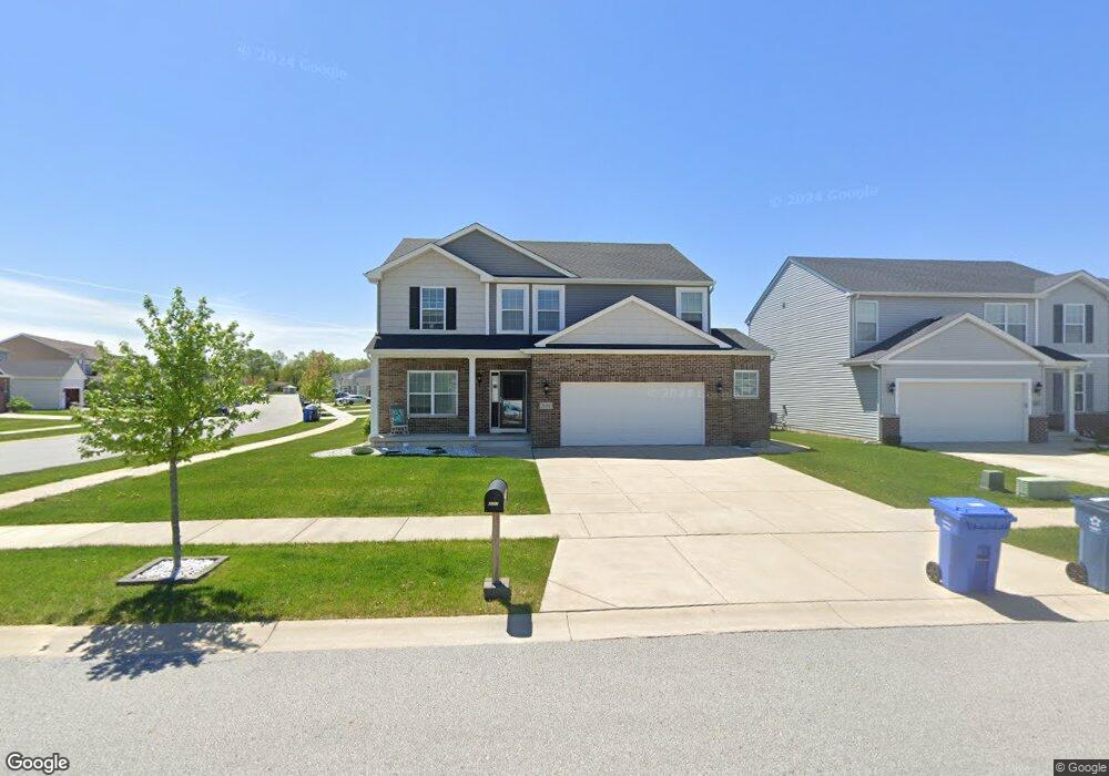
2057 W 132nd Ave Crown Point, IN 46307
Estimated Value: $434,594 - $514,000
4
Beds
3
Baths
2,563
Sq Ft
$183/Sq Ft
Est. Value
About This Home
This home is located at 2057 W 132nd Ave, Crown Point, IN 46307 and is currently estimated at $469,899, approximately $183 per square foot. 2057 W 132nd Ave is a home located in Lake County with nearby schools including Dwight D. Eisenhower Elementary School, Robert Taft Middle School, and Crown Point High School.
Ownership History
Date
Name
Owned For
Owner Type
Purchase Details
Closed on
Mar 14, 2017
Sold by
Providence Homes At Regency Inc
Bought by
Erpelding David and Conrad Karla M
Current Estimated Value
Home Financials for this Owner
Home Financials are based on the most recent Mortgage that was taken out on this home.
Original Mortgage
$244,800
Outstanding Balance
$202,139
Interest Rate
4.19%
Mortgage Type
New Conventional
Estimated Equity
$267,760
Purchase Details
Closed on
Nov 30, 2016
Sold by
The Regency Of Crown Point Llc
Bought by
Providence Homes At Regency Inc
Home Financials for this Owner
Home Financials are based on the most recent Mortgage that was taken out on this home.
Original Mortgage
$428,800
Interest Rate
3.94%
Mortgage Type
Purchase Money Mortgage
Create a Home Valuation Report for This Property
The Home Valuation Report is an in-depth analysis detailing your home's value as well as a comparison with similar homes in the area
Home Values in the Area
Average Home Value in this Area
Purchase History
| Date | Buyer | Sale Price | Title Company |
|---|---|---|---|
| Erpelding David | -- | Chicago Title Ins Co | |
| Providence Homes At Regency Inc | -- | Chicago Title Ins Co |
Source: Public Records
Mortgage History
| Date | Status | Borrower | Loan Amount |
|---|---|---|---|
| Open | Erpelding David | $244,800 | |
| Previous Owner | Providence Homes At Regency Inc | $428,800 |
Source: Public Records
Tax History Compared to Growth
Tax History
| Year | Tax Paid | Tax Assessment Tax Assessment Total Assessment is a certain percentage of the fair market value that is determined by local assessors to be the total taxable value of land and additions on the property. | Land | Improvement |
|---|---|---|---|---|
| 2024 | $4,027 | $397,700 | $65,400 | $332,300 |
| 2023 | $4,027 | $363,600 | $65,400 | $298,200 |
| 2022 | $3,833 | $343,200 | $65,400 | $277,800 |
| 2021 | $3,629 | $325,300 | $65,400 | $259,900 |
| 2020 | $3,450 | $309,500 | $65,400 | $244,100 |
| 2019 | $3,334 | $299,300 | $65,400 | $233,900 |
| 2018 | $4,041 | $293,600 | $65,400 | $228,200 |
| 2017 | $13 | $1,000 | $1,000 | $0 |
Source: Public Records
Map
Nearby Homes
- 13111 Taft St
- 13085 Taft St
- 13192 Hayes St
- 12938 Hayes St
- 1790 W 134th Ct
- 12819 Grant St
- 2800 W 133rd Ave
- 2439 W 127th Ave
- 2725 W 127th Ln
- 12768 Ellsworth Place
- 253 Nomo Place
- 283 Nomo Place
- The Ganby Plan at Sawgrass
- The Monarch Plan at Sawgrass
- The Keystone Plan at Sawgrass
- The Breckenridge Plan at Sawgrass
- 11498 Hancock Dr
- 244 Sawgrass Dr
- 246 Sawgrass Dr
- 248 Sawgrass Dr
- 2073 W 132nd Ave
- 13178 Roosevelt Place
- 2079 W 132nd Ave
- 13184 Roosevelt Place
- 13169 Roosevelt Place
- 2082 W 132nd Ave
- 13181 Roosevelt Place
- 13190 Roosevelt Place
- 2046 W 132nd Ave
- 2028 W 132nd Ave
- 2060 W 132nd Ave
- 2109 W 132nd Ave
- 13195 Roosevelt Place
- 13198 Roosevelt Place
- 2016 W 132nd Ave
- 2016 W 132nd Ave
- 2076 W 132nd Ave
- 13201 Roosevelt Place
- 13202 Mckinley Place
- 13204 Roosevelt Place