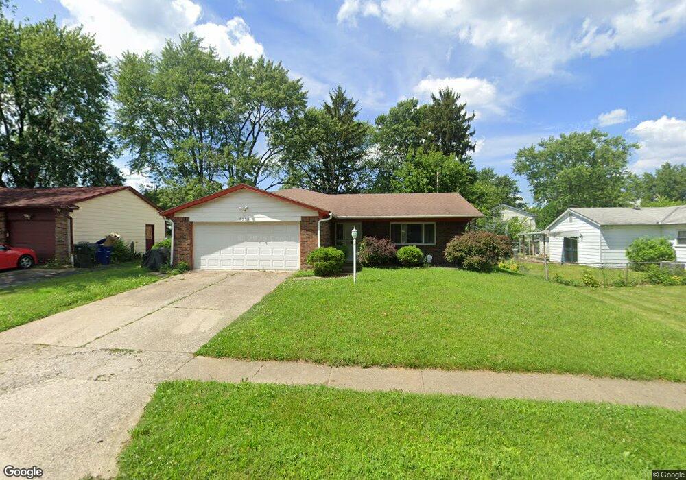
2058 Sharbot Dr Columbus, OH 43229
Forest Park East NeighborhoodEstimated Value: $282,091 - $315,000
3
Beds
2
Baths
1,785
Sq Ft
$166/Sq Ft
Est. Value
About This Home
This home is located at 2058 Sharbot Dr, Columbus, OH 43229 and is currently estimated at $296,023, approximately $165 per square foot. 2058 Sharbot Dr is a home located in Franklin County with nearby schools including Northtowne Elementary School, Woodward Park Middle School, and Northland High School.
Ownership History
Date
Name
Owned For
Owner Type
Purchase Details
Closed on
Aug 27, 1999
Sold by
Rasmussen Elwin O and Rasmussen Patricia A
Bought by
Ethridge Jina A
Current Estimated Value
Purchase Details
Closed on
Aug 26, 1971
Bought by
Rasmussen Elwin O
Create a Home Valuation Report for This Property
The Home Valuation Report is an in-depth analysis detailing your home's value as well as a comparison with similar homes in the area
Home Values in the Area
Average Home Value in this Area
Purchase History
| Date | Buyer | Sale Price | Title Company |
|---|---|---|---|
| Ethridge Jina A | $108,900 | Chicago Title | |
| Rasmussen Elwin O | -- | -- |
Source: Public Records
Tax History Compared to Growth
Tax History
| Year | Tax Paid | Tax Assessment Tax Assessment Total Assessment is a certain percentage of the fair market value that is determined by local assessors to be the total taxable value of land and additions on the property. | Land | Improvement |
|---|---|---|---|---|
| 2024 | $6,551 | $75,570 | $20,370 | $55,200 |
| 2023 | $3,348 | $75,565 | $20,370 | $55,195 |
| 2022 | $3,411 | $43,720 | $11,380 | $32,340 |
| 2021 | $2,272 | $43,720 | $11,380 | $32,340 |
| 2020 | $2,274 | $43,720 | $11,380 | $32,340 |
| 2019 | $2,068 | $34,090 | $9,100 | $24,990 |
| 2018 | $1,937 | $34,090 | $9,100 | $24,990 |
| 2017 | $2,067 | $34,090 | $9,100 | $24,990 |
| 2016 | $1,995 | $30,110 | $9,000 | $21,110 |
| 2015 | $1,811 | $30,110 | $9,000 | $21,110 |
| 2014 | $1,815 | $30,110 | $9,000 | $21,110 |
| 2013 | $895 | $30,100 | $8,995 | $21,105 |
Source: Public Records
Map
Nearby Homes
- 2033 Brittany Rd
- 4849 Heatherton Dr
- 2134 Trent Rd
- 4714 Ascot Dr
- 4885 Northtowne Blvd
- 2244 Balmoral Rd
- 2158 Kilbourne Ave
- 5056 Northtowne Blvd Unit 5054
- 2058 Northcliff Dr
- 5124 Northcliff Loop W
- 5204 Honeytree Loop W
- 2550 Minerva Ave
- 1704 Riverbirch Dr
- 0 Claridon Rd
- 5022 Sienna Ln
- 4309 Walford St
- 2576 Claridon Rd
- 0 Chester Rd
- 4923 Karl Rd Unit 4925
- 0 Abington Rd Unit 224031739
- 2046 Sharbot Dr
- 4803 Cannington Dr
- 2055 Cannington Ct
- 2047 Cannington Ct
- 4815 Cannington Dr
- 2038 Sharbot Dr
- 2039 Cannington Ct
- 2053 Sharbot Dr
- 2061 Sharbot Dr
- 2047 Sharbot Dr
- 2030 Sharbot Dr
- 2031 Cannington Ct
- 2084 Sharbot Dr
- 4806 Cannington Dr
- 2035 Sharbot Dr
- 2081 Sharbot Dr
- 4814 Cannington Dr
- 2023 Cannington Ct
- 2022 Sharbot Dr
- 4822 Cannington Dr