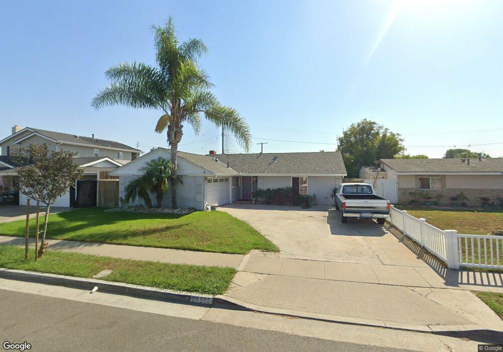
20582 Farnsworth Ln Huntington Beach, CA 92646
Southeast NeighborhoodEstimated Value: $1,099,000 - $1,406,000
3
Beds
2
Baths
1,027
Sq Ft
$1,183/Sq Ft
Est. Value
About This Home
This home is located at 20582 Farnsworth Ln, Huntington Beach, CA 92646 and is currently estimated at $1,214,850, approximately $1,182 per square foot. 20582 Farnsworth Ln is a home located in Orange County with nearby schools including John R. Peterson Elementary, Isaac L. Sowers Middle School, and Edison High School.
Ownership History
Date
Name
Owned For
Owner Type
Purchase Details
Closed on
Aug 20, 2020
Sold by
Pacific Sands Llc
Bought by
Elm David D and Elm Lorraine D
Current Estimated Value
Purchase Details
Closed on
Sep 13, 2016
Sold by
Elm David
Bought by
Elm David D and Elm Lorraine D
Purchase Details
Closed on
Feb 26, 1998
Sold by
Kraushaar Charles K and Kraushaar Yolanda
Bought by
Federal Deposit Insurance Corporation
Create a Home Valuation Report for This Property
The Home Valuation Report is an in-depth analysis detailing your home's value as well as a comparison with similar homes in the area
Home Values in the Area
Average Home Value in this Area
Purchase History
| Date | Buyer | Sale Price | Title Company |
|---|---|---|---|
| Elm David D | -- | Fidelity National Title | |
| Elm David D | -- | None Available | |
| Federal Deposit Insurance Corporation | $165,750 | First American Title Ins Co |
Source: Public Records
Tax History Compared to Growth
Tax History
| Year | Tax Paid | Tax Assessment Tax Assessment Total Assessment is a certain percentage of the fair market value that is determined by local assessors to be the total taxable value of land and additions on the property. | Land | Improvement |
|---|---|---|---|---|
| 2025 | $3,653 | $308,829 | $239,671 | $69,158 |
| 2024 | $3,653 | $302,774 | $234,972 | $67,802 |
| 2023 | $3,567 | $296,838 | $230,365 | $66,473 |
| 2022 | $3,472 | $291,018 | $225,848 | $65,170 |
| 2021 | $3,484 | $285,312 | $221,419 | $63,893 |
| 2020 | $3,460 | $282,387 | $219,149 | $63,238 |
| 2019 | $3,422 | $276,850 | $214,851 | $61,999 |
| 2018 | $3,370 | $271,422 | $210,638 | $60,784 |
| 2017 | $3,325 | $266,100 | $206,507 | $59,593 |
| 2016 | $3,108 | $260,883 | $202,458 | $58,425 |
| 2015 | $3,076 | $256,965 | $199,417 | $57,548 |
| 2014 | $3,011 | $251,932 | $195,511 | $56,421 |
Source: Public Records
Map
Nearby Homes
- 20401 Somerville Ln
- 8342 Seaport Dr
- 8565 Colusa Cir Unit 906C
- 20302 Tidepool Cir Unit 204
- 20371 Bluffside Cir Unit B214
- 8565 Larkhall Cir Unit 804A
- 20701 Beach Blvd Unit 128
- 20701 Beach Blvd Unit 65
- 20701 Beach Blvd Unit 142
- 20701 Beach Blvd Unit 285
- 20701 Beach Blvd Unit 30
- 20701 Beach Blvd Unit 107
- 20701 Beach Blvd Unit 251
- 20701 Beach Blvd Unit 200
- 20701 Beach Blvd Unit 103
- 20701 Beach Blvd Unit 298
- 20331 Bluffside Cir Unit 417
- 20331 Bluffside Cir Unit 411
- 20331 Bluffside Cir Unit 222
- 20331 Bluffside Cir Unit A320
- 20592 Farnsworth Ln
- 20562 Farnsworth Ln
- 20581 Goshawk Ln
- 20591 Goshawk Ln
- 20561 Goshawk Ln
- 20602 Farnsworth Ln
- 20601 Goshawk Ln
- 20612 Farnsworth Ln
- 20611 Goshawk Ln
- 8231 Reilly Dr
- 8241 Reilly Dr
- 8251 Reilly Dr
- 20622 Farnsworth Ln
- 20621 Goshawk Ln
- 20592 Goshawk Ln
- 20562 Goshawk Ln
- 8261 Reilly Dr
- 20602 Goshawk Ln
- 20632 Farnsworth Ln
- 8271 Reilly Dr